2000s (21st Century) Maps of Kino Springs, Arizona
Explore 5 historic maps of Kino Springs from the 2000s (21st Century). These maps offer a rare glimpse into what life looked like during the 2000s — showing old roads, neighborhoods, homes, and landmarks that have changed or disappeared over time.
Whether you're researching your family's past, planning a metal detecting trip, or studying how Kino Springs's landscape evolved across the 2000s, these high-resolution maps are a powerful tool for exploring the history of this region.
- Focus on a specific era: All maps on this page are from the 2000s, giving you a focused view of this time period.
- See what’s changed: Compare century-old streets, trails, and buildings to today's modern landscape using overlays and satellite layers.
- Research with precision: Use these maps for genealogy, historical research, land use analysis, or educational projects.
- View, download, or print: Maps are fully viewable online in high resolution, and can be downloaded or printed for your own records.
Start exploring Kino Springs's history through authentic maps from the 2000s. This is your window into the past.
Kino Springs, AZ maps
(5)- 2004 Map of Kino Springs, 2007 Print
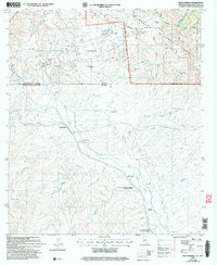 2004 Kino Springs2007 Print · USGSThe Arizona-Mexico border landscape comes into focus at the start of the millennium, tracing the Santa Cruz River as it flows south into Sonora. Genealogists and historians can locate legacy settlements and ranching sites like Buena Vista Ranch, Mascareñas, and La Capilla.
 - 2012 Map of Kino Springs, 2012 Print
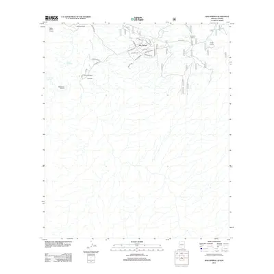 2012 Kino Springs2012 Print · USGSCovers Kino Springs, including Cárdenas Valdez (Mascareñas), Cadillal, and other nearby areas
 - 2014 Map of Kino Springs, 2014 Print
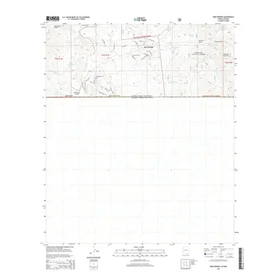 2014 Kino Springs2014 Print · USGSCovers Kino Springs, including Cárdenas Valdez (Mascareñas), Cadillal, and other nearby areas
 - 2018 Map of Kino Springs, 2018 Print
 2018 Kino Springs2018 Print · USGSCovers Kino Springs, including Cárdenas Valdez (Mascareñas), Cadillal, and other nearby areas
 - 2021 Map of Kino Springs, 2021 Print
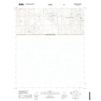
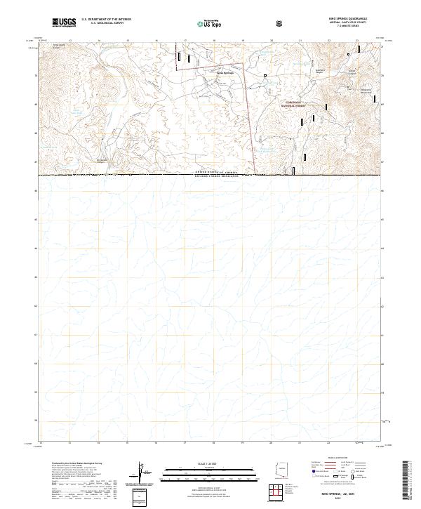 2021 Kino Springs2021 Print · USGSThe borderlands of southern Arizona are captured here just north of the Mexican line in the early twenty-first century. Genealogists and historians can trace the residential streets of Kino Springs or locate rural water landmarks like Quien Sabe Tank and Granger Tank.
End of results
Showing maps 1-5 of 5
Top cities near Kino Springs
Frequently asked questions
- What are the different types of historical maps available for Kino Springs?
- What is the oldest map of Kino Springs?
- Where can I purchase historical maps of Kino Springs for my home or office?
- Where can I download high-res historical maps of Kino Springs?
- Are there historical topographic maps available for Kino Springs?
- Is there historical aerial imagery available for Kino Springs?
- Where are historical maps of Kino Springs sourced from?