2020s Maps of Wickenburg, Arizona
Explore 4 historic maps of Wickenburg from the 2020s. These maps offer a rare glimpse into what life looked like during the 2020s — showing old roads, neighborhoods, homes, and landmarks that have changed or disappeared over time.
Whether you're researching your family's past, planning a metal detecting trip, or studying how Wickenburg's landscape evolved across the 2020s, these high-resolution maps are a powerful tool for exploring the history of this region.
- Focus on a specific era: All maps on this page are from the 2020s, giving you a focused view of this time period.
- See what’s changed: Compare century-old streets, trails, and buildings to today's modern landscape using overlays and satellite layers.
- Research with precision: Use these maps for genealogy, historical research, land use analysis, or educational projects.
- View, download, or print: Maps are fully viewable online in high resolution, and can be downloaded or printed for your own records.
Start exploring Wickenburg's history through authentic maps from the 2020s. This is your window into the past.
Wickenburg, AZ maps
(4)- 2021 Map of Vulture Peak, 2021 Print
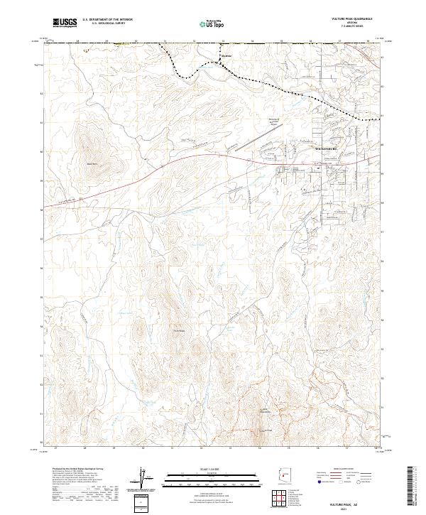 2021 Vulture Peak2021 Print · USGSWickenburg and the high desert of Maricopa County are shown here in the early twenty-first century as suburban expansion meets historical ranching lands. Genealogists and historians can trace the development of Wickenburg and locate landmarks like Matthie, Vulture Peak, and the Old Stagecoach Rd.
 - 2021 Map of Wickenburg, 2021 Print
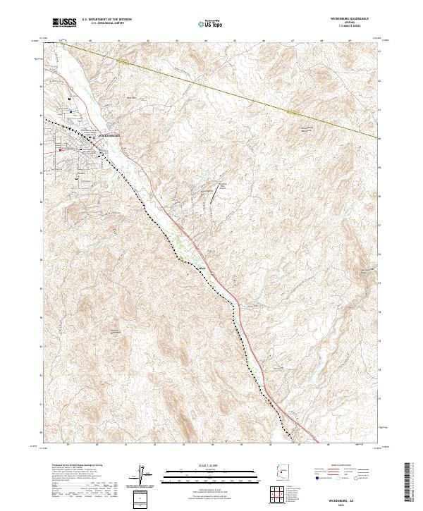 2021 Wickenburg2021 Print · USGSWickenburg and the Hassayampa River valley are shown in high detail during the early twenty-first century as the area continued to balance its mining heritage with modern growth. Researchers can trace local genealogy through the Garcia Cemetery and Pioneer Cemetery or locate the settlement of Allah near the river.
 - 2021 Map of Flores, 2021 Print
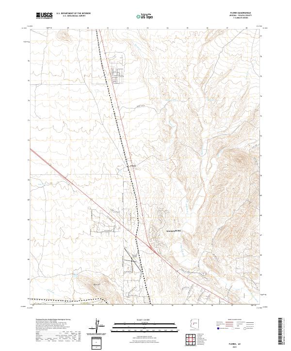 2021 Flores2021 Print · USGSThe outskirts of Wickenburg and the settlement of Flores appear here in the early twenty-first century as the high desert landscape transitions into modern rural tracts. Researchers can trace local landmarks like Moreton Airpark, Black Hill, and the winding Martinez Wash.
 - 2021 Map of Sam Powell Peak, 2021 Print
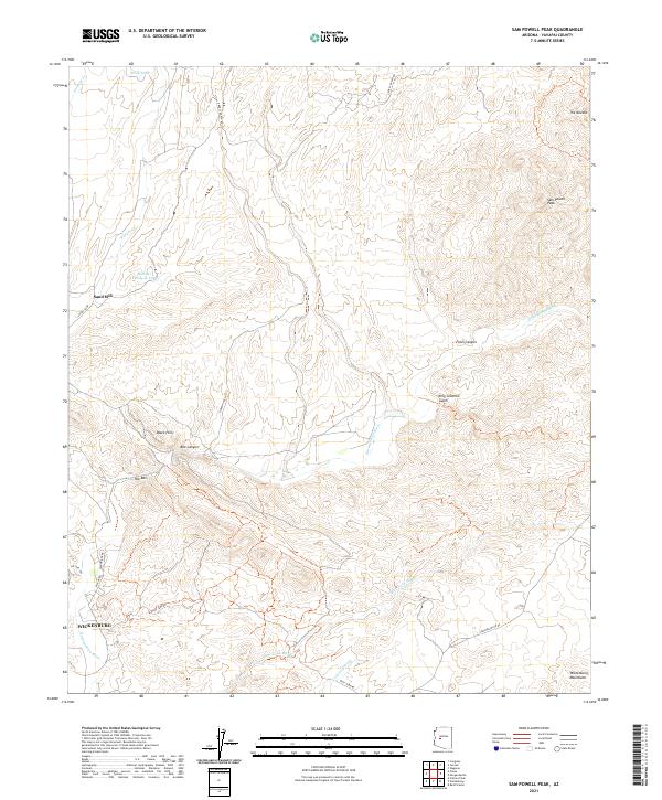 2021 Sam Powell Peak2021 Print · USGSYavapai County's high desert landscape is detailed here in the 2020s, centered on the corridor of the Hassayampa River. Local historians and explorers can trace the terrain around Sam Powell Peak, the Sand Mill, and the many drainages like King Solomon Gulch.
End of results
Showing maps 1-4 of 4
Top cities near Wickenburg
- Surprise historical maps
- Buckeye historical maps
- Congress historical maps
- Circle City historical maps
- Morristown historical maps
Frequently asked questions
- What are the different types of historical maps available for Wickenburg?
- What is the oldest map of Wickenburg?
- Where can I purchase historical maps of Wickenburg for my home or office?
- Where can I download high-res historical maps of Wickenburg?
- Are there historical topographic maps available for Wickenburg?
- Is there historical aerial imagery available for Wickenburg?
- Where are historical maps of Wickenburg sourced from?