Old Maps of Wickenburg, Arizona for Genealogy
Trace your family roots with 42 historic maps of Wickenburg. These high-res maps reveal old neighborhoods, homesites, landmarks, and streets — helping you uncover where your ancestors lived and how the area evolved over time.
- Explore historic neighborhoods: Identify where your relatives may have lived in the 1800s or 1900s.
- Compare maps over time: Trace the changes in streets, buildings, and landmarks for multi-generational research.
- Perfect for genealogy & ancestry research: Used by family historians and researchers to map out lineage and migration.
These maps are an incredible resource for exploring your personal connection to Wickenburg's past.
Wickenburg, AZ maps
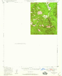
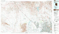
(42)- 1887 Map of Prescott
 1887 Prescott1887 Print · USGSThe central Arizona highlands appear in the territorial era, showing the early development of mining and military outposts. Genealogists can trace family-named sites and vanished camps like Big Bug, Stanton, and the original site of Walnut Grove.
 - 1892 Map of Prescott, 1898 Print
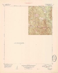
 1892 Prescott1898 Print · USGSCentral Arizona in the late nineteenth century was a territory defined by remote mining camps and military outposts. Genealogists and historians can trace early routes between Prescott and Jerome, locating vanished names like Meersville and Bumble-bee.5 unique versions available
 - 1903 Map of Congress, 1962 Print
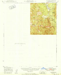
 1903 Congress1962 Print · USGSYavapai County's high desert mining camps and cattle ranches are captured here at the turn of the century. Genealogists and historians can trace the early rail-and-mine economy through sites like Congress Junction, Octave, and the Walnut Grove Dam.
 - 1904 Map of Congress
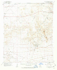
 1904 Congress1904 Print · USGSArizona's mining heartland in Yavapai County comes alive during this early boom era. Genealogists and historians can trace the foundations of Congress Junction, the bustling Congress Mine, and the legendary gold camp at Stanton along the Hassayampa River.3 unique versions available
 - 1947 Map of Wagoner, 1959 Print
 1947 Wagoner1959 Print · USGSYavapai County ranching country is captured here in the late 1940s as modern aviation began to reach remote outposts. Genealogists and historians can locate family holdings at the Diamond 2 Ranch and Cooper Ranch or trace old trails near Wagoner and Minnehaha Flat.2 unique versions available
 - 1948 Map of Wagoner
 1948 Wagoner1948 Print · USGSRanching life in Yavapai County takes center stage in the late 1940s, showing a remote landscape defined by the Hassayampa River. Genealogists and historians can locate old outposts like Wagoner and Minnehaha or trace family landmarks like the Cooper Ranch.
 - 1950 Map of Wagoner
 1950 Wagoner1950 Print · USGSYavapai County ranching life is preserved in this mid-century survey of the Arizona interior as it appeared just after the war. Researchers can trace the layout of the Diamond 2 Ranch, the isolated settlement of Minnehaha, and the winding course of the Hassayampa River.2 unique versions available
 - 1950 Map of Prescott, 1951 Print
 1950 Prescott1951 Print · USGSArizona's mining and ranching frontiers were in full operation during the early fifties, from the vertical streets of Jerome to the remote western desert. Genealogists and researchers can trace rural life via the Bland School, the United Verde Mine, and stops along the Atchison Topeka and Santa Fe Railway.
 - 1954 Map of Prescott, 1963 Print
 1954 Prescott1963 Print · USGSYavapai County mining and ranching districts are shown in high detail during the mid-twentieth century. Researchers can trace the legacy of remote camps and transport hubs like Swansea, Octave, and the Bagdad Mine along the desert rail lines.4 unique versions available
 - 1954 Map of Phoenix, 1964 Print
 1954 Phoenix1964 Print · USGSMid-century Arizona is captured here as the Phoenix metropolitan area begins its rapid expansion into the surrounding desert. Genealogists and historians can trace the development of agricultural hubs like Buckeye and Tolleson, or locate remote landmarks like the Vulture Mine and Nottbusch Cem.5 unique versions available
 - 1957 Map of Phoenix
 1957 Phoenix1957 Print · USGSGreater Phoenix and the central Arizona desert during the mid-fifties reveal a landscape of growing suburbs and active desert mines. Researchers can trace the legacy of local landmarks like Wickenburg Prison, the Vulture Mine, and the Tonopah Post Office.
 - 1958 Map of Prescott
 1958 Prescott1958 Print · USGSCentral Arizona's rugged mining and ranching corridors come alive in the late fifties. Genealogists and historians can trace the remote Trout Creek School, the mining operations at Jerome, and the rail stops at Skull Valley and Kirkland.
 - 1958 Map of Phoenix
 1958 Phoenix1958 Print · USGSThe Phoenix Valley enters a period of postwar expansion, where desert irrigation meets massive military aviation footprints. Trace the development of Phoenix and Glendale alongside the legendary Vulture Mine and the auxiliary runways of Luke Air Force Base.
 - 1959 Map of Prescott
 1959 Prescott1959 Print · USGSYavapai County and the central Arizona highlands come alive in the late fifties, showcasing a landscape of mountain mining towns and forest outposts. Researchers can trace the industrial footprints of the United Verde Mine, follow the Atchison Topeka and Santa Fe rails, and locate remote settlements like Swansea or Skull Valley.2 unique versions available
 - 1960 Map of Prescott
 1960 Prescott1960 Print · USGSYavapai County and the surrounding high-desert mining districts are captured here during a period of steady industrial and rail activity. Researchers can trace the routes of the Atchison Topeka and Santa Fe Railway and locate historic sites like the United Verde Mine and Bland School.2 unique versions available
 - 1960 Map of Phoenix
 1960 Phoenix1960 Print · USGSCentral Arizona in the mid-fifties reveals a landscape of rapid suburban growth alongside enduring desert mining and ranching. Genealogists and historians can trace rail-side settlements like Vicksburg Junction and Waddell, or locate the Vulture Mine and early sites like Agua Fria School.
 - 1961 Map of Vulture Mountains, 1963 Print
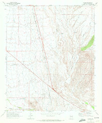
 1961 Vulture Mountains1963 Print · USGSThe Arizona desert around Wickenburg reveals its deep mining history and railroad heritage during the early 1960s. Researchers can locate the famed Vulture Mine, trace the Atchison Topeka and Santa Fe line, and find the Wickenburg Massacre Historical Monument.3 unique versions available
 - 1964 Map of Wickenburg, 1965 Print
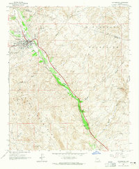 1964 Wickenburg1965 Print · USGSWickenburg and the surrounding desert peaks were defined by the rail and river corridors of the mid-sixties. Researchers can trace the path of the Atchison Topeka and Santa Fe railroad past Allah, locate the Dragon Mine, or find the Remuda Ranch Landing Strip.4 unique versions available
 - 1965 Map of Prescott
 1965 Prescott1965 Print · USGSArizona's mining heartland is captured during the mid-sixties, from the copper mines of Jerome to the cattle country of Williamson Valley Wash. Genealogists and historians can trace old mining camps at Octave and Stanton or the historic Whipple Military Reservation.
 - 1969 Map of Phoenix, 1970 Print
 1969 Phoenix1970 Print · USGSCentral Arizona is seen at a technological turning point in the late sixties, using Apollo 9 space photography to map the desert landscape. Researchers can trace the growth of Sun City, locate old workings at Vulture Mine, and follow the Gila River past Buckeye.2 unique versions available
 - 1969 Map of Flores, 1972 Print
 1969 Flores1972 Print · USGSYavapai County during the late sixties shows a landscape where rail and aviation meet the high desert. Researchers can trace the Atchison Topeka and Santa Fe line through Flores and locate regional landmarks like Moreton Airport and Black Hill.3 unique versions available
 - 1969 Map of Sam Powell Peak, 1972 Print
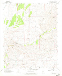 1969 Sam Powell Peak1972 Print · USGSThe high desert of Yavapai County is captured here in the late sixties, revealing a landscape defined by mining prospects and cattle fencing. Researchers can trace the rugged network of pack trails leading to the Mistake Mine, Oro Grande Mine, and the Sand Mill.3 unique versions available
 - 1971 Map of Phoenix
 1971 Phoenix1971 Print · USGSCentral Arizona at the start of the seventies shows a desert metropolis expanding toward the Sun Valley retirement boom. Trace the growth of Sun City and Glendale, or locate remote historic sites like the Vulture Gold Mine and Nottbusch Cemetery.
 - 1981 Map of Bradshaw Mts, 1996 Print
 1981 Bradshaw Mts1996 Print · USGSYavapai County during the early 1980s reveals a high-desert landscape shaped by mining camps and the winding Atchison Topeka and Santa Fe railroad. Researchers can trace historic industrial sites like the Crown King Mine and remote settlements such as Bumble Bee and Cleator.2 unique versions available
 - 1988 Map of Phoenix North, 1989 Print
 1988 Phoenix North1989 Print · USGSNorth of Phoenix in the late eighties, the desert landscape transitions from the mining heritage of Wickenburg to the burgeoning suburbs of the valley. Trace the paths of the Atchison Topeka and Santa Fe Railway or locate old operations like the Vulture Mine.2 unique versions available
Showing maps 1-25 of 42
Top cities near Wickenburg
- Surprise historical maps
- Buckeye historical maps
- Congress historical maps
- Circle City historical maps
- Morristown historical maps
Frequently asked questions
- What are the different types of historical maps available for Wickenburg?
- What is the oldest map of Wickenburg?
- Where can I purchase historical maps of Wickenburg for my home or office?
- Where can I download high-res historical maps of Wickenburg?
- Are there historical topographic maps available for Wickenburg?
- Is there historical aerial imagery available for Wickenburg?
- Where are historical maps of Wickenburg sourced from?