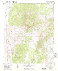
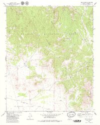
1900s (20th Century) Maps of Chino Valley, Arizona
Explore 21 historic maps of Chino Valley from the 1900s (20th Century). These maps offer a rare glimpse into what life looked like during the 1900s — showing old roads, neighborhoods, homes, and landmarks that have changed or disappeared over time.
Whether you're researching your family's past, planning a metal detecting trip, or studying how Chino Valley's landscape evolved across the 1900s, these high-resolution maps are a powerful tool for exploring the history of this region.
- Focus on a specific era: All maps on this page are from the 1900s, giving you a focused view of this time period.
- See what’s changed: Compare century-old streets, trails, and buildings to today's modern landscape using overlays and satellite layers.
- Research with precision: Use these maps for genealogy, historical research, land use analysis, or educational projects.
- View, download, or print: Maps are fully viewable online in high resolution, and can be downloaded or printed for your own records.
Start exploring Chino Valley's history through authentic maps from the 1900s. This is your window into the past.
Chino Valley, AZ maps
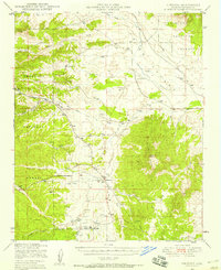
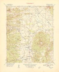
(21)- 1905 Map of Jerome
 1905 Jerome1905 Print · USGSArizona's copper mining and ranching frontiers come to life in this early century survey of the Verde Valley. Trace the narrow-gauge United Verde and Pacific RR as it climbs toward Jerome, or locate family-named sites like Carter's Ranch and Perkins Ranch.2 unique versions available
 - 1947 Map of Simmons, 1958 Print
 1947 Simmons1958 Print · USGSYavapai County ranching country is captured here in the late 1940s, showing a landscape defined by cattle outfits and remote valley outposts. Researchers can trace historic family-named locations such as Seven V Ranch, Wineglass Ranch, and the Eddy Place near Simmons Pk.2 unique versions available
 - 1947 Map of Paulden, 1958 Print
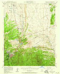
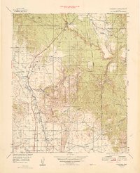
 1947 Paulden1958 Print · USGSCentral Arizona ranching and rail history come alive in this late 1940s survey of the Chino Valley. Genealogists and historians can trace the Atchison Topeka and Santa Fe line past Drake, Sullivan Lake, and the historic Del Rio Ranch.3 unique versions available
 - 1947 Map of Prescott, 1959 Print
 1947 Prescott1959 Print · USGSArizona's territorial capital region is captured here in the late 1940s as the town expands toward the high desert. Genealogists and researchers can trace the limits of the Whipple Military Reservation, locate the Cem in Miller Valley, and follow the Atchison Topeka and Santa Fe rail line.3 unique versions available
 - 1948 Map of Prescott
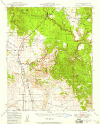
 1948 Prescott1948 Print · USGSPrescott and the surrounding Yavapai County highlands are shown here in the late 1940s as a bustling hub of mining, military presence, and rail transport. Researchers can trace historic landmarks like the Whipple Military Reservation, the Iron King Mine, and the Fain Ranch.4 unique versions available
 - 1948 Map of Simmons
 1948 Simmons1948 Print · USGSYavapai County ranching country is captured here in the late 1940s, showing a land defined by water rights and cattle. Genealogists and historians can trace old homesteads and landmarks like Simmons, Inscription Canyon, and the Las Vegas Ranch.
 - 1949 Map of Paulden
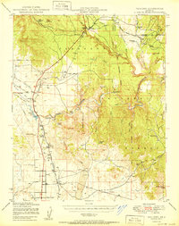
 1949 Paulden1949 Print · USGSHigh desert ranching and rail infrastructure define this portion of Yavapai County in the late forties. Researchers can trace historic family holdings like Del Rio Ranch and Bar Heart Ranch alongside the Atchison Topeka and Santa Fe rail line.
 - 1950 Map of Paulden
 1950 Paulden1950 Print · USGSYavapai County ranching and rail infrastructure are captured here in the mid-twentieth century as the high desert settlements expanded. Researchers can trace the path of the Atchison Topeka and Santa Fe through Drake and locate family landmarks like Stewart Ranch and Hubbel Ranch.2 unique versions available
 - 1950 Map of Simmons
 1950 Simmons1950 Print · USGSYavapai County ranching country is captured here during the post-war era of the late 1940s. Genealogists and historians can trace significant family holdings like Seven V Ranch and Las Vegas Ranch or locate landmarks such as Inscription Canyon.2 unique versions available
 - 1950 Map of Prescott, 1951 Print
 1950 Prescott1951 Print · USGSArizona's mining and ranching frontiers were in full operation during the early fifties, from the vertical streets of Jerome to the remote western desert. Genealogists and researchers can trace rural life via the Bland School, the United Verde Mine, and stops along the Atchison Topeka and Santa Fe Railway.
 - 1954 Map of Prescott, 1963 Print
 1954 Prescott1963 Print · USGSYavapai County mining and ranching districts are shown in high detail during the mid-twentieth century. Researchers can trace the legacy of remote camps and transport hubs like Swansea, Octave, and the Bagdad Mine along the desert rail lines.4 unique versions available
 - 1958 Map of Prescott
 1958 Prescott1958 Print · USGSCentral Arizona's rugged mining and ranching corridors come alive in the late fifties. Genealogists and historians can trace the remote Trout Creek School, the mining operations at Jerome, and the rail stops at Skull Valley and Kirkland.
 - 1959 Map of Prescott
 1959 Prescott1959 Print · USGSYavapai County and the central Arizona highlands come alive in the late fifties, showcasing a landscape of mountain mining towns and forest outposts. Researchers can trace the industrial footprints of the United Verde Mine, follow the Atchison Topeka and Santa Fe rails, and locate remote settlements like Swansea or Skull Valley.2 unique versions available
 - 1960 Map of Prescott
 1960 Prescott1960 Print · USGSYavapai County and the surrounding high-desert mining districts are captured here during a period of steady industrial and rail activity. Researchers can trace the routes of the Atchison Topeka and Santa Fe Railway and locate historic sites like the United Verde Mine and Bland School.2 unique versions available
 - 1965 Map of Prescott
 1965 Prescott1965 Print · USGSArizona's mining heartland is captured during the mid-sixties, from the copper mines of Jerome to the cattle country of Williamson Valley Wash. Genealogists and historians can trace old mining camps at Octave and Stanton or the historic Whipple Military Reservation.
 - 1973 Map of Prescott Valley North, 1976 Print
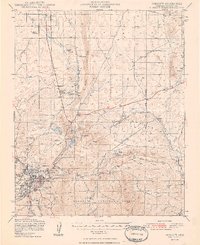
 1973 Prescott Valley North1976 Print · USGSIn the early 1970s, the area north of Prescott Valley was a landscape of ranching water tanks and early residential street grids. Trace the beginnings of local neighborhoods and find historical sites like the Old Hopkins Mine and the Agua Fria River.3 unique versions available
 - 1973 Map of Chino Valley South, 1977 Print
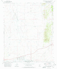
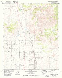
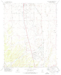 1973 Chino Valley South1977 Print · USGSYavapai County during the early 1970s shows a landscape of aviation and irrigation development south of the town center. Local researchers can trace the Atchison Topeka and Santa Fe rail line, Rolling Hills Cem, and private airstrips like Robin Landing Field.2 unique versions available
 - 1979 Map of Sullivan Buttes
 1979 Sullivan Buttes1979 Print · USGSYavapai County ranching and rail activity are captured here during the late seventies, showing a landscape shaped by water management and transit. Researchers can locate remote outposts like Matii Ranch and Tucker Siding or trace the path of Inscription Canyon.3 unique versions available
 - 1979 Map of King Canyon
 1979 King Canyon1979 Print · USGSYavapai County ranching and forest lands are shown here in the late seventies, centered on the high basins near the Verde River. Researchers can trace historical infrastructure like the Old Railroad Grade and find early landmarks including Ruins and St Matthews Mtn.3 unique versions available
 - 1979 Map of Chino Valley North
 1979 Chino Valley North1979 Print · USGSNorthern Arizona's high desert meets the Verde River headwaters in the late 1970s, as ranching and rail infrastructure define the landscape. Researchers can trace the legacy of the Atchison Topeka and Santa Fe and local Indian Ruins near Del Rio Ranch.2 unique versions available
 - 1981 Map of Prescott, 1996 Print
 1981 Prescott1996 Print · USGSYavapai County experienced a period of transition in the early eighties as mining heritage and modern growth converged. Genealogists and historians can trace the industrial footprints of the United Verde Mine and the rail route of the Atchison Topeka and Santa Fe.2 unique versions available
End of results
Showing maps 1-21 of 21
Top cities near Chino Valley
- Prescott historical maps
- Prescott Valley historical maps
- Williamson historical maps
- Paulden historical maps
Frequently asked questions
- What are the different types of historical maps available for Chino Valley?
- What is the oldest map of Chino Valley?
- Where can I purchase historical maps of Chino Valley for my home or office?
- Where can I download high-res historical maps of Chino Valley?
- Are there historical topographic maps available for Chino Valley?
- Is there historical aerial imagery available for Chino Valley?
- Where are historical maps of Chino Valley sourced from?