2000s (21st Century) Maps of Leland, Arkansas
Explore 5 historic maps of Leland from the 2000s (21st Century). These maps offer a rare glimpse into what life looked like during the 2000s — showing old roads, neighborhoods, homes, and landmarks that have changed or disappeared over time.
Whether you're researching your family's past, planning a metal detecting trip, or studying how Leland's landscape evolved across the 2000s, these high-resolution maps are a powerful tool for exploring the history of this region.
- Focus on a specific era: All maps on this page are from the 2000s, giving you a focused view of this time period.
- See what’s changed: Compare century-old streets, trails, and buildings to today's modern landscape using overlays and satellite layers.
- Research with precision: Use these maps for genealogy, historical research, land use analysis, or educational projects.
- View, download, or print: Maps are fully viewable online in high resolution, and can be downloaded or printed for your own records.
Start exploring Leland's history through authentic maps from the 2000s. This is your window into the past.
Leland, AR maps
(5)- 2011 Map of Red Leaf, 2011 Print
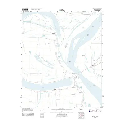 2011 Red Leaf2011 Print · USGSCovers Leland, including Greenville, Shives, and other nearby areas
 - 2014 Map of Red Leaf, 2014 Print
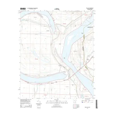 2014 Red Leaf2014 Print · USGSCovers Leland, including Greenville, Shives, and other nearby areas
 - 2017 Map of Red Leaf, 2017 Print
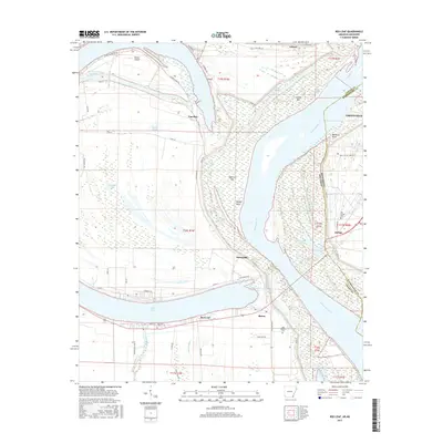 2017 Red Leaf2017 Print · USGSCovers Leland, including Greenville, Shives, and other nearby areas
 - 2020 Map of Red Leaf, 2020 Print
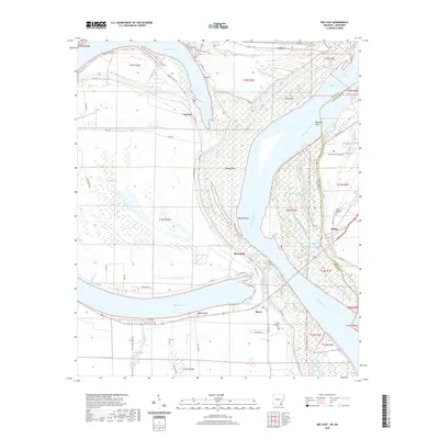 2020 Red Leaf2020 Print · USGSCovers Leland, including Greenville, Shives, and other nearby areas
 - 2024 Map of Red Leaf, 2024 Print
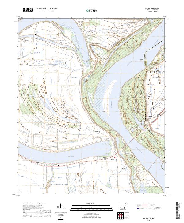 2024 Red Leaf2024 Print · USGSThe Chicot County riverfront in the 2020s remains a landscape defined by the shifting currents of the Mississippi River and its massive alluvial bends. Researchers can trace the heritage of local estates at the Rossmere Plantation Cem or follow old water routes at Whiskey Chute and Lake Chicot.
End of results
Showing maps 1-5 of 5
Top cities near Leland
Frequently asked questions
- What are the different types of historical maps available for Leland?
- What is the oldest map of Leland?
- Where can I purchase historical maps of Leland for my home or office?
- Where can I download high-res historical maps of Leland?
- Are there historical topographic maps available for Leland?
- Is there historical aerial imagery available for Leland?
- Where are historical maps of Leland sourced from?