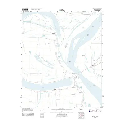
2011 Map of Red Leaf
USGS Topo · Published 2011About this map
Mississippi River meanders define the complex landscape of this borderland, where the water divides Arkansas and Mississippi. The massive oxbow of Lake Chicot dominates the western portion of the sheet, while the river's main channel winds past Walker Bend and Island Number 84. This environment is a maze of hydraulic management and alluvial history, evidenced by the Sunnyside Revetment and Leland Bar Dikes designed to stabilize the shifting banks.
Find a feature on this map
53 named features on this map. Tap any name to fly to it.
Don’t see what you’re looking for? This feature index may not catch every label — zoom into the map to look around manually.
Map Details
Editions of this 2011 Red Leaf Map
This is the sole edition of this map. No revisions or reprints were ever made.
Other maps of this area

1936 · Eudora
USGS Topo · 1:62,500

1936 · Lake Village
USGS Topo · 1:62,500

1939 · Readland
USGS Topo · 1:62,500

1939 · Refuge
USGS Topo · 1:62,500

1953 · Greenwood
USGS Topo · 1:250,000

1955 · Lake Village
USGS Topo · 1:62,500

1956 · Greenwood
USGS Topo · 1:250,000

1957 · Eudora
USGS Topo · 1:62,500
1970 · Luna
USGS Topo · 1:24,000
1970 · Greenville
USGS Topo · 1:24,000