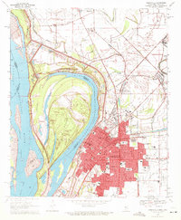
1970 Map of Greenville
USGS Topo · Published 1972About this map
The Mississippi River defines the western edge of this 1970 survey, where complex hydrology is on full display through the Leland Cutoff and Tarpley Cutoff. These engineering feats left behind large oxbows like Lake Ferguson and created the expansive Archer Island, which sits between the main channel and the city of Greenville. The urban core of Greenville is densely detailed, showing the local infrastructure of the era, including the General Hospital, City Hall, and numerous neighborhood schools like McBride Sch and Coleman High Sch.
Find a feature on this map
71 named features on this map. Tap any name to fly to it.
Don’t see what you’re looking for? This feature index may not catch every label — zoom into the map to look around manually.
Map Details
Editions of this 1970 Greenville Map
2 editions found
Other maps of this area

1933 · Lamont
USGS Topo · 1:62,500

1939 · Refuge
USGS Topo · 1:62,500

1939 · Lamont
USGS Topo · 1:62,500

1939 · Tralake
USGS Topo · 1:62,500

1939 · Choctaw
USGS Topo · 1:62,500

1953 · Greenwood
USGS Topo · 1:250,000

1956 · Greenwood
USGS Topo · 1:250,000

1967 · Arcola
USGS Topo · 1:24,000

1967 · Stringtown
USGS Topo · 1:24,000

1967 · Leland
USGS Topo · 1:24,000