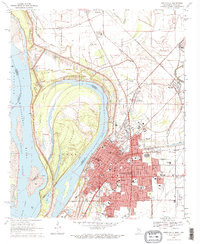
1970 Map of Greenville
USGS Topo · Published 1972About this map
Lake Ferguson and the serpentine curves of the Mississippi River dominate this 1970s landscape, illustrating the complex hydrology of the Delta. The city of Greenville appears as a dense urban core protected by an extensive Levee system, with its residential and industrial growth constrained by the river's historical path. To the north, the ancient history of the region is preserved at Winterville State Park, which contains a notable Indian Mound near the settlement of Winterville. The map captures a diverse community, evidenced by specialized sites like the Chinese Cem and Jewish Cem, alongside numerous educational institutions such as Coleman High Sch and St Josephs Sch. Transportation remains central to the area's identity, shown through the Illinois Central Railroad and the now-labeled Greenville Municipal Airport (Abandoned), marking the shift from aviation to other land uses in the late twentieth century.
Find a feature on this map
70 named features on this map. Tap any name to fly to it.
Don’t see what you’re looking for? This feature index may not catch every label — zoom into the map to look around manually.
Map Details
Editions of this 1970 Greenville Map
2 editions found
Other maps of this area

1933 · Lamont
USGS Topo · 1:62,500

1939 · Refuge
USGS Topo · 1:62,500

1939 · Lamont
USGS Topo · 1:62,500

1939 · Tralake
USGS Topo · 1:62,500

1939 · Choctaw
USGS Topo · 1:62,500

1953 · Greenwood
USGS Topo · 1:250,000

1956 · Greenwood
USGS Topo · 1:250,000

1967 · Arcola
USGS Topo · 1:24,000

1967 · Stringtown
USGS Topo · 1:24,000

1967 · Leland
USGS Topo · 1:24,000