Old Maps of Parkin, Arkansas for Genealogy
Trace your family roots with 23 historic maps of Parkin. These high-res maps reveal old neighborhoods, homesites, landmarks, and streets — helping you uncover where your ancestors lived and how the area evolved over time.
- Explore historic neighborhoods: Identify where your relatives may have lived in the 1800s or 1900s.
- Compare maps over time: Trace the changes in streets, buildings, and landmarks for multi-generational research.
- Perfect for genealogy & ancestry research: Used by family historians and researchers to map out lineage and migration.
These maps are an incredible resource for exploring your personal connection to Parkin's past.
Parkin, AR maps
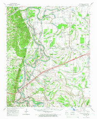
(23)- 1940 Map of Princedale, 1942 Print
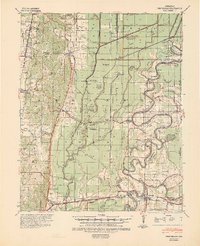 1940 Princedale1942 Print · USGSEastern Arkansas at the cusp of World War II is mapped here as a land of managed floodways and emerging rail towns. Genealogists can trace family footprints at Hare Farm Sch, Sharps Chapel, and along the banks of the St Francis River.2 unique versions available
 - 1940 Map of Whitmore, 1942 Print
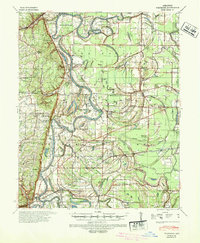 1940 Whitmore1942 Print · USGSSt. Francis County in the early 1940s shows a complex river-and-rail landscape shaped by the meanders of the St Francis River. Researchers can trace old family settlements and rural institutions like Wittsburg, the Church of Bethlehem, and Walters Cem.2 unique versions available
 - 1953 Map of Memphis, 1966 Print
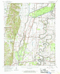
 1953 Memphis1966 Print · USGSEastern Arkansas and the Memphis riverfront are shown here during the mid-century period of regional growth and river management. Local historians can trace the paths of the Chicago Rock Island & Pacific RR through Forrest City or locate river landmarks like President's Island.3 unique versions available
 - 1956 Map of Memphis
 1956 Memphis1956 Print · USGSThe Mississippi Delta and the bluffs of West Tennessee meet in the mid-fifties, showing a landscape defined by massive river systems and rail hubs. Researchers can trace the path of Crowleys Ridge or locate vanished river landings near Centennial Island and Island No 35.
 - 1956 Map of Whitmore, 1957 Print
 1956 Whitmore1957 Print · USGSThe St. Francis River delta was a landscape of intricate oxbows and rural congregations in the mid-fifties. Genealogists can trace family roots at Shiloh Ch & Cem or Locust Grove Ch & Cem and locate vanished school sites like Reiff Sch.
 - 1956 Map of Princedale, 1957 Print
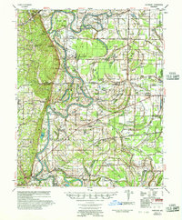
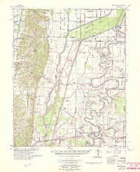
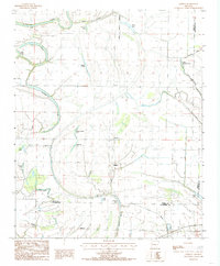
 1956 Princedale1957 Print · USGSCross County in the mid-fifties is captured here as a landscape defined by the winding St Francis River and a massive network of drainage ditches. Researchers can locate many family-named landmarks and vanished rural hubs like Bay Village, Burr Place, and the Wildwood Ch & Sch.
 - 1960 Map of Whitmore, 1966 Print
 1960 Whitmore1966 Print · USGSIn the Arkansas delta during the early sixties, the river loops and rail lines shaped every community. Genealogists can trace family landmarks like Wittsburg Cem, Newcastle, and rural schools such as Campbell Sch near the Missouri Pacific RR.
 - 1962 Map of Princedale, 1968 Print
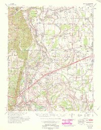
 1962 Princedale1968 Print · USGSEastern Arkansas in the early sixties reveals a landscape shaped by Poinsett Ridge and the winding St. Francis River. Genealogists and local historians can trace family locations like Yarbo Place, rural landmarks such as McDonald Ch, and the stop at Cherry Valley Halt.
 - 1965 Map of Whitmore
 1965 Whitmore1965 Print · USGSEastern Arkansas at the mid-century reveals a landscape shaped by the St Francis River and the high ground of Crowley s Ridge. Researchers can trace the heritage of rural communities through dozens of landmarks like Wittsburg Cemetery, Harris Chapel, and Campbell Sch.
 - 1966 Map of Princedale
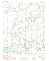
 1966 Princedale1966 Print · USGSEastern Arkansas river life in the mid-sixties centered on the complex drainage of the St Francis River. Genealogists can trace family landmarks like Burr Place and Harefarm Cem or rural centers like Wildwood Ch & Sch.
 - 1984 Map of Gieseck, 1985 Print
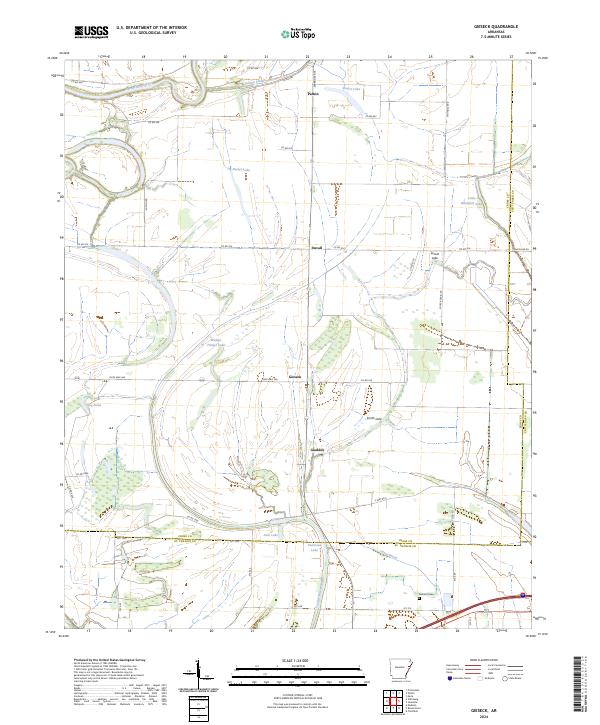
 1984 Gieseck1985 Print · USGSEastern Arkansas at the edge of the St. Francis Sunken Lands shows a landscape of engineered drainage and remnant oxbows in the mid-1980s. Genealogists and local historians can trace the footprint of Parkin, Gieseck, and Gladden, alongside landmarks like Patterson Lake and Little Blackfish Lake.2 unique versions available
 - 1984 Map of Parkin, 1985 Print
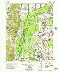
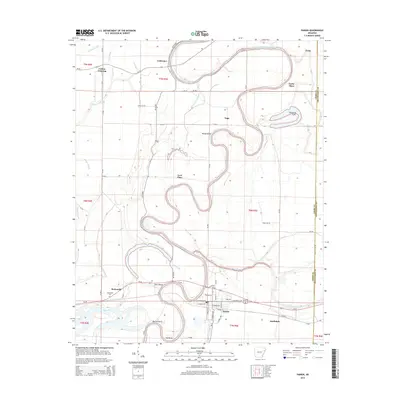
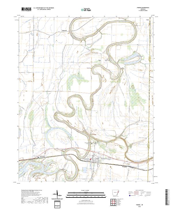
 1984 Parkin1985 Print · USGSThe St. Francis River basin in the mid-1980s reveals a landscape of deep river bends and delta wetlands along the Cross County line. Genealogists can locate family sites near Parkin, Coldwater, or Smithdale, and trace the shifting banks of Pemiscot Lake and Barnes Lake.2 unique versions available
 - 1986 Map of Memphis West
 1986 Memphis West1986 Print · USGSThe Mississippi River delta and the rise of Crowleys Ridge define this mid-1980s look at the Mid-South. Researchers can trace the development of West Memphis and Marion or locate landmarks like Crittenden Mem Cem and Village Creek State Park.2 unique versions available
 - 2011 Map of Gieseck, 2011 Print
 2011 Gieseck2011 Print · USGSCovers Parkin, including Gladden, Duvall, and other nearby areas
 - 2011 Map of Parkin, 2011 Print
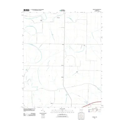
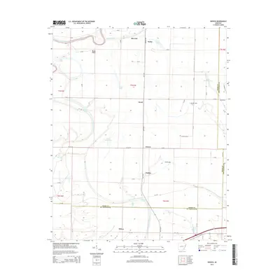
 2011 Parkin2011 Print · USGSCovers Parkin, including Yarbo Place, Smithdale, and other nearby areas
 - 2014 Map of Parkin, 2014 Print
 2014 Parkin2014 Print · USGSCovers Parkin, including Yarbo Place, Smithdale, and other nearby areas
 - 2014 Map of Gieseck, 2014 Print
 2014 Gieseck2014 Print · USGSCovers Parkin, including Gladden, Duvall, and other nearby areas
 - 2017 Map of Gieseck, 2017 Print
 2017 Gieseck2017 Print · USGSCovers Parkin, including Gladden, Duvall, and other nearby areas
 - 2017 Map of Parkin, 2017 Print
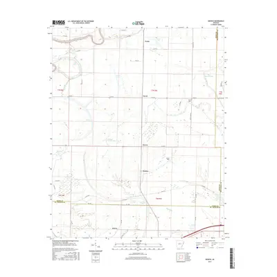
 2017 Parkin2017 Print · USGSCovers Parkin, including Yarbo Place, Smithdale, and other nearby areas
 - 2020 Map of Parkin, 2020 Print
 2020 Parkin2020 Print · USGSCovers Parkin, including Yarbo Place, Smithdale, and other nearby areas
 - 2020 Map of Gieseck, 2020 Print
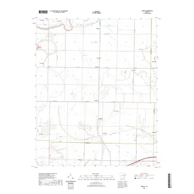 2020 Gieseck2020 Print · USGSCovers Parkin, including Gladden, Duvall, and other nearby areas
 - 2024 Map of Parkin, 2024 Print
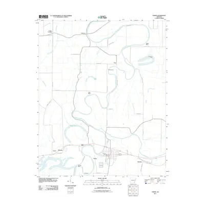
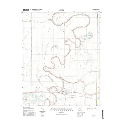
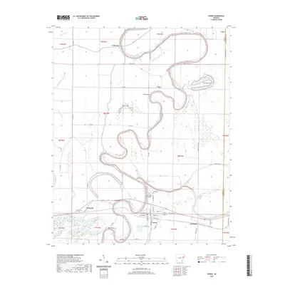
 2024 Parkin2024 Print · USGSThe Arkansas Delta comes alive on this map, showing the winding river bends and historic settlements of Cross County in the early twenty-first century. Researchers can trace the oxbows of the Saint Francis River and locate Parkin Archeological State Park Cem or the site of Old Neelys Ferry.
 - 2024 Map of Gieseck, 2024 Print
 2024 Gieseck2024 Print · USGSCross County, Arkansas, is captured here in its modern agricultural character, defined by the winding Saint Francis River and its many bayous. Genealogists and local historians can trace the rural communities of Gieseck and Gladden or locate family roots near Jackson Cem.
End of results
Showing maps 1-23 of 23
Top cities near Parkin
- Forrest City historical maps
- Wynne historical maps
- Earle historical maps
- Tyronza historical maps
- Cherry Valley historical maps
- Crawfordsville historical maps
See more
Frequently asked questions
- What are the different types of historical maps available for Parkin?
- What is the oldest map of Parkin?
- Where can I purchase historical maps of Parkin for my home or office?
- Where can I download high-res historical maps of Parkin?
- Are there historical topographic maps available for Parkin?
- Is there historical aerial imagery available for Parkin?
- Where are historical maps of Parkin sourced from?