Old Maps of Faulkner County, Arkansas for Genealogy
Trace your family roots with 166 historic maps of Faulkner County. These high-res maps reveal old neighborhoods, homesites, landmarks, and streets — helping you uncover where your ancestors lived and how the area evolved over time.
- Explore historic neighborhoods: Identify where your relatives may have lived in the 1800s or 1900s.
- Compare maps over time: Trace the changes in streets, buildings, and landmarks for multi-generational research.
- Perfect for genealogy & ancestry research: Used by family historians and researchers to map out lineage and migration.
These maps are an incredible resource for exploring your personal connection to Faulkner County's past.
Faulkner County, AR maps
(166)- 1890 Map of Benton
 1890 Benton1890 Print · USGSSaline and Pulaski counties are shown here in the late nineteenth century as the rail network began to reshape the river-valley economy. Genealogists and researchers can trace family roots through old settlements like Brazils and Avilla or locate landmarks like Goosepond Mt and Aplin.
 - 1891 Map of Little Rock
 1891 Little Rock1891 Print · USGSLittle Rock and the central Arkansas river valley are shown in detail during the 1890s, when rail travel and river trade dominated the local economy. Genealogists can trace early homesteads and communities near Argenta, the Indian Mounds at Toltec, and Sweet Home.
 - 1892 Map of Morrillton
 1892 Morrillton1892 Print · USGSThe Arkansas River valley at the end of the nineteenth century was a landscape of vital ferry crossings and early rail expansion. Genealogists and historians can trace the foundations of Morrillton and Perryville or locate river landmarks like Galla Rock Fy. and Stouts Ldg.
 - 1893 Map of Little Rock
 1893 Little Rock1893 Print · USGSLittle Rock and the Arkansas River valley are shown here in the early 1890s, just as the regional rail network was maturing. Genealogists can trace family roots through old settlements like Argenta, Shilcott, and Collegeville, or locate archaeological sites such as the Indian Mounds.5 unique versions available
 - 1894 Map of Morrillton
 1894 Morrillton1894 Print · USGSThe Arkansas River valley and the Ouachita foothills meet in the 1890s, where river traffic and the rail line define the local economy. Genealogists can trace early homesteads and crossings near Morrillton, Burnetts Ford, and the rugged heights of Cedar Falls Mt.5 unique versions available
 - 1894 Map of Benton
 1894 Benton1894 Print · USGSCentral Arkansas in the late nineteenth century was a landscape of steep ridges and critical river crossings. Genealogists and researchers can trace the early rail corridor of the St. Louis Iron Mountain and Southern R. R. near Benton or locate family roots in Avilla and Brazils.5 unique versions available
 - 1941 Map of Olmstead, 1945 Print
 1941 Olmstead1945 Print · USGSNorth of Little Rock in the early 1940s, this area was a network of bayous and ridges punctuated by rural crossroads and family homesteads. Genealogists and local historians can trace legacy sites like Tates Mill, Sumner Cem, and several country meeting houses including Zion Hill Ch and Harmony Ch.
 - 1943 Map of Pinnacle Mtn, 1946 Print
 1943 Pinnacle Mtn1946 Print · USGSPulaski County at the end of the war shows a landscape of river-bend settlements and rising ridges. Genealogists can trace family names at the Brimmette Cem and Pankey Cem or locate old school sites like Round Hill Sch.
 - 1953 Map of Cato
 1953 Cato1953 Print · USGSThe hills of central Arkansas meet heavy military and rural history during the mid-fifties near the Faulkner-Pulaski line. Trace the borders of (Former Camp J T Robinson) and locate local landmarks like Blue Hill School and Cato Pentecostal Church.4 unique versions available
 - 1953 Map of Mayflower, 1957 Print
 1953 Mayflower1957 Print · USGSThe Arkansas River valley at mid-century shows a landscape defined by military reservations and rural settlement patterns. Genealogists and local historians can trace the foundations of Mayflower and find historic sites like White City Church and Mayflower Cemetery.5 unique versions available
 - 1954 Map of Pinnacle Mountain, 1957 Print
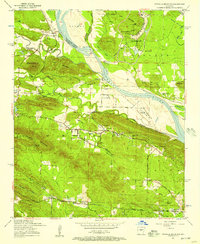 1954 Pinnacle Mountain1957 Print · USGSThe foothills of the Ouachitas meet the Arkansas River mid-century, where industry and rural life intersect. Genealogists and historians can trace family locations near the Maumelle Ordnance Works, Joe T Robinson School, and Natural Steps.
 - 1954 Map of Olmstead, 1957 Print
 1954 Olmstead1957 Print · USGSPulaski County at the dawn of the jet age shows a rural landscape of ridges and bayous meeting the new military installations. Genealogists can locate family sites like Mount Valley Cemetery, Tates Mill, and the Bayou Mete School.4 unique versions available
 - 1955 Map of Little Rock, 1978 Print
 1955 Little Rock1978 Print · USGSCentral Arkansas in the mid-fifties exhibits a landscape of growing cities, massive military installations, and mountain reservoirs. Genealogists and historians can trace the industrial Bauxite Mines, regional rail lines, and local landmarks like Antioch Church.
 - 1956 Map of Little Rock
 1956 Little Rock1956 Print · USGSCentral Arkansas in the mid-fifties shows a landscape defined by burgeoning military bases and the timber-and-mineral wealth of the Ouachitas. Genealogists and researchers can trace old rail lines like the Missouri Pacific and find established communities such as Bauxite, Sheridan, and Mabelvale.
 - 1956 Map of Russellville
 1956 Russellville1956 Print · USGSThe Arkansas River valley and the surrounding Boston Mountains are captured here in the mid-fifties, showing a landscape of small timber towns and new reservoirs. Genealogists can trace family roots through upland settlements like Pelsor and Witts Springs or locate the campus of Arkansas Polytechnic College.2 unique versions available
 - 1960 Map of Little Rock
 1960 Little Rock1960 Print · USGSCentral Arkansas in the late fifties shows a landscape of growing military bases and massive new reservoirs. Local historians can trace the mid-century expansion of Little Rock and Hot Springs alongside the industrial works at Bauxite and the Pine Bluff Arsenal.
 - 1961 Map of Menifee, 1962 Print
 1961 Menifee1962 Print · USGSConway County communities are captured here in the early sixties as they developed along the Missouri Pacific rail line. Genealogists and local historians can locate several rural landmarks including the County Training Sch, Pilgrim Rest Ch, and the waters of Old River Lake.3 unique versions available
 - 1961 Map of Pinnacle Mountain, 1962 Print
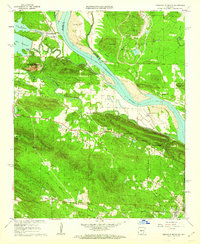 1961 Pinnacle Mountain1962 Print · USGSThe peaks of the Arkansas River Valley stand tall in the early sixties, as suburban growth reaches toward the river's edge. Researchers can trace family history at the Old Soldiers Cem, visit the County Prison Farm, or locate the Pumping Station near Natural Steps.4 unique versions available
 - 1961 Map of Fourche, 1962 Print
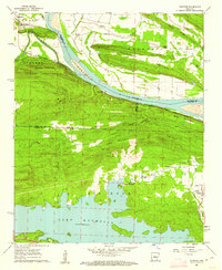 1961 Fourche1962 Print · USGSThe Arkansas River valley meets the Ouachita foothills in the early sixties, showing a landscape of river-bend towns and rising ridgelines. Genealogists can trace family roots through Little Italy and Lundsford Corner, or locate historic sites like Mt Moriah Ch and Rainey Cem.5 unique versions available
 - 1961 Map of Gleason, 1962 Print
 1961 Gleason1962 Print · USGSThe Arkansas River valley comes alive in the early sixties, showing the vital river crossings and mountain ridges of Faulkner and Perry counties. Genealogists and local historians can trace the Toadsuck Ferry, the Missouri Pacific rail line, and rural landmarks like Bethel Ch or Casey Cem.3 unique versions available
 - 1961 Map of Conway, 1963 Print
 1961 Conway1963 Print · USGSThe college town of Conway and the northern reaches of Lake Conway are captured here in the early sixties as the city expanded along the rail lines. Researchers can locate numerous local landmarks including Hendrix College, Oak Grove Cemetery, and State Teachers College.4 unique versions available
 - 1961 Map of Conway, 1963 Print
 1961 Conway1963 Print · USGSConway and central Arkansas are captured here during a season of mid-century growth and collegiate expansion. Researchers can locate vanished rural landmarks and early infrastructure like Hendrix College, Beaver Fork Lake, and the Drive-in Theater.
 - 1961 Map of Bee Branch, 1963 Print
 1961 Bee Branch1963 Print · USGSCentral Arkansas settlements and highland ridges are mapped in the early sixties, showing the rural network of the Van Buren and Faulkner county lines. Researchers can find numerous family landmarks such as Quattlebaum Cem, Pinnacle Springs Tabernacle, and the Solomon Grove Sch.2 unique versions available
 - 1961 Map of Greenbrier, 1966 Print
 1961 Greenbrier1966 Print · USGSThe Greenbrier area of Faulkner County is captured here in the early 1960s, showing a landscape of upland ridges and creek valleys. Researchers can trace rural lineages through sites like Bethlehem Ch, Estep Cem, and the community of Wooster.2 unique versions available
 - 1961 Map of Damascus, 1966 Print
 1961 Damascus1966 Print · USGSThe borderlands of Van Buren and Faulkner counties are captured here in the early sixties, showing a rural landscape defined by creek valleys and high ridges. Genealogists and local historians can locate community anchors like Solomon Grove School, Martinville Cem, and the historic TREATY BOUNDARY.3 unique versions available
Showing maps 1-25 of 166
Top cities of Faulkner County
- Conway historical maps
- Greenbrier historical maps
- Vilonia historical maps
- Mayflower historical maps
- Wooster historical maps
- Holland historical maps
See more
Frequently asked questions
- What are the different types of historical maps available for Faulkner County?
- What is the oldest map of Faulkner County?
- Where can I purchase historical maps of Faulkner County for my home or office?
- Where can I download high-res historical maps of Faulkner County?
- Are there historical topographic maps available for Faulkner County?
- Is there historical aerial imagery available for Faulkner County?
- Where are historical maps of Faulkner County sourced from?