1960s Maps of Grant County, Arkansas
Explore 18 historic maps of Grant County from the 1960s. These maps offer a rare glimpse into what life looked like during the 1960s — showing old roads, neighborhoods, homes, and landmarks that have changed or disappeared over time.
Whether you're researching your family's past, planning a metal detecting trip, or studying how Grant County's landscape evolved across the 1960s, these high-resolution maps are a powerful tool for exploring the history of this region.
- Focus on a specific era: All maps on this page are from the 1960s, giving you a focused view of this time period.
- See what’s changed: Compare century-old streets, trails, and buildings to today's modern landscape using overlays and satellite layers.
- Research with precision: Use these maps for genealogy, historical research, land use analysis, or educational projects.
- View, download, or print: Maps are fully viewable online in high resolution, and can be downloaded or printed for your own records.
Start exploring Grant County's history through authentic maps from the 1960s. This is your window into the past.
Grant County, AR maps
(18)- 1960 Map of Little Rock
 1960 Little Rock1960 Print · USGSCentral Arkansas in the late fifties shows a landscape of growing military bases and massive new reservoirs. Local historians can trace the mid-century expansion of Little Rock and Hot Springs alongside the industrial works at Bauxite and the Pine Bluff Arsenal.
 - 1962 Map of Pine Bluff NW, 1963 Print
 1962 Pine Bluff NW1963 Print · USGSJefferson and Grant counties are captured here in the early sixties, showing a landscape of timbered creek bottoms and quiet rural crossroads. Genealogists and local historians can locate several family landmarks, including Fitzhugh Cem, Lee Cem, and Double Wells Ch.4 unique versions available
 - 1962 Map of Kedron, 1963 Print
 1962 Kedron1963 Print · USGSCleveland and Jefferson Counties are documented here in the early sixties, showing the rail-and-river network of rural Arkansas. Genealogists and local historians can trace family roots through sites like Piney Grove Cem, Mt Carmel Ch, and the settlement of Kedron.3 unique versions available
 - 1963 Map of Traskwood, 1964 Print
 1963 Traskwood1964 Print · USGSSaline and Hot Spring counties are captured here in the early sixties as new highway construction began to reshape the rural landscape. Genealogists and local historians can trace the foundations of Glen Rose, Francois, and Traskwood, alongside landmarks like Holy Ridge Ch and the Fairplay Cem.4 unique versions available
 - 1963 Map of Prattsville, 1964 Print
 1963 Prattsville1964 Print · USGSGrant County is captured in the early sixties as a network of creek-bottom farms and timberland centered on the Saline River. Genealogists and local historians can locate the Sweet Home Ch, Cooper Sch, and the community of Philadelphia.2 unique versions available
 - 1963 Map of Tull, 1964 Print
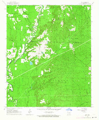 1963 Tull1964 Print · USGSIn the early sixties, the Saline and Grant county line was a landscape of river crossings and small settlements like Tull. Researchers can locate several family burial grounds, including Ashcraft Cem and Jacob Cem, or trace the Missouri Pacific rail line.3 unique versions available
 - 1964 Map of Poyen
 1964 Poyen1964 Print · USGSThe borderlands of Grant and Hot Spring Counties come into focus in the mid-1960s, showing a landscape shaped by timber and rail. Genealogists and local historians can trace family locations near Poyen, Rhinehart, and landmarks like Huskey Ch or the Cunningham Cem.3 unique versions available
 - 1964 Map of Little Rock
 1964 Little Rock1964 Print · USGSCentral Arkansas in the mid-sixties is a landscape of mountain ridges, industrial rail lines, and growing military hubs. Researchers can trace the development of Bauxite and Hot Springs or locate rural landmarks like Sparkman and the Pine Bluff Arsenal.
 - 1964 Map of Staves, 1965 Print
 1964 Staves1965 Print · USGSThe Saline River bottoms of central Arkansas were sparsely settled but culturally rich in the early 1960s. Genealogists can trace family landmarks like Clement Cem, Bethany Ch, and the high ground at White Oak Bluff.3 unique versions available
 - 1964 Map of Sheridan, 1965 Print
 1964 Sheridan1965 Print · USGSSheridan and the surrounding Grant County countryside are captured here in the mid-1960s as a bustling crossroads of rail and local industry. Researchers can trace family roots at Lost Creek Cem or locate cultural landmarks like the Drive-in Theater and Ephesus Ch.3 unique versions available
 - 1964 Map of Cane Creek, 1965 Print
 1964 Cane Creek1965 Print · USGSGrant and Saline counties in the early sixties reveal a landscape of timber stands and creek-bottom farms. Genealogists and historians can trace family roots at Gum Springs Cem, Orion Cem, and small settlements like Tollman and Cane Creek.4 unique versions available
 - 1964 Map of Belfast, 1965 Print
 1964 Belfast1965 Print · USGSBelfast and the surrounding Grant County townships appear here in the mid-sixties, dominated by timbered ridges and rural rail life. Researchers can trace family sites like Jones Cem, locate the Mars Hill Ch school, and follow the MISSOURI PACIFIC rail line through the valley.4 unique versions available
 - 1964 Map of Bunn, 1965 Print
 1964 Bunn1965 Print · USGSThe rural pine forests of south-central Arkansas are documented here in the early 1960s at the intersection of Dallas, Cleveland, and Grant counties. Family historians can locate several remote burial grounds and churches, including Lee Ridge Ch, Harrison Cem, and the rail stop at Bunn.3 unique versions available
 - 1964 Map of Millerville, 1965 Print
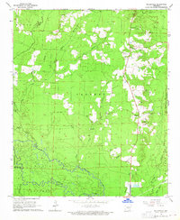 1964 Millerville1965 Print · USGSGrant County and the Saline River bottoms are captured here in the mid-1960s as a landscape of timber and gravel extraction. Genealogists can trace family roots at Shiloh Ch and Bethel Cem, or locate the historic Lookout Tower near Millerville.3 unique versions available
 - 1964 Map of Prague, 1966 Print
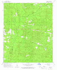 1964 Prague1966 Print · USGSGrant County is captured in the mid-1960s, showing a rural landscape defined by the winding Hurricane Creek and its many branches. Genealogists and local historians can trace family roots through sites like Prague, Center Grove, and the Center Campground Cem.3 unique versions available
 - 1964 Map of Grapevine, 1966 Print
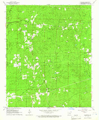 1964 Grapevine1966 Print · USGSGrant County in the mid-1960s is characterized by its rural townships and creek networks like Derrieusseaux Creek. Genealogists can trace early local centers and family burials at St Paul Cem, Hedden Chapel, and the St Paul Sch.3 unique versions available
 - 1965 Map of Leola, 1966 Print
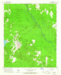 1965 Leola1966 Print · USGSLeola and the surrounding timberlands of Grant and Dallas counties are captured here in the mid-1960s. Genealogists and local historians can trace family-named sites such as Moores Chapel, Taylor Cem, and the rail stops at Thiel or Carver.3 unique versions available
 - 1965 Map of Willow, 1966 Print
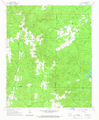 1965 Willow1966 Print · USGSThe mid-Arkansas timberlands near the tri-county corner of Hot Spring, Grant, and Dallas counties are captured here in the mid-1960s. Researchers can trace rural lineages through the Chicago Rock Island and Pacific rail stops at Rolla and local landmarks like Hunters Chapel and Lono Cem.3 unique versions available
End of results
Showing maps 1-18 of 18
Top cities of Grant County
- Sheridan historical maps
- Tull historical maps
- Leola historical maps
- Prattsville historical maps
- Poyen historical maps
Frequently asked questions
- What are the different types of historical maps available for Grant County?
- What is the oldest map of Grant County?
- Where can I purchase historical maps of Grant County for my home or office?
- Where can I download high-res historical maps of Grant County?
- Are there historical topographic maps available for Grant County?
- Is there historical aerial imagery available for Grant County?
- Where are historical maps of Grant County sourced from?