Old Maps of Howard County, Arkansas for Metal Detecting
Plan your next treasure hunt with 142 historic maps of Howard County. Find old homesites, ghost towns, trails, and gathering spots that may be lost to time — perfect for identifying promising metal detecting locations.
- Locate forgotten sites: Uncover places like long-lost settlements, abandoned rail lines, or gathering spots.
- Plan better hunts: Use map overlays combined with LiDAR or satellite views to narrow in on historically rich areas.
- Made for detectorists: Thousands of hobbyists use these maps to discover relics, coins, and hidden history.
Use these historic maps to boost your research and find new opportunities beneath the surface of Howard County.
Howard County, AR maps
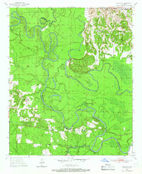
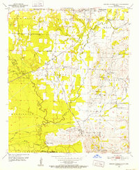
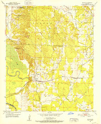
(142)- 1906 Map of Caddo Gap
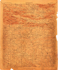 1906 Caddo Gap1906 Print · USGSWest-central Arkansas at the dawn of the twentieth century shows a rugged landscape defined by the Ouachita ridges and early mountain industries. Researchers can trace defunct mining communities like Slatington and Fancy Hill, or locate long-gone railway stops at Hickory Station and Brocktown.3 unique versions available
 - 1913 Map of De Queen
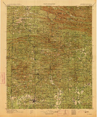 1913 De Queen1913 Print · USGSThe southern Ouachita Mountains and the Arkansas-Oklahoma borderlands appear here in the early twentieth century as the railroad transformed the timber and mining industries. Researchers can trace historic sites like the Welcome Home School, the Kansas City Southern RR corridor, and the early streets of De Queen.4 unique versions available
 - 1936 Map of Athens
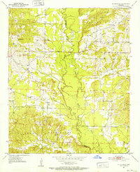
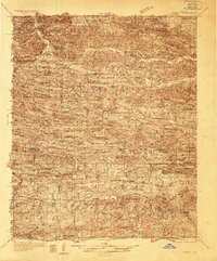 1936 Athens1936 Print · USGSThe rural communities of western Arkansas were still deeply connected by river valleys and mountain gaps in the mid-1930s. Genealogists can trace family footprints at Athens, Langley, and Misels Chapel, or locate remote burials at Hutchinsons Cem and Abernathy Cem.4 unique versions available
 - 1942 Map of Athens
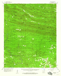
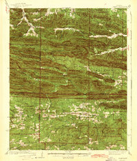 1942 Athens1942 Print · USGSThe Ouachita highlands of western Arkansas are captured here in the early 1940s, showing a rugged network of forest ridges and small farm settlements. Researchers can locate family sites and local landmarks including Misels Chapel, Cox Cem, and schoolhouses like Miller Sch or Pleasant Hill Sch.
 - 1950 Map of Mcalester
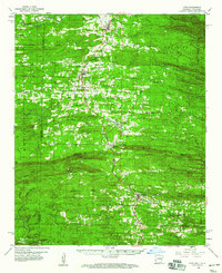
 1950 Mcalester1950 Print · USGSThe Ouachita Mountains and the coal country of Southeast Oklahoma are shown here in the late 1940s. Genealogists and historians can trace the rail-driven growth of McAlester, Wilburton, and Antlers alongside the rugged terrain of Kiamichi Mountain.2 unique versions available
 - 1950 Map of Red Bluff, 1966 Print
 1950 Red Bluff1966 Print · USGSHempstead and Little River counties are captured at mid-century as the river-and-rail economy shaped local life. Genealogists can locate family landmarks like Saratoga Cemetery, Mt Olive Church, and the site of Ward Ferry.2 unique versions available
 - 1950 Map of Ben Lomond, 1966 Print
 1950 Ben Lomond1966 Print · USGSMid-century Sevier and Little River counties appear here as a patchwork of river-bottom farms and small timber-country settlements. Genealogists and researchers can trace local roots at Rice Chapel, White Cliffs Sch, and the White Cliffs Station along the river.2 unique versions available
 - 1951 Map of Ben Lomond
 1951 Ben Lomond1951 Print · USGSSevier County and the Little River bottomlands are captured here in the early fifties during a period of steady rural development. Genealogists can trace family roots through landmarks like Rice Chapel, Brownstown Cemetery, and the White Cliffs School.2 unique versions available
 - 1951 Map of Red Bluff
 1951 Red Bluff1951 Print · USGSHempstead County at the start of the fifties shows a landscape shaped by the winding oxbows of the Little River. Genealogists and researchers can trace local family roots at Saratoga Cem or locate the rail-side community of Red Bluff along the ST Louis San Francisco line.2 unique versions available
 - 1951 Map of Mineral Springs South, 1952 Print
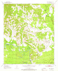
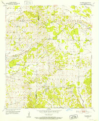
 1951 Mineral Springs South1952 Print · USGSHoward County's agricultural and industrial landscape is captured here in the early 1950s. Genealogists and historians can trace community roots through landmarks like the County Training Sch in Tollette and the riverfront at Saline Landing.4 unique versions available
 - 1951 Map of Columbus, 1952 Print
 1951 Columbus1952 Print · USGSHempstead County rural life is captured in the early fifties, showing a landscape of small settlements and country crossroads. Genealogists can trace family footprints at Macedonia Cem, Columbus High Sch, and the vanished storefronts of Yancy.3 unique versions available
 - 1951 Map of Mineral Springs North, 1952 Print
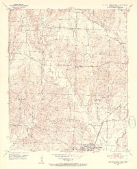 1951 Mineral Springs North1952 Print · USGSHoward County's rural landscape is captured here in the early fifties, showing the transition from isolated homesteads to rail-connected communities. Genealogists can trace family footprints at York Chapel, Temperanceville, and the well-marked Graves Cem.3 unique versions available
 - 1951 Map of Nashville, 1952 Print
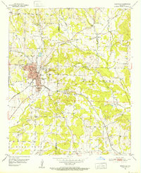 1951 Nashville1952 Print · USGSNashville and the surrounding Howard County countryside are shown here in the early fifties, centering on a thriving railroad town. Genealogists can trace family names and sites across rural settlements like Bingen, old churches like Oak Grove Ch, and the Missouri Pacific rail line.3 unique versions available
 - 1951 Map of Mc Nab, 1952 Print
 1951 Mc Nab1952 Print · USGSHempstead County in the early fifties is captured here as a network of rail-side settlements and rural congregations. Genealogists can locate Douglas Sch, the Whitehouse Cem, and several local churches like Zion Hill Ch and Mars Hill Ch.3 unique versions available
 - 1951 Map of Silver Ridge, 1952 Print
 1951 Silver Ridge1952 Print · USGSThe Arkansas river valley in Sevier and Howard Counties is captured here in the early fifties, showing a rural landscape of winding bayous and small family-centered hubs. Genealogists can locate specific community sites like Silver Ridge, Milford, and the Mt Garmon Cem.3 unique versions available
 - 1953 Map of Texarkana, 1964 Print
 1953 Texarkana1964 Print · USGSThe Texas-Arkansas borderlands are captured here in the mid-fifties, during a decade of massive military and hydraulic engineering projects. Genealogists and researchers can locate family landmarks like Old Boston Cem, Siloam Ch, and the vast Red River Arsenal.4 unique versions available
 - 1953 Map of El Dorado, 1967 Print
 1953 El Dorado1967 Print · USGSSouth Arkansas in the mid-1960s was a landscape of industrial growth and river-fed commerce. Researchers can trace the extensive Oil and Gas Fields around Magnolia, the expansive U S Naval Ammunition Depot, and the busy rail lines of the Missouri Pacific.3 unique versions available
 - 1955 Map of Little Rock, 1978 Print
 1955 Little Rock1978 Print · USGSCentral Arkansas in the mid-fifties exhibits a landscape of growing cities, massive military installations, and mountain reservoirs. Genealogists and historians can trace the industrial Bauxite Mines, regional rail lines, and local landmarks like Antioch Church.
 - 1956 Map of Texarkana
 1956 Texarkana1956 Print · USGSThe Ark-La-Tex borderlands come alive in the mid-fifties, showing the transition from a rail-dependent rural economy to a post-war industrial landscape. Researchers can trace the massive Red River Ordnance Depot and find towns like Talco, Bogata, and Naples.
 - 1956 Map of Little Rock
 1956 Little Rock1956 Print · USGSCentral Arkansas in the mid-fifties shows a landscape defined by burgeoning military bases and the timber-and-mineral wealth of the Ouachitas. Genealogists and researchers can trace old rail lines like the Missouri Pacific and find established communities such as Bauxite, Sheridan, and Mabelvale.
 - 1957 Map of El Dorado
 1957 El Dorado1957 Print · USGSSouth Arkansas in the mid-1950s was a critical hub of military logistics and rail-river commerce. Genealogists and historians can trace family land across the Arkansas Louisiana border and locate sites like the U.S. Naval Ammunition Depot or the rail junctions at Magnolia and Camden.
 - 1958 Map of El Dorado
 1958 El Dorado1958 Print · USGSSouthern Arkansas and the Louisiana borderlands are shown during a period of heavy rail traffic and defense industry activity. Researchers can trace the legacy of the U. S. Naval Ammunition Depot or locate family roots in Smackover, Huttig, and Nashville.3 unique versions available
 - 1959 Map of Umpire, 1960 Print
 1959 Umpire1960 Print · USGSThe rural borderlands of Polk and Howard counties come into focus in the late fifties, showing the isolated homesteads and forest clearings of the Ouachita foothills. Genealogists can trace family footprints through sites like Umpire, Mineola, and the Cedar Hill Cem.3 unique versions available
 - 1959 Map of Cove, 1960 Print
 1959 Cove1960 Print · USGSWestern Arkansas and the Oklahoma borderlands are captured here in the late fifties, showing the mountain corridor of the Kansas City Southern. Trace local history through landmark sites like Old Cove, Bethel Chapel, and several family burial grounds including Piney Cem.2 unique versions available
 - 1960 Map of El Dorado
 1960 El Dorado1960 Print · USGSSouth Central Arkansas in the late fifties was a hub of energy production and defense industry. Researchers can trace the extensive Oil and Gas Fields around El Dorado or locate family landmarks like Old Park Cem and New Hope Church.
Showing maps 1-25 of 142
Top cities of Howard County
- Nashville historical maps
- Mineral Springs historical maps
- Dierks historical maps
- Tollette historical maps
Frequently asked questions
- What are the different types of historical maps available for Howard County?
- What is the oldest map of Howard County?
- Where can I purchase historical maps of Howard County for my home or office?
- Where can I download high-res historical maps of Howard County?
- Are there historical topographic maps available for Howard County?
- Is there historical aerial imagery available for Howard County?
- Where are historical maps of Howard County sourced from?