1960s Maps of Lafayette County, Arkansas
Explore 6 historic maps of Lafayette County from the 1960s. These maps offer a rare glimpse into what life looked like during the 1960s — showing old roads, neighborhoods, homes, and landmarks that have changed or disappeared over time.
Whether you're researching your family's past, planning a metal detecting trip, or studying how Lafayette County's landscape evolved across the 1960s, these high-resolution maps are a powerful tool for exploring the history of this region.
- Focus on a specific era: All maps on this page are from the 1960s, giving you a focused view of this time period.
- See what’s changed: Compare century-old streets, trails, and buildings to today's modern landscape using overlays and satellite layers.
- Research with precision: Use these maps for genealogy, historical research, land use analysis, or educational projects.
- View, download, or print: Maps are fully viewable online in high resolution, and can be downloaded or printed for your own records.
Start exploring Lafayette County's history through authentic maps from the 1960s. This is your window into the past.
Lafayette County, AR maps
(6)- 1960 Map of El Dorado
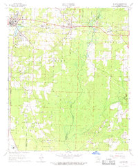
 1960 El Dorado1960 Print · USGSSouth Central Arkansas in the late fifties was a hub of energy production and defense industry. Researchers can trace the extensive Oil and Gas Fields around El Dorado or locate family landmarks like Old Park Cem and New Hope Church.
 - 1960 Map of Bussey, 1961 Print
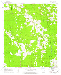 1960 Bussey1961 Print · USGSSouthwest Arkansas at the start of the sixties reveals a landscape of rural townships and oil production. Genealogists and historians can trace the foundations of local communities at Bussey and Sharman, alongside the Woodard Sch and the Kansas City Southern line.3 unique versions available
 - 1960 Map of Taylor, 1961 Print
 1960 Taylor1961 Print · USGSThe Arkansas-Louisiana state line comes alive in the early sixties, showing the industrial heart of the Springhill Oil Field and Taylor. Trace the family-named landmarks of the day, from the Kansas City Southern rail line to Salem Grace Ch and Browning Sch.2 unique versions available
 - 1968 Map of Buckner, 1969 Print
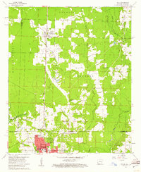
 1968 Buckner1969 Print · USGSLafayette and Columbia counties in the late sixties were defined by the steady pulse of rail traffic and the extraction of local resources. Genealogists and historians can trace the foundations of these communities through sites like Buckner Cemetery, Oak Grove Church, and the St Louis Southwestern railroad.
 - 1968 Map of Lamartine, 1969 Print
 1968 Lamartine1969 Print · USGSColumbia and Nevada County rural life is captured here in the late sixties as the local oil industry operated alongside quiet crossroads. Genealogists can trace family landmarks and early settlements like Lamartine, Bethel, and the Willisville Oil Field.2 unique versions available
 - 1968 Map of Falcon, 1969 Print
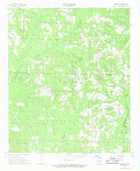
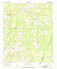 1968 Falcon1969 Print · USGSSouthwest Arkansas in the late sixties reveals a landscape where timber and agriculture met the energy boom. Genealogists and historians can trace community roots through Clevet Springs Ch, the Shiloh Lookout Tower, and the Falcon Cem.
End of results
Showing maps 1-6 of 6
Top cities of Lafayette County
Frequently asked questions
- What are the different types of historical maps available for Lafayette County?
- What is the oldest map of Lafayette County?
- Where can I purchase historical maps of Lafayette County for my home or office?
- Where can I download high-res historical maps of Lafayette County?
- Are there historical topographic maps available for Lafayette County?
- Is there historical aerial imagery available for Lafayette County?
- Where are historical maps of Lafayette County sourced from?