1960s Maps of Monroe County, Arkansas
Explore 13 historic maps of Monroe County from the 1960s. These maps offer a rare glimpse into what life looked like during the 1960s — showing old roads, neighborhoods, homes, and landmarks that have changed or disappeared over time.
Whether you're researching your family's past, planning a metal detecting trip, or studying how Monroe County's landscape evolved across the 1960s, these high-resolution maps are a powerful tool for exploring the history of this region.
- Focus on a specific era: All maps on this page are from the 1960s, giving you a focused view of this time period.
- See what’s changed: Compare century-old streets, trails, and buildings to today's modern landscape using overlays and satellite layers.
- Research with precision: Use these maps for genealogy, historical research, land use analysis, or educational projects.
- View, download, or print: Maps are fully viewable online in high resolution, and can be downloaded or printed for your own records.
Start exploring Monroe County's history through authentic maps from the 1960s. This is your window into the past.
Monroe County, AR maps
(13)- 1960 Map of Helena
 1960 Helena1960 Print · USGSThe Arkansas and Mississippi Delta regions meet along the great river bends during a period of significant agricultural and rail expansion. Genealogists and historians can trace the paths of the Missouri Pacific railroad through Clarendon or locate landings along the Mississippi River and White River.
 - 1967 Map of Indian Bay SE, 1968 Print
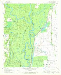 1967 Indian Bay SE1968 Print · USGSThe Arkansas Delta's bottomlands are preserved in the late sixties within the White River National Wildlife Refuge. Researchers can trace old river landings and local family landmarks like Hortons Landing, Jones Cem, and Eagle Nest Lake.3 unique versions available
 - 1967 Map of Turner, 1968 Print
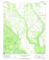 1967 Turner1968 Print · USGSMonroe and Phillips counties come alive in the late sixties as the White River bottomlands give way to a network of rural settlements. Genealogists and local historians can trace family roots at Israel Cem, St John Ch, and the community of Turner.2 unique versions available
 - 1967 Map of Crocketts Bluff, 1968 Print
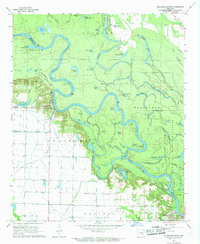 1967 Crocketts Bluff1968 Print · USGSThe Arkansas River Delta bottomlands are captured here in the late 1960s, showing the complex interaction of agriculture and river wildness. Researchers can locate family landmarks like Lutheran Cemetery and Hopewell Church or trace the early waterfront at Crocketts Bluff.3 unique versions available
 - 1968 Map of De Witt NE, 1969 Print
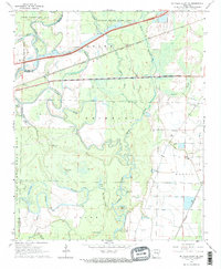
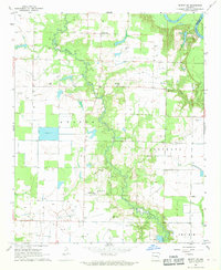 1968 De Witt NE1969 Print · USGSIn the late sixties, the Arkansas Grand Prairie was a landscape defined by delta agriculture and rural congregations. Researchers can trace the heritage of the Keaton and Crockett districts through local landmarks like Emanuel and St Olive Ch.
 - 1968 Map of De Valls Bluff SE, 1969 Print
 1968 De Valls Bluff SE1969 Print · USGSMonroe and Prairie counties in the late sixties show a landscape defined by the winding Cache River and its dense network of bayous. Genealogists and historians can trace the rural communities of Eden and Dagmar or locate the Philadelphia Cem and Choctaw Cem.2 unique versions available
 - 1968 Map of De Valls Bluff NE, 1969 Print
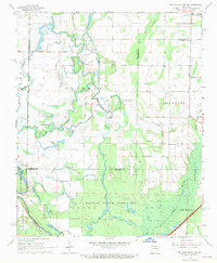 1968 De Valls Bluff NE1969 Print · USGSCotton Plant and the surrounding Delta bottomlands are captured here in the late sixties at the convergence of three counties. Genealogists and local historians can trace rural congregations at Mt Pleasant Ch and Ash Grove Ch or explore the oxbows of the Cache River.3 unique versions available
 - 1968 Map of Des Arc East, 1969 Print
 1968 Des Arc East1969 Print · USGSThe White River delta in the late 1960s reveals a world of complex oxbow lakes and riverfront settlements. Genealogists and researchers can trace the rail corridor of the Chicago Rock Island and Pacific through Letchworth and locate the historic St Luke Cem.
 - 1968 Map of Ulm, 1970 Print
 1968 Ulm1970 Print · USGSThe Grand Prairie region of Arkansas is captured here in the late 1960s, showing a landscape defined by rice farming and rail transit. Researchers can trace the layout of Ulm and find local landmarks like St Paul Ch, Zion Cem, and the St Louis Southwestern railroad.
 - 1968 Map of Clarendon, 1970 Print
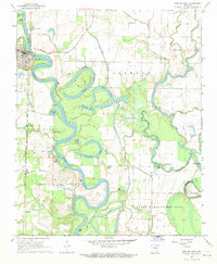
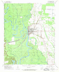 1968 Clarendon1970 Print · USGSThe riverfront town of Clarendon and the surrounding Arkansas Delta are captured here in the late sixties. Researchers can trace the St Louis Southwestern rail line or locate rural family landmarks like Bateman Cem and Philadelphia Ch.2 unique versions available
 - 1968 Map of Aberdeen, 1970 Print
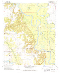 1968 Aberdeen1970 Print · USGSThe White River bottomlands of the Arkansas Delta are seen here in the late sixties, where river crossings and bayou life define the landscape. Trace local heritage at Preston Ferry, the Indian Mound, and rural landmarks like Hunter Chapel or Mt Pisgah Cem.2 unique versions available
 - 1968 Map of De Valls Bluff, 1970 Print
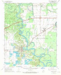 1968 De Valls Bluff1970 Print · USGSPrairie County in the late sixties reveals a landscape of river-bottom commerce and rail connectivity along the White River. Trace the old rail lines and pioneer burials at Oaklawn Cem or family-named landmarks like Pfennighausen Ridge.3 unique versions available
 - 1968 Map of Roe, 1970 Print
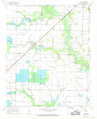
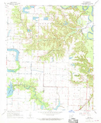 1968 Roe1970 Print · USGSThe town of Roe stands at the edge of the White River bottoms in the late sixties. Researchers can trace the St Louis Southwestern rail line or locate rural landmarks like Peckerwood Lake, Mt Carmel Ch, and Crosley Slough.
End of results
Showing maps 1-13 of 13
Top cities of Monroe County
- Brinkley historical maps
- Clarendon historical maps
- Holly Grove historical maps
- Roe historical maps
- Fargo historical maps
Frequently asked questions
- What are the different types of historical maps available for Monroe County?
- What is the oldest map of Monroe County?
- Where can I purchase historical maps of Monroe County for my home or office?
- Where can I download high-res historical maps of Monroe County?
- Are there historical topographic maps available for Monroe County?
- Is there historical aerial imagery available for Monroe County?
- Where are historical maps of Monroe County sourced from?