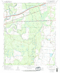
1968 Map of De Valls Bluff SE
USGS Topo · Published 1969About this map
The Cache River dominates this landscape, winding through a complex of wetlands and bayous along the border of Prairie and Monroe counties. This 1968 survey details a region characterized by its river-and-rail economy, where the Chicago Rock Island and Pacific and St Louis Southwestern railroads intersect the lowlands. The presence of numerous oxbow lakes and sloughs, such as McFarland Brake, Horseshoe Lake, and Channey Slough, indicates a dynamic alluvial environment subject to seasonal change. Small settlements and points of interest like Dagmar and Eden are situated near the higher ground of the Upper Surrounded Hill. For genealogists and local historians, the map provides precise locations for the Philadelphia Cem and Choctaw Cem, as well as the riverfront at Dobbs Landing, offering a clear view of the rural infrastructure before modern developments altered the local drainage patterns.
Find a feature on this map
36 named features on this map. Tap any name to fly to it.
Don’t see what you’re looking for? This feature index may not catch every label — zoom into the map to look around manually.
Map Details
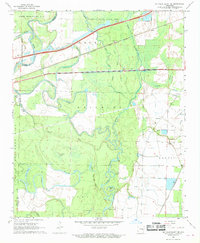
Editions of this 1968 De Valls Bluff SE Map
2 editions found
Other maps of this area

1935 · Clarendon
USGS Topo · 1:62,500

1940 · Holly Grove
USGS Topo · 1:62,500

1940 · Brinkley
USGS Topo · 1:62,500

1941 · De Valls Bluff
USGS Topo · 1:62,500

1941 · Clarendon
USGS Topo · 1:62,500

1948 · Helena
USGS Topo · 1:250,000

1950 · Helena
USGS Topo · 1:250,000

1955 · Helena
USGS Topo · 1:250,000
1957 · Clarendon
USGS Topo · 1:62,500

1957 · Holly Grove
USGS Topo · 1:62,500