1930s Maps of Phillips County, Arkansas
Explore 7 historic maps of Phillips County from the 1930s. These maps offer a rare glimpse into what life looked like during the 1930s — showing old roads, neighborhoods, homes, and landmarks that have changed or disappeared over time.
Whether you're researching your family's past, planning a metal detecting trip, or studying how Phillips County's landscape evolved across the 1930s, these high-resolution maps are a powerful tool for exploring the history of this region.
- Focus on a specific era: All maps on this page are from the 1930s, giving you a focused view of this time period.
- See what’s changed: Compare century-old streets, trails, and buildings to today's modern landscape using overlays and satellite layers.
- Research with precision: Use these maps for genealogy, historical research, land use analysis, or educational projects.
- View, download, or print: Maps are fully viewable online in high resolution, and can be downloaded or printed for your own records.
Start exploring Phillips County's history through authentic maps from the 1930s. This is your window into the past.
Phillips County, AR maps
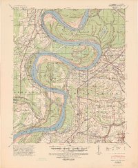
(7)- 1930 Map of Mellwood
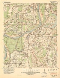
 1930 Mellwood1930 Print · USGSThe Mississippi Delta's shifting banks and rail-tied settlements are frozen in time just before the great mid-century levee expansions. Trace the history of the 1910s floods via the Ferguson Crevasse and locate river-dependent towns like Mellwood and Deeson.
 - 1939 Map of Farrell, 1941 Print
 1939 Farrell1941 Print · USGSThe Mississippi Delta riverfront at Friar Point is captured here in the years before the Second World War. Researchers can trace family sites like Preston Places and Stovall or locate old rural centers including McLemore Sch and Llewellyn Ch & Sch.2 unique versions available
 - 1939 Map of Modoc, 1941 Print
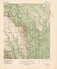
 1939 Modoc1941 Print · USGSPhillips County sits at a crossroads of river and rail during the late 1930s, as the Delta landscape was shaped by flooding and the Missouri Pacific line. Genealogists can trace family roots at Mt Zion Ch Sch & Cem, Beach Tree Ch & Sch, and the old station at Hugo Sta.
 - 1939 Map of Indian Bay, 1941 Print
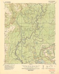
 1939 Indian Bay1941 Print · USGSThe Arkansas delta near the confluence of the White River and Arkansas River is shown here just before the Second World War. Genealogists and local historians can trace numerous rural schoolhouses and churches, including Pin Oak Sch, Hill Chapel, and the St John Church and Cemetery.2 unique versions available
 - 1939 Map of Henrico, 1941 Print
 1939 Henrico1941 Print · USGSThe river bottomlands of the Arkansas delta are mapped here in the late 1930s as flood control efforts reshaped the basin. Genealogists can trace early landmarks like Fairview Ch & Sch, Henrico Cem, and the small settlement at Lagrue Springs.2 unique versions available
 - 1939 Map of Latour, 1944 Print
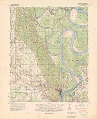 1939 Latour1944 Print · USGSPhillips County and the Mississippi Delta are shown here just before the Second World War as a landscape defined by river navigation and rail transport. Researchers can trace the footprints of communities like Helena and find family-named landmarks such as Tate Ldg, Zion Ch, and Flower Chapel Cemetery.2 unique versions available
 - 1939 Map of Mellwood, 1946 Print
 1939 Mellwood1946 Print · USGSThe Mississippi River Delta of the late thirties reveals a landscape of massive levee projects and rail-dependent river towns. Genealogists can trace family roots through numerous rural church sites and burial grounds like Jerusalem Ch & Cem, St Joseph Ch & Cem, and the unique Laconia Circle.2 unique versions available
End of results
Showing maps 1-7 of 7
Top cities of Phillips County
- Helena-West Helena historical maps
- Marvell historical maps
- Elaine historical maps
- Lake View historical maps
- Lexa historical maps
Frequently asked questions
- What are the different types of historical maps available for Phillips County?
- What is the oldest map of Phillips County?
- Where can I purchase historical maps of Phillips County for my home or office?
- Where can I download high-res historical maps of Phillips County?
- Are there historical topographic maps available for Phillips County?
- Is there historical aerial imagery available for Phillips County?
- Where are historical maps of Phillips County sourced from?