Old Maps of Poinsett County, Arkansas for Metal Detecting
Plan your next treasure hunt with 153 historic maps of Poinsett County. Find old homesites, ghost towns, trails, and gathering spots that may be lost to time — perfect for identifying promising metal detecting locations.
- Locate forgotten sites: Uncover places like long-lost settlements, abandoned rail lines, or gathering spots.
- Plan better hunts: Use map overlays combined with LiDAR or satellite views to narrow in on historically rich areas.
- Made for detectorists: Thousands of hobbyists use these maps to discover relics, coins, and hidden history.
Use these historic maps to boost your research and find new opportunities beneath the surface of Poinsett County.
Poinsett County, AR maps
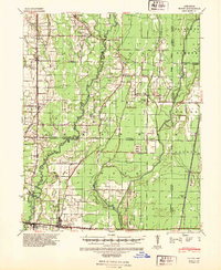
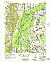
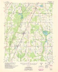
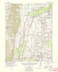
(153)- 1935 Map of Tuckerman, 1946 Print
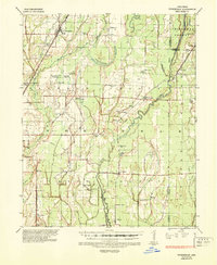 1935 Tuckerman1946 Print · USGSNortheast Arkansas in the mid-thirties was a landscape shaped by the Cache River and a dense network of drainage ditches. Family historians can trace rural roots through numerous combined sites like Antioch Ch & Cem and Green Haw Sch & Cem.2 unique versions available
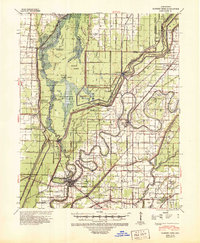
 - 1939 Map of Vanndale, 1941 Print
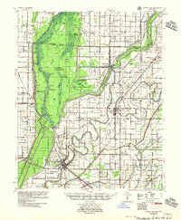
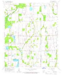
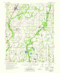
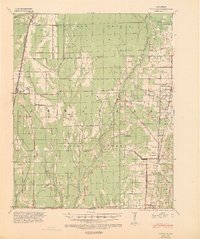 1939 Vanndale1941 Print · USGSCross and Poinsett counties are captured here in the late 1930s, showing a landscape defined by the distinct rise of Crowleys Ridge. Genealogists can locate family landmarks like Union Grove Cem and several country schools, including Rose Sch and Rolf Sch.2 unique versions available
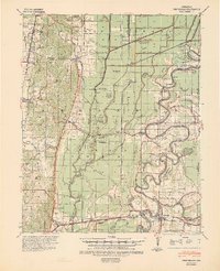
 - 1939 Map of Weiner, 1941 Print
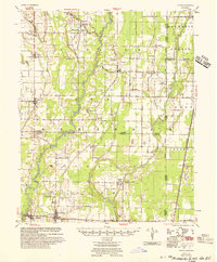
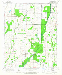
 1939 Weiner1941 Print · USGSPoinsett County agricultural life centers on the rail corridor during the late thirties, before the modernization of the Delta landscape. Genealogists and historians can locate vanished rural landmarks such as O Bear Siding and schools like Beautiful Home Sch or Ukana Sch.3 unique versions available
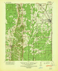
 - 1940 Map of Deckerville, 1942 Print
 1940 Deckerville1942 Print · USGSCrittenden and Poinsett counties are shown here as the local river-and-rail economy matured before the war. Genealogists can trace family landmarks like the King Solomon Sch & Cem, Booker Sch, and New Bethlehem Ch & Cem.
 - 1940 Map of Princedale, 1942 Print
 1940 Princedale1942 Print · USGSEastern Arkansas at the cusp of World War II is mapped here as a land of managed floodways and emerging rail towns. Genealogists can trace family footprints at Hare Farm Sch, Sharps Chapel, and along the banks of the St Francis River.2 unique versions available
 - 1940 Map of Dee, 1942 Print
 1940 Dee1942 Print · USGSPoinsett County at the start of the 1940s reveals a landscape split between the natural rises of Crowleys Ridge and an expansive system of reclamation drainage. Trace family roots through numerous country schools like Judd Hill Sch or sites like Bolivar Cem.
 - 1940 Map of Tilton, 1947 Print
 1940 Tilton1947 Print · USGSEastern Arkansas at the start of the 1940s is captured here as a landscape of river-fed bottoms and thriving rail-side towns. Genealogists and local historians can trace family roots through the numerous rural landmarks like Fakes Chapel & Cem, Pumpkin Bend Cem, and Weldon Sch.2 unique versions available
 - 1941 Map of Marked Tree, 1946 Print
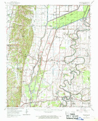
 1941 Marked Tree1946 Print · USGSPoinsett County at the start of the 1940s reveals a landscape of massive drainage projects and river engineering. Trace the early footprints of Marked Tree and Lepanto alongside rural landmarks like Frys Mill, Pilgrims Rest Ch, and the Spear Lake Sch & Cem.2 unique versions available
 - 1953 Map of Memphis, 1966 Print
 1953 Memphis1966 Print · USGSEastern Arkansas and the Memphis riverfront are shown here during the mid-century period of regional growth and river management. Local historians can trace the paths of the Chicago Rock Island & Pacific RR through Forrest City or locate river landmarks like President's Island.3 unique versions available
 - 1956 Map of Marked Tree
 1956 Marked Tree1956 Print · USGSThe Arkansas Delta comes into focus in the mid-1950s as drainage projects transformed the Sunk Lands for agriculture. Researchers can trace the junction of the St Louis Southwestern RR and locate local landmarks like the Hatchie Coon Hunting Lodge and Nichols Cem.2 unique versions available
 - 1956 Map of Memphis
 1956 Memphis1956 Print · USGSThe Mississippi Delta and the bluffs of West Tennessee meet in the mid-fifties, showing a landscape defined by massive river systems and rail hubs. Researchers can trace the path of Crowleys Ridge or locate vanished river landings near Centennial Island and Island No 35.
 - 1956 Map of Tilton
 1956 Tilton1956 Print · USGSThe Arkansas Delta comes into focus in the mid-1950s, showing a landscape of drainage canals and rail-line towns. Researchers can trace family roots at Pumpkin Bend, Beedeville, and the crossroads of McCrory.
 - 1956 Map of Princedale, 1957 Print
 1956 Princedale1957 Print · USGSCross County in the mid-fifties is captured here as a landscape defined by the winding St Francis River and a massive network of drainage ditches. Researchers can locate many family-named landmarks and vanished rural hubs like Bay Village, Burr Place, and the Wildwood Ch & Sch.
 - 1957 Map of Deckerville, 1958 Print
 1957 Deckerville1958 Print · USGSThe Arkansas delta in the mid-fifties is captured here during its peak era of rail-and-river transport and intensive drainage. Genealogists can trace hundreds of rural family landmarks, including New Bethlehem Ch & Sch, St Peter Sch, and Prosperity Ch Sch & Cem.
 - 1958 Map of Dee
 1958 Dee1958 Print · USGSThe Poinsett County lowlands and the elevation of Crowleys Ridge are captured here in the late fifties as the regional drainage network reached maturity. Genealogists and local historians can trace family locations near Stacy Store, Bolivar Ch & Cem, and the timber hub of Trumann.
 - 1958 Map of Vanndale
 1958 Vanndale1958 Print · USGSCross and Poinsett Counties are captured in the late fifties, showing a landscape defined by the L'Anguille River and the regional rail lines. Researchers can trace rural genealogy through landmarks like Tilton Sch & Ch, Union Grove Cem, and Slocum Cem.2 unique versions available
 - 1959 Map of Weiner, 1961 Print
 1959 Weiner1961 Print · USGSThe Arkansas Delta near the Poinsett and Craighead border shows a landscape defined by rice farming and rail transit in the late fifties. You can trace family roots at Walker Cem and local churches like Chilson Ch or explore the rail hubs of Weiner and Waldenburg.
 - 1960 Map of Weiner
 1960 Weiner1960 Print · USGSNortheast Arkansas at the dawn of the 1960s shows a landscape defined by the ST LOUIS SOUTHWESTERN rail line and reclaimed delta bottomlands. Researchers can trace rural life through landmarks like Walker Cem, Chilson Ch, and the sprawling Public Hunting Area.
 - 1962 Map of Princedale, 1968 Print
 1962 Princedale1968 Print · USGSEastern Arkansas in the early sixties reveals a landscape shaped by Poinsett Ridge and the winding St. Francis River. Genealogists and local historians can trace family locations like Yarbo Place, rural landmarks such as McDonald Ch, and the stop at Cherry Valley Halt.
 - 1965 Map of Amagon, 1966 Print
 1965 Amagon1966 Print · USGSNortheast Arkansas in the mid-sixties is captured here as a landscape of managed wetlands and small rural communities. Genealogists can locate family burial sites at Carter Cem and Johnson Cem or trace the early industrial footprint of Stringers Mill.
 - 1965 Map of Grubbs, 1966 Print
 1965 Grubbs1966 Print · USGSNear the Cache River in the mid-1960s, this area of Jackson County shows a landscape of engineered drainage and small farming outposts. Researchers can locate several remote burial grounds and churches, including Denton Island Cem, Hollows Chapel, and the settlement of Grubbs.
 - 1966 Map of Princedale
 1966 Princedale1966 Print · USGSEastern Arkansas river life in the mid-sixties centered on the complex drainage of the St Francis River. Genealogists can trace family landmarks like Burr Place and Harefarm Cem or rural centers like Wildwood Ch & Sch.
 - 1967 Map of Tuckerman
 1967 Tuckerman1967 Print · USGSThe Jackson County lowlands are captured here in the mid-sixties, showing a landscape defined by the Cache River and its sloughs. Trace family history at Gracelawn Cem, find old school sites like Eastside Sch, and locate industrial landmarks like Stringers Mill.
 - 1974 Map of Tyronza, 1976 Print
 1974 Tyronza1976 Print · USGSThe Arkansas delta comes into focus during the mid-1970s, showing a landscape of precise drainage ditches and rail-side towns. Genealogists can trace family roots through numerous rural landmarks like Milam Chapel, Pilgrims Rest Ch, and the communities of Deckerville and Birdsong.
 - 1974 Map of Joyland, 1976 Print
 1974 Joyland1976 Print · USGSThe Delta lowlands of Poinsett and Crittenden counties are shown in the mid-seventies, defined by the winding St Francis River and its complex irrigation network. Genealogists can trace rural communities like Black Oak and Galilee, or locate family sites near Tyronza Cem and New Hope Ch.2 unique versions available
Showing maps 1-25 of 153
Top cities of Poinsett County
- Trumann historical maps
- Marked Tree historical maps
- Harrisburg historical maps
- Lepanto historical maps
- Tyronza historical maps
- Weiner historical maps
See more
Frequently asked questions
- What are the different types of historical maps available for Poinsett County?
- What is the oldest map of Poinsett County?
- Where can I purchase historical maps of Poinsett County for my home or office?
- Where can I download high-res historical maps of Poinsett County?
- Are there historical topographic maps available for Poinsett County?
- Is there historical aerial imagery available for Poinsett County?
- Where are historical maps of Poinsett County sourced from?