Old Maps of Dover, Arkansas for Academic Research
Study the evolution of Dover with 36 high-resolution historic maps. Whether you're teaching, researching, or modeling changes in land use, these maps provide essential visual documentation of urban, environmental, and geographic change.
- Analyze long-term change: Track patterns in development, transportation, and natural features.
- Ideal for environmental or urban studies: Support academic projects with primary historical map data.
- Use in the classroom or lab: Educators and researchers rely on these maps to bring historical context to life.
These maps are a powerful tool for teaching, research, and visualizing how Dover has changed over the decades.
Dover, AR maps
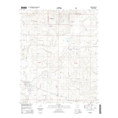
(36)- 1888 Map of Dardanelle #1
 1888 Dardanelle #11888 Print · USGSPope County at the end of the 1880s was a landscape of rising ridges and vital new rail connections. Family historians can trace early homesteads near Dover and Scottsville, or follow the old tracks of the Little Rock and Fort Smith Railway.
 - 1890 Map of Dardanelle
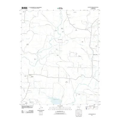
 1890 Dardanelle1890 Print · USGSThe Arkansas River valley was a primary corridor of settlement in the 1890s, anchored by the river towns of Dardanelle and Russellville. Genealogists can locate early homesteads near Mt. Nebo, Lutherville, or the old post office at Chickalah.7 unique versions available
 - 1956 Map of Russellville
 1956 Russellville1956 Print · USGSThe Arkansas River valley and the surrounding Boston Mountains are captured here in the mid-fifties, showing a landscape of small timber towns and new reservoirs. Genealogists can trace family roots through upland settlements like Pelsor and Witts Springs or locate the campus of Arkansas Polytechnic College.2 unique versions available
 - 1961 Map of Dover, 1963 Print
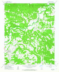 1961 Dover1963 Print · USGSPope County enters the early sixties as a landscape of river-valley farms and timbered highlands. Researchers can locate family landmarks like McFadden Cem, rural congregations at Fairview Ch, and the early industrial footprint of local Gas Wells.3 unique versions available
 - 1962 Map of Russellville East, 1963 Print
 1962 Russellville East1963 Print · USGSEastern Russellville and its rural outskirts are documented in the early sixties as new highway construction began reshaping the Illinois Bayou region. Genealogists can locate family landmarks such as Bakers Creek Cem, Crawford Sch, and the Missouri Pacific rail line.3 unique versions available
 - 1963 Map of Lee Mountain, 1964 Print
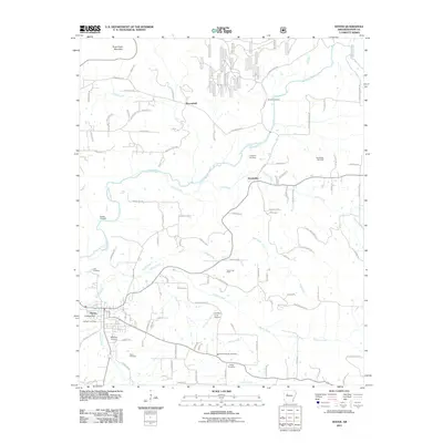
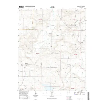
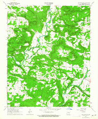 1963 Lee Mountain1964 Print · USGSThe Pope and Johnson county line crosses a landscape of high ridges and creek bottoms in the early 1960s. Researchers can locate numerous family-named burial grounds like Pollard Cem and remote rural churches including Cumberland Ch and the Assembly of God Ch.2 unique versions available
 - 1963 Map of Russellville West, 1964 Print
 1963 Russellville West1964 Print · USGSThe river valley and western Russellville appear here during a period of major change as the Dardanelle Reservoir reshaped the landscape. Researchers can trace the INDIAN TREATY BOUNDARY, locate old family plots at Swann Cem, or study the grounds of Arkansas Polytechnic College.2 unique versions available
 - 1964 Map of Russellville
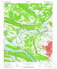
 1964 Russellville1964 Print · USGSMid-century Central Arkansas is defined here by the river-valley towns and the surrounding mountain ranges before the full expansion of the interstate system. Genealogists and historians can trace rail-town development along the Missouri Pacific Railroad and locate landmarks like Arkansas Polytechnic College or Petit Jean State Park.
 - 1977 Map of Russellville
 1977 Russellville1977 Print · USGSThe Arkansas River Valley and surrounding Ozark Mountains are documented here during a period of significant postwar growth and infrastructure development. Genealogists and researchers can locate family landmarks such as Mount Carmel Cem, St Josephs Church, and several remote Coal Mine sites along the Missouri Pacific RR line.
 - 1984 Map of Russellville
 1984 Russellville1984 Print · USGSThe Arkansas River valley in the mid-eighties shows a landscape defined by the rise of Lake Dardanelle and the enduring presence of the Ozark National Forest. Researchers can find historical institutions like Arkansas Tech Univ and Sacred Heart Church or trace the routes of the Missouri Pacific RR.2 unique versions available
 - 1984 Map of Russellville
 1984 Russellville1984 Print · USGSThe Arkansas River valley was undergoing significant change in the 1950s as transportation and water management reshaped the region from Russellville to Conway. Researchers can trace the era's rail networks like the Missouri Pacific RR and explore landmarks like Magazine Mountain and Petit Jean State Park.
 - 1992 Map of Russellville, 1993 Print
 1992 Russellville1993 Print · USGSCentral Arkansas in the early nineties shows a landscape defined by the Arkansas River valley and the surrounding national forests. Trace the development of river towns like Russellville and Dardanelle alongside landmarks such as Lake Dardanelle and Magazine Mtn.
 - 1993 Map of Russellville West
 1993 Russellville West1993 Print · USGSRussellville and the Arkansas River valley are captured in the early nineties as the city grew around Arkansas Tech University. Local historians can trace the Old Indian Treaty Boundary and locate family landmarks like Booher Cem and Damascus Ch.
 - 1993 Map of Dover
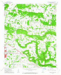
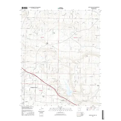
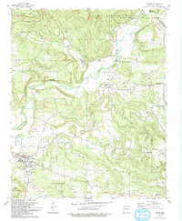 1993 Dover1993 Print · USGSDover and the surrounding Pope County hills are shown here in the early nineties as a landscape of gas fields and old family settlements. Genealogists can trace several burial grounds and rural parishes, such as Old Lake Cem, Scottsville Ch, and Haley Ch Cem.
 - 1993 Map of Lee Mountain
 1993 Lee Mountain1993 Print · USGSPope and Johnson Counties are mapped here in the early nineties as rural communities followed the winding paths of Big Piney Creek. Genealogists and hikers can trace family sites like Chesser Cem or explore landmarks in Booger Hollow and Piney.
 - 1993 Map of Russellville East
 1993 Russellville East1993 Print · USGSIn the early nineties, the eastern expansion of Russellville and Pottsville was well underway along the Galla Creek valley. Researchers can trace rural lineages through sites like Utley Sem, Old Baptist Cem, and the Crow Mountain Community Center.
 - 2011 Map of Dover, 2011 Print
 2011 Dover2011 Print · USGSCovers Dover, including Broomfield, Scottsville, and other nearby areas
 - 2011 Map of Lee Mountain, 2011 Print
 2011 Lee Mountain2011 Print · USGSCovers Dover, including Augsburg, Piney, and other nearby areas
 - 2011 Map of Russellville East, 2011 Print
 2011 Russellville East2011 Print · USGSCovers Dover, including Russellville, Pottsville, and other nearby areas
 - 2011 Map of Russellville West, 2011 Print
 2011 Russellville West2011 Print · USGSCovers Dover, including Russellville, Dardanelle, and other nearby areas
 - 2014 Map of Russellville East, 2014 Print
 2014 Russellville East2014 Print · USGSCovers Dover, including Russellville, Pottsville, and other nearby areas
 - 2014 Map of Russellville West, 2014 Print
 2014 Russellville West2014 Print · USGSCovers Dover, including Russellville, Dardanelle, and other nearby areas
 - 2014 Map of Dover, 2014 Print
 2014 Dover2014 Print · USGSCovers Dover, including Broomfield, Scottsville, and other nearby areas
 - 2014 Map of Lee Mountain, 2014 Print
 2014 Lee Mountain2014 Print · USGSCovers Dover, including Augsburg, Piney, and other nearby areas
 - 2017 Map of Russellville East, 2017 Print
 2017 Russellville East2017 Print · USGSCovers Dover, including Russellville, Pottsville, and other nearby areas
Showing maps 1-25 of 36
Top cities near Dover
- Russellville historical maps
- Dardanelle historical maps
- Atkins historical maps
- Pottsville historical maps
- London historical maps
- Knoxville historical maps
See more
Top neighborhoods of Dover
Frequently asked questions
- What are the different types of historical maps available for Dover?
- What is the oldest map of Dover?
- Where can I purchase historical maps of Dover for my home or office?
- Where can I download high-res historical maps of Dover?
- Are there historical topographic maps available for Dover?
- Is there historical aerial imagery available for Dover?
- Where are historical maps of Dover sourced from?