1980s Maps of Pulaski County, Arkansas
Explore 19 historic maps of Pulaski County from the 1980s. These maps offer a rare glimpse into what life looked like during the 1980s — showing old roads, neighborhoods, homes, and landmarks that have changed or disappeared over time.
Whether you're researching your family's past, planning a metal detecting trip, or studying how Pulaski County's landscape evolved across the 1980s, these high-resolution maps are a powerful tool for exploring the history of this region.
- Focus on a specific era: All maps on this page are from the 1980s, giving you a focused view of this time period.
- See what’s changed: Compare century-old streets, trails, and buildings to today's modern landscape using overlays and satellite layers.
- Research with precision: Use these maps for genealogy, historical research, land use analysis, or educational projects.
- View, download, or print: Maps are fully viewable online in high resolution, and can be downloaded or printed for your own records.
Start exploring Pulaski County's history through authentic maps from the 1980s. This is your window into the past.
Pulaski County, AR maps
(19)- 1983 Map of Conway, 1984 Print
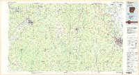
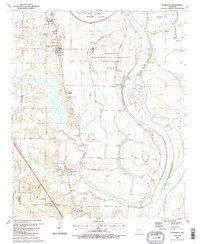
 1983 Conway1984 Print · USGSThe Arkansas River valley in the early eighties shows a landscape of river-bend settlements and expanding wildlife areas. Genealogists and historians can trace the Missouri Pacific RR through old river towns like Toad Suck, Morrilton, and Menifee.
 - 1984 Map of Russellville
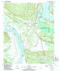
 1984 Russellville1984 Print · USGSThe Arkansas River valley was undergoing significant change in the 1950s as transportation and water management reshaped the region from Russellville to Conway. Researchers can trace the era's rail networks like the Missouri Pacific RR and explore landmarks like Magazine Mountain and Petit Jean State Park.
 - 1985 Map of Malvern
 1985 Malvern1985 Print · USGSCentral Arkansas in the mid-eighties shows a landscape of timberlands and river valleys anchored by the industrial hubs of Malvern and Pine Bluff. Genealogists can locate family landmarks and rural institutions like Social Hill Sch, Magnet Cove, and Pine Bluff Arsenal.2 unique versions available
 - 1985 Map of Little Rock, 1988 Print
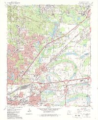
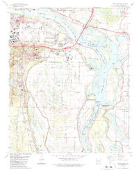
 1985 Little Rock1988 Print · USGSLittle Rock and its surrounding river valley are shown in the mid-eighties as the region balanced urban expansion with its industrial and military roots. Genealogists and historians can locate dozens of institutions and family landmarks, including Mount Holly Cem, the Bauxite Mines, and Central High Sch.
 - 1986 Map of McAlmont
 1986 McAlmont1986 Print · USGSThe northern suburbs of Little Rock expanded rapidly during the eighties as regional transit and industry matured. Genealogists and local historians can trace family roots through Hickman Memorial Cem or locate former landmarks like the Drive-in Theater and Pecan Grove.3 unique versions available
 - 1986 Map of Little Rock
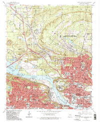
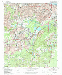 1986 Little Rock1986 Print · USGSLittle Rock is shown in the mid-eighties as a hub of civic and industrial activity, from the State Capitol to the southern mining districts. Researchers can trace neighborhood development and family history at sites like Central High Sch, Oakland Cemetery, and Wakefield Village.2 unique versions available
 - 1986 Map of Alexander
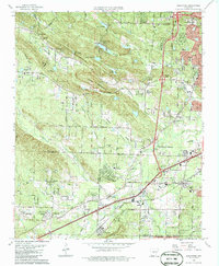 1986 Alexander1986 Print · USGSThe borderlands of Pulaski and Saline counties come into focus during the mid-eighties as suburban growth reaches into the highlands. Genealogists can trace family names at Alexander Cem, Quinn Chapel, and the settlement of Collegeville.
 - 1986 Map of Sweet Home
 1986 Sweet Home1986 Print · USGSThe Arkansas River corridor south of Little Rock is shown in the mid-1980s as a bustling industrial and transport hub. Genealogists can trace families around Sweet Home and College Station, while historians can locate the David D Terry Lock and Dam and Baucum Cem.
 - 1986 Map of North Little Rock
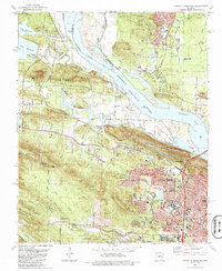
 1986 North Little Rock1986 Print · USGSThe Arkansas River corridor in the mid-eighties shows a period of significant civic and military development in Pulaski County. Researchers can trace the footprints of Camp Joseph T. Robinson, the historic St Josephs Orphanage, and neighborhood schools like Boone Park Sch.2 unique versions available
 - 1986 Map of Pinnacle Mountain
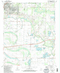
 1986 Pinnacle Mountain1986 Print · USGSPulaski County at the peak of the 1980s displays a landscape where the suburbs of Little Rock meet the rugged heights of the Fulk Mountains. Genealogists can locate numerous family burial grounds including Old Soldiers Cem, Grimmette Cem, and Ives Cem.
 - 1987 Map of Cato
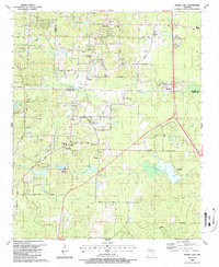
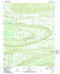 1987 Cato1987 Print · USGSThe northern Pulaski County hills meet the Faulkner County line in the late eighties, featuring a landscape defined by military training grounds and rural settlements. Genealogists and local historians can trace family-named sites like Brockington Corner, Mt Psyam Cemetery, and the Immaculate Heart of Mary School.
 - 1987 Map of Keo
 1987 Keo1987 Print · USGSThe Lonoke and Pulaski county lines meet in this agricultural corridor during the late eighties, where rail and water dictate the landscape. Researchers can trace rural life through landmarks like Alexander Cem, the St Louis Southwestern tracks in Keo, and Millers Chapel.
 - 1987 Map of Scott
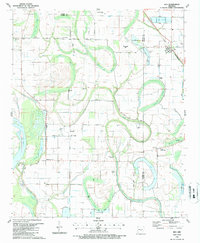
 1987 Scott1987 Print · USGSThe Arkansas River bottomlands in the late eighties reveal a landscape of oxbow lakes, ancient earthworks, and rural rail stops. Genealogists and historians can locate family landmarks like Walkers Corner, Le Grande Cem, and the notable Toltec Mounds State Park.
 - 1987 Map of Olmstead
 1987 Olmstead1987 Print · USGSPulaski County in the late 1980s shows a mix of military installations and rural crossroads as the suburbs began to reach northward. Researchers can locate family landmarks like Tates Mill, St Peters Rock Ch, and the community of Olmstead.2 unique versions available
 - 1987 Map of Cabot
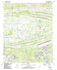
 1987 Cabot1987 Print · USGSCabot and Jacksonville were expanding rapidly in the late eighties as the local landscape transitioned from military airbase to residential suburb. Genealogists can locate family landmarks like Concord Cem, Mt Tabor Ch, and the rural homesteads along Backbone Ridge.2 unique versions available
 - 1987 Map of Jacksonville
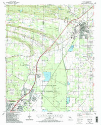
 1987 Jacksonville1987 Print · USGSJacksonville and the surrounding wetlands of Pulaski and Lonoke counties are shown here in the late 1980s. Researchers can trace family sites like Lone Cypress Cem, the small community of Union Valley, and historic Military Road.2 unique versions available
 - 1987 Map of Spring Lake
 1987 Spring Lake1987 Print · USGSSaline and Pulaski counties meet in this detailed survey from the late eighties, documenting a landscape of small communities and rural churches. Genealogists can trace family roots through Upchurch Cem and Hicks Cem or locate local landmarks like East End School and the Carmelite Novitiate.
 - 1987 Map of Mayflower
 1987 Mayflower1987 Print · USGSFaulkner and Pulaski counties are shown in the late 1980s as the suburbs and conservation areas north of Little Rock began to take their modern form. Researchers can trace the development of Mayflower and Maumelle, locate family sites near Mayflower Cem, or explore the riparian landscape of Fletcher Bend and Grassy Lake.2 unique versions available
 - 1987 Map of Woodson, 1988 Print
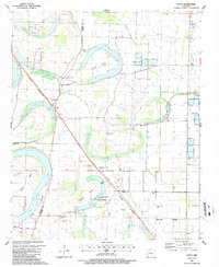
 1987 Woodson1988 Print · USGSThe Arkansas River lowlands south of Little Rock come into focus in the mid-1980s, where river bends and bayous meet rural settlements. Researchers can trace the layout of Wrightsville, find family sites at Kuykendall Cem, or locate local landmarks like Gospel Temple Ch.2 unique versions available
End of results
Showing maps 1-19 of 19
Top cities of Pulaski County
- Little Rock historical maps
- North Little Rock historical maps
- Jacksonville historical maps
- Sherwood historical maps
- Maumelle historical maps
- Wrightsville historical maps
See more
Frequently asked questions
- What are the different types of historical maps available for Pulaski County?
- What is the oldest map of Pulaski County?
- Where can I purchase historical maps of Pulaski County for my home or office?
- Where can I download high-res historical maps of Pulaski County?
- Are there historical topographic maps available for Pulaski County?
- Is there historical aerial imagery available for Pulaski County?
- Where are historical maps of Pulaski County sourced from?