Old Maps of Pulaski County, Arkansas for Metal Detecting
Plan your next treasure hunt with 236 historic maps of Pulaski County. Find old homesites, ghost towns, trails, and gathering spots that may be lost to time — perfect for identifying promising metal detecting locations.
- Locate forgotten sites: Uncover places like long-lost settlements, abandoned rail lines, or gathering spots.
- Plan better hunts: Use map overlays combined with LiDAR or satellite views to narrow in on historically rich areas.
- Made for detectorists: Thousands of hobbyists use these maps to discover relics, coins, and hidden history.
Use these historic maps to boost your research and find new opportunities beneath the surface of Pulaski County.
Pulaski County, AR maps
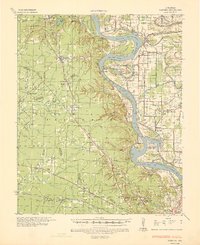
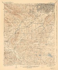
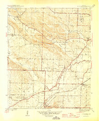
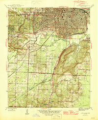
(236)- 1890 Map of Benton
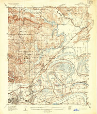
 1890 Benton1890 Print · USGSSaline and Pulaski counties are shown here in the late nineteenth century as the rail network began to reshape the river-valley economy. Genealogists and researchers can trace family roots through old settlements like Brazils and Avilla or locate landmarks like Goosepond Mt and Aplin.
 - 1891 Map of Little Rock
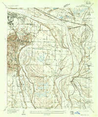
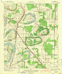
 1891 Little Rock1891 Print · USGSLittle Rock and the central Arkansas river valley are shown in detail during the 1890s, when rail travel and river trade dominated the local economy. Genealogists can trace early homesteads and communities near Argenta, the Indian Mounds at Toltec, and Sweet Home.
 - 1893 Map of Little Rock
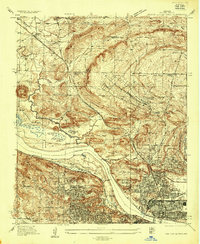
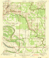
 1893 Little Rock1893 Print · USGSLittle Rock and the Arkansas River valley are shown here in the early 1890s, just as the regional rail network was maturing. Genealogists can trace family roots through old settlements like Argenta, Shilcott, and Collegeville, or locate archaeological sites such as the Indian Mounds.5 unique versions available
 - 1894 Map of Benton
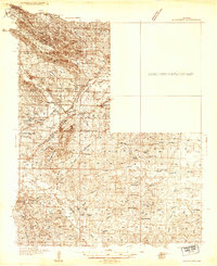
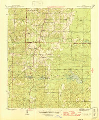
 1894 Benton1894 Print · USGSCentral Arkansas in the late nineteenth century was a landscape of steep ridges and critical river crossings. Genealogists and researchers can trace the early rail corridor of the St. Louis Iron Mountain and Southern R. R. near Benton or locate family roots in Avilla and Brazils.5 unique versions available
 - 1932 Map of Pastoria, 1965 Print
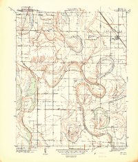
 1932 Pastoria1965 Print · USGSThe Arkansas River valley comes alive in the mid-1930s, showing a landscape defined by deep river bends and rural institutional life. Genealogists can trace family roots through numerous sites like Haywood College, Pastoria Ch & Cem, and the State Penal Farm.2 unique versions available
 - 1935 Map of Mc Almont
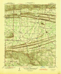
 1935 Mc Almont1935 Print · USGSPulaski County during the mid-1930s is mapped here with a focus on the railroad hubs and river bottomlands northeast of the capital. Genealogists can trace family landmarks like Brushy Cem, St Luke Ch, and the Sylvan Hills Res settlement.
 - 1935 Map of Little Rock
 1935 Little Rock1935 Print · USGSLittle Rock and its southern outskirts are captured in the mid-thirties, showcasing a city defined by its railroads and quarrying industry. Genealogists can trace family footprints near Oakland Cem or the rural community of Geyer Springs, while identifying landmarks like the Old Penitentiary Site and Biddle Shops.
 - 1935 Map of Sweet Home
 1935 Sweet Home1935 Print · USGSSoutheast of Little Rock during the mid-thirties, the river plain was defined by large-scale institutional farms and military camps. Genealogists can trace family connections at All Souls Rest Cem, St Stephens Cem, and the Union Industrial Agricultural College.
 - 1935 Map of North Little Rock
 1935 North Little Rock1935 Print · USGSNorth Little Rock and the surrounding Pulaski County hills are captured here in the mid-1930s during a period of significant military and civic expansion. Local historians can trace the grounds of Camp Pike, find the historic St Josephs Orphanage, or locate family sites near Palestine Cem.
 - 1935 Map of Alexander
 1935 Alexander1935 Print · USGSSaline and Pulaski counties come alive in this mid-1930s survey as the rail-and-creek network shaped local life. Researchers can trace family roots through numerous country landmarks including Sardis Sch, Salem Cem, and the State Girls Indust Home.2 unique versions available
 - 1935 Map of Pastoria, 1937 Print
 1935 Pastoria1937 Print · USGSJefferson County's riverfront landscape in the mid-1930s shows a complex network of bayous, schools, and small post offices. Researchers can trace family history at Haywood College, locate the State Penal Farm, or find long-standing community landmarks like Morris Chapel Sch & Ch.2 unique versions available
 - 1938 Map of Benton
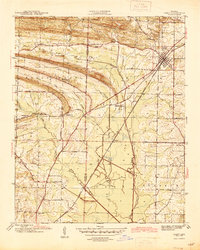
 1938 Benton1938 Print · USGSSaline County industry and rural life are captured here in the late 1930s, just as the Bauxite Mines were fueling the local economy. Researchers can trace family roots through numerous country churches like Grape Chapel or locate old river crossings such as Wray Ford and Daniels Ford.4 unique versions available
 - 1939 Map of Keo
 1939 Keo1939 Print · USGSThe Arkansas Delta comes alive in the late thirties as a network of rail-side settlements and oxbow lakes. Genealogists and local historians can trace the foundations of rural life through sites like Keo, Macedonia Chapel, and the St Louis Southwestern Railway.3 unique versions available
 - 1940 Map of Woodson, 1945 Print
 1940 Woodson1945 Print · USGSPulaski County at the start of the 1940s reveals a riverside landscape of bayous and railroad towns. Researchers can trace rural life through landmarks like Gospel Temple Ch, the State Industrial School, and Campbell Cem.2 unique versions available
 - 1941 Map of Alexander
 1941 Alexander1941 Print · USGSIn the 1930s, the corridor between Pulaski and Saline County was a bustling landscape of rail lines and rural townships. Genealogists and historians can trace family roots through numerous local landmarks, including the Dawson Sch, Vimy Ridge, and the Industrial Home.2 unique versions available
 - 1941 Map of Keo
 1941 Keo1941 Print · USGSThe river bottomlands of Lonoke and Pulaski County are revealed here just before the war, dominated by the serpentine curves of the Arkansas River. Genealogists can trace the rural community through numerous local landmarks like Paradise Ch, Millers Chapel, and the settlement at Wampoo.
 - 1941 Map of Olmstead, 1945 Print
 1941 Olmstead1945 Print · USGSNorth of Little Rock in the early 1940s, this area was a network of bayous and ridges punctuated by rural crossroads and family homesteads. Genealogists and local historians can trace legacy sites like Tates Mill, Sumner Cem, and several country meeting houses including Zion Hill Ch and Harmony Ch.
 - 1941 Map of Cabot, 1945 Print
 1941 Cabot1945 Print · USGSLonoke and Pulaski counties are captured in detail during the early 1940s, showing a landscape defined by prominent ridges and the Missouri Pacific rail line. Researchers can trace family sites near Concord Cem or locate historic rural centers like Holland and Mt Tabor Ch.2 unique versions available
 - 1942 Map of Scott
 1942 Scott1942 Print · USGSThe alluvial plains east of Little Rock come to life in this early 1940s survey of the Arkansas River oxbows. Researchers can pinpoint the Toltec Mounds and trace a dense network of country schools and churches like Banes Chapel Sch and Mt Hope Ch.2 unique versions available
 - 1943 Map of Jacksonville
 1943 Jacksonville1943 Print · USGSJacksonville and the Pulaski-Lonoke county line appear here in the early 1940s, revealing a landscape of rail junctions and rural homesteads. Genealogists can trace early family sites like Mc Graw Cem, the South Bend Sch, and the route of the Old Military Road.2 unique versions available
 - 1943 Map of Pinnacle Mtn, 1946 Print
 1943 Pinnacle Mtn1946 Print · USGSPulaski County at the end of the war shows a landscape of river-bend settlements and rising ridges. Genealogists can trace family names at the Brimmette Cem and Pankey Cem or locate old school sites like Round Hill Sch.
 - 1944 Map of Benton
 1944 Benton1944 Print · USGSSaline County in the mid-1940s centers on the industrial hub of Benton and the neighboring Bauxite Mines. Genealogists and historians can trace family roots through numerous rural landmarks like Grape Chapel, Pitkin Cem, and the State Hospital.
 - 1944 Map of Alexander, 1946 Print
 1944 Alexander1946 Print · USGSSouthwest of Little Rock during the mid-forties, this area reveals a landscape of institutional history and rural community life along the Missouri Pacific Road. Researchers can trace old property and family lines near Alexander Cem, Mabelvale, and the Salasco Sanitarium.2 unique versions available
 - 1944 Map of Spring Lake, 1946 Print
 1944 Spring Lake1946 Print · USGSSaline and Pulaski counties meet in this mid-century survey of the Arkansas countryside south of Little Rock. Genealogists and local historians can trace the foundations of these communities through landmarks like Landmark Sch, Ivy Chapel, and Jay Cem.
 - 1944 Map of Little Rock, 1946 Print
 1944 Little Rock1946 Print · USGSMid-century Little Rock and its southern rural outskirts are captured here during a period of industrial and residential expansion. Researchers can trace the legacy of local families through landmarks like Feltons Store, Longley Sch, and rural congregations at Primrose Ch.2 unique versions available
Showing maps 1-25 of 236
Top cities of Pulaski County
- Little Rock historical maps
- North Little Rock historical maps
- Jacksonville historical maps
- Sherwood historical maps
- Maumelle historical maps
- Wrightsville historical maps
See more
Frequently asked questions
- What are the different types of historical maps available for Pulaski County?
- What is the oldest map of Pulaski County?
- Where can I purchase historical maps of Pulaski County for my home or office?
- Where can I download high-res historical maps of Pulaski County?
- Are there historical topographic maps available for Pulaski County?
- Is there historical aerial imagery available for Pulaski County?
- Where are historical maps of Pulaski County sourced from?