Old Maps of Sevier County, Arkansas for Genealogy
Trace your family roots with 114 historic maps of Sevier County. These high-res maps reveal old neighborhoods, homesites, landmarks, and streets — helping you uncover where your ancestors lived and how the area evolved over time.
- Explore historic neighborhoods: Identify where your relatives may have lived in the 1800s or 1900s.
- Compare maps over time: Trace the changes in streets, buildings, and landmarks for multi-generational research.
- Perfect for genealogy & ancestry research: Used by family historians and researchers to map out lineage and migration.
These maps are an incredible resource for exploring your personal connection to Sevier County's past.
Sevier County, AR maps
(114)- 1913 Map of De Queen
 1913 De Queen1913 Print · USGSThe southern Ouachita Mountains and the Arkansas-Oklahoma borderlands appear here in the early twentieth century as the railroad transformed the timber and mining industries. Researchers can trace historic sites like the Welcome Home School, the Kansas City Southern RR corridor, and the early streets of De Queen.4 unique versions available
 - 1950 Map of Mcalester
 1950 Mcalester1950 Print · USGSThe Ouachita Mountains and the coal country of Southeast Oklahoma are shown here in the late 1940s. Genealogists and historians can trace the rail-driven growth of McAlester, Wilburton, and Antlers alongside the rugged terrain of Kiamichi Mountain.2 unique versions available
 - 1950 Map of Ben Lomond, 1966 Print
 1950 Ben Lomond1966 Print · USGSMid-century Sevier and Little River counties appear here as a patchwork of river-bottom farms and small timber-country settlements. Genealogists and researchers can trace local roots at Rice Chapel, White Cliffs Sch, and the White Cliffs Station along the river.2 unique versions available
 - 1950 Map of Falls Chapel, 1973 Print
 1950 Falls Chapel1973 Print · USGSThe river bottomlands of Sevier and Little River counties are captured here in the early postwar era, as the Cossatot River meanders toward its confluence. Genealogists can trace family landmarks like Hopson Cem and the Paraclifta Monument or the rail lines of the Kansas City Southern.2 unique versions available
 - 1950 Map of Winthrop, 1976 Print
 1950 Winthrop1976 Print · USGSLittle River County and Sevier County are captured here at mid-century, showcasing the intersection of the rail economy and the river lowlands. Researchers can trace the path of the Kansas City Southern railroad as it connects Winthrop and Alleene, or locate family sites near Alleene Cem and Freeman Cem.
 - 1951 Map of Winthrop
 1951 Winthrop1951 Print · USGSLittle River and Sevier County are captured here in the early fifties, where the railroad and river define local life. Trace family history at Alleene Cem or follow the Kansas City Southern line through Winthrop and Red Lake.2 unique versions available
 - 1951 Map of Ben Lomond
 1951 Ben Lomond1951 Print · USGSSevier County and the Little River bottomlands are captured here in the early fifties during a period of steady rural development. Genealogists can trace family roots through landmarks like Rice Chapel, Brownstown Cemetery, and the White Cliffs School.2 unique versions available
 - 1951 Map of Falls Chapel
 1951 Falls Chapel1951 Print · USGSSevier County bottomlands come into focus in the early 1950s where the river forks met the rail line. Genealogists can locate family landmarks like Hopson Cem, Pattors Store, and the site of the Paraclifta Monument.2 unique versions available
 - 1951 Map of Mineral Springs South, 1952 Print
 1951 Mineral Springs South1952 Print · USGSHoward County's agricultural and industrial landscape is captured here in the early 1950s. Genealogists and historians can trace community roots through landmarks like the County Training Sch in Tollette and the riverfront at Saline Landing.4 unique versions available
 - 1951 Map of Cerrogordo, 1952 Print
 1951 Cerrogordo1952 Print · USGSThe Oklahoma-Arkansas borderlands come alive in the early fifties, showing the meandering Little River and the communities along its banks. Genealogists and local historians can locate vanished landmarks like Plainview Sch, Pauley Cem, and the old settlement at Cerrogordo.4 unique versions available
 - 1951 Map of Horatio, 1952 Print
 1951 Horatio1952 Print · USGSSevier County's rail-and-river landscape comes alive in the early fifties, centered on the Kansas City Southern corridor. Genealogists can trace family footprints at Old Central Ch, Norwoodville Cem, and the Beacon Hill Sch.3 unique versions available
 - 1951 Map of Lockesburg, 1952 Print
 1951 Lockesburg1952 Print · USGSThe Sevier County backcountry near the Oklahoma border comes alive in this early 1950s survey of the Cossatot River valley. Researchers can trace the mid-century footprints of Lockesburg and Bellville or locate family-named landmarks like Old Union Ch and Sand Field Cem.3 unique versions available
 - 1951 Map of Silver Ridge, 1952 Print
 1951 Silver Ridge1952 Print · USGSThe Arkansas river valley in Sevier and Howard Counties is captured here in the early fifties, showing a rural landscape of winding bayous and small family-centered hubs. Genealogists can locate specific community sites like Silver Ridge, Milford, and the Mt Garmon Cem.3 unique versions available
 - 1953 Map of Texarkana, 1964 Print
 1953 Texarkana1964 Print · USGSThe Texas-Arkansas borderlands are captured here in the mid-fifties, during a decade of massive military and hydraulic engineering projects. Genealogists and researchers can locate family landmarks like Old Boston Cem, Siloam Ch, and the vast Red River Arsenal.4 unique versions available
 - 1953 Map of El Dorado, 1967 Print
 1953 El Dorado1967 Print · USGSSouth Arkansas in the mid-1960s was a landscape of industrial growth and river-fed commerce. Researchers can trace the extensive Oil and Gas Fields around Magnolia, the expansive U S Naval Ammunition Depot, and the busy rail lines of the Missouri Pacific.3 unique versions available
 - 1956 Map of Texarkana
 1956 Texarkana1956 Print · USGSThe Ark-La-Tex borderlands come alive in the mid-fifties, showing the transition from a rail-dependent rural economy to a post-war industrial landscape. Researchers can trace the massive Red River Ordnance Depot and find towns like Talco, Bogata, and Naples.
 - 1957 Map of El Dorado
 1957 El Dorado1957 Print · USGSSouth Arkansas in the mid-1950s was a critical hub of military logistics and rail-river commerce. Genealogists and historians can trace family land across the Arkansas Louisiana border and locate sites like the U.S. Naval Ammunition Depot or the rail junctions at Magnolia and Camden.
 - 1958 Map of El Dorado
 1958 El Dorado1958 Print · USGSSouthern Arkansas and the Louisiana borderlands are shown during a period of heavy rail traffic and defense industry activity. Researchers can trace the legacy of the U. S. Naval Ammunition Depot or locate family roots in Smackover, Huttig, and Nashville.3 unique versions available
 - 1960 Map of El Dorado
 1960 El Dorado1960 Print · USGSSouth Central Arkansas in the late fifties was a hub of energy production and defense industry. Researchers can trace the extensive Oil and Gas Fields around El Dorado or locate family landmarks like Old Park Cem and New Hope Church.
 - 1962 Map of McAlester
 1962 McAlester1962 Print · USGSSoutheastern Oklahoma and western Arkansas are shown here during the early sixties, a time of transition for the region's mountain communities and timberlands. Researchers can trace the paths of the Kansas City Southern RR through Heavener or locate settlements like Talihina and Broken Bow near the Kiamichi Mountains.2 unique versions available
 - 1964 Map of Gillham Dam, 1966 Print
 1964 Gillham Dam1966 Print · USGSThe Cossatot River valley in the mid-1960s was a landscape in transition as the massive Gillham Dam project began. Researchers can trace the original river crossings at Three Shoes Ford or locate family plots at New Hope Cem and Cossatot Cem.
 - 1964 Map of Gillham, 1966 Print
 1964 Gillham1966 Print · USGSSevier and Polk counties are shown here in the mid-1960s, just as the regional landscape began to adapt to new water infrastructure. Researchers can trace the Kansas City Southern line through Grannis and Gillham, or locate family sites like Overturf Cem and Almond Ch.2 unique versions available
 - 1965 Map of McAlester
 1965 McAlester1965 Print · USGSSoutheastern Oklahoma and western Arkansas appear here in the mid-1960s, showing the intersection of the timber industry and the growing reservoir system. Genealogists can trace family roots through settlements like Antlers, Idabel, and Kiowa or follow the historic routes of the Kansas City Southern Ry.3 unique versions available
 - 1965 Map of Chapel Hill, 1967 Print
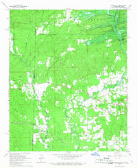 1965 Chapel Hill1967 Print · USGSThe border country of Sevier County comes alive in the mid-sixties as the De Queen Reservoir begins to reshape the landscape. Local historians can trace family roots through Ultima Thule, the Chapel Hill Cem, and the path of the De Queen and Eastern railroad.2 unique versions available
 - 1966 Map of De Queen, 1967 Print
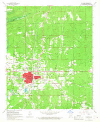 1966 De Queen1967 Print · USGSDe Queen and Sevier County are captured in the mid-1960s just as a new reservoir began to reshape the local geography. Trace the path of the Kansas City Southern railroad through Process City or locate family sites like Redman Cemetery and Smyrna Ch.
Showing maps 1-25 of 114
Top cities of Sevier County
- De Queen historical maps
- Horatio historical maps
- Lockesburg historical maps
- Gillham historical maps
- Ben Lomond historical maps
Frequently asked questions
- What are the different types of historical maps available for Sevier County?
- What is the oldest map of Sevier County?
- Where can I purchase historical maps of Sevier County for my home or office?
- Where can I download high-res historical maps of Sevier County?
- Are there historical topographic maps available for Sevier County?
- Is there historical aerial imagery available for Sevier County?
- Where are historical maps of Sevier County sourced from?