2020s Maps of Hayward, California
Explore 6 historic maps of Hayward from the 2020s. These maps offer a rare glimpse into what life looked like during the 2020s — showing old roads, neighborhoods, homes, and landmarks that have changed or disappeared over time.
Whether you're researching your family's past, planning a metal detecting trip, or studying how Hayward's landscape evolved across the 2020s, these high-resolution maps are a powerful tool for exploring the history of this region.
- Focus on a specific era: All maps on this page are from the 2020s, giving you a focused view of this time period.
- See what’s changed: Compare century-old streets, trails, and buildings to today's modern landscape using overlays and satellite layers.
- Research with precision: Use these maps for genealogy, historical research, land use analysis, or educational projects.
- View, download, or print: Maps are fully viewable online in high resolution, and can be downloaded or printed for your own records.
Start exploring Hayward's history through authentic maps from the 2020s. This is your window into the past.
Hayward, CA maps
(6)- 2021 Map of Dublin, 2021 Print
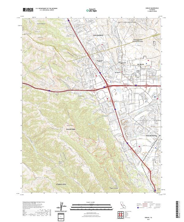 2021 Dublin2021 Print · USGSThe Tri-Valley area comes into sharp focus during this era of suburban expansion and hill-country preservation. Researchers can trace local history from the Dublin Pioneer Cem to the modern East County Hall of Justice while exploring the trails of Walpert Ridge.
 - 2021 Map of Niles, 2021 Print
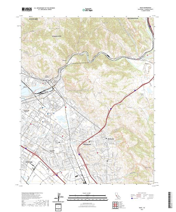 2021 Niles2021 Print · USGSFremont and the surrounding East Bay hills are documented here in the early twenty-first century as suburban growth meets the ridges of the Diablo Range. Researchers can trace historic local identities in the Niles District, locate the Mission San Jose Cem, and follow the Hetch Hetchy Aqueduct across the landscape.
 - 2021 Map of Redwood Point, 2021 Print
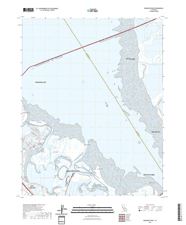 2021 Redwood Point2021 Print · USGSThe San Francisco Bay shoreline in 2021 shows a complex landscape of reclaimed land and tidal marshes. Trace the development of Redwood City and Foster City alongside Bair Island and the San Carlos Airport.
 - 2021 Map of San Leandro, 2021 Print
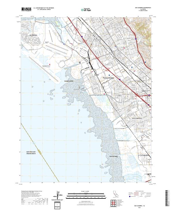 2021 San Leandro2021 Print · USGSThe East Bay shoreline is captured here in the early 2020s, showing the dense urban development between the bay and the hills. Researchers can trace local landmarks like San Lorenzo Cem, Lorenzo Station, and the expanse of Metropolitan Oakland International Airport.
 - 2021 Map of Hayward, 2021 Print
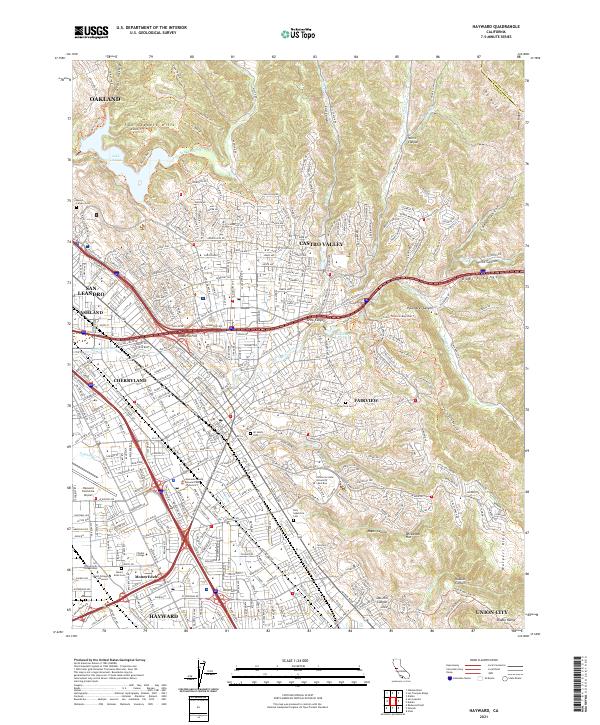 2021 Hayward2021 Print · USGSThe East Bay hills and coastal plain come alive in this detailed look at suburban growth. Trace family history at Lone Tree Cem or explore the transit network near Hayward Executive Airport and the BART rail line.
 - 2021 Map of Newark, 2021 Print
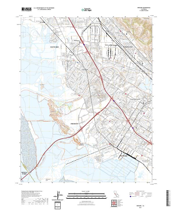 2021 Newark2021 Print · USGSThe East Bay shoreline and southern Alameda County are shown during their late-period expansion. Researchers can trace family history through sites like the Presbyterian Cem and Holy Spirit Cem or locate the historic Jarvis Landing.
End of results
Showing maps 1-6 of 6
Top cities near Hayward
- San Jose historical maps
- San Francisco historical maps
- Oakland historical maps
- Fremont historical maps
- Sunnyvale historical maps
- Santa Clara historical maps
See more
Top neighborhoods of Hayward
- Halvern historical maps
- Carpenter historical maps
- Sorenson historical maps
- Russell City historical maps
- Baumberg historical maps
Frequently asked questions
- What are the different types of historical maps available for Hayward?
- What is the oldest map of Hayward?
- Where can I purchase historical maps of Hayward for my home or office?
- Where can I download high-res historical maps of Hayward?
- Are there historical topographic maps available for Hayward?
- Is there historical aerial imagery available for Hayward?
- Where are historical maps of Hayward sourced from?