Old Maps of Colusa, California for Academic Research
Study the evolution of Colusa with 27 high-resolution historic maps. Whether you're teaching, researching, or modeling changes in land use, these maps provide essential visual documentation of urban, environmental, and geographic change.
- Analyze long-term change: Track patterns in development, transportation, and natural features.
- Ideal for environmental or urban studies: Support academic projects with primary historical map data.
- Use in the classroom or lab: Educators and researchers rely on these maps to bring historical context to life.
These maps are a powerful tool for teaching, research, and visualizing how Colusa has changed over the decades.
Colusa, CA maps
(27)- 1888 Map of Marysville
 1888 Marysville1888 Print · USGSThe Sacramento Valley in the late nineteenth century was a landscape of fertile river bottoms and emerging rail towns. Researchers can trace the river economy through Moons Ferry and Eddys Ferry or locate early family holdings like Hock Farm and Butte House.
 - 1891 Map of Marysville
 1891 Marysville1891 Print · USGSThe Sacramento Valley in the late nineteenth century centers on the volcanic peaks of the Marysville Buttes. Genealogists and historians can trace pioneer landings and river crossings such as Hock Farm, Princeton Ferry, and the early street grids of Sutter City.
 - 1894 Map of Marysville
 1894 Marysville1894 Print · USGSThe Sacramento Valley in the 1890s is captured here as a landscape of river ferries and expanding rail lines. Genealogists can trace family footprints in Sutter City, identify old river crossings like Moons Ferry, or locate the historic Hock Farm.
 - 1895 Map of Marysville
 1895 Marysville1895 Print · USGSThe Sacramento Valley in the 1890s centered on the dramatic profile of the Marysville Buttes and a bustling river-and-rail economy. Researchers can trace early river crossings like Moons Ferry, the historic Hock Farm, and the early footprints of Marysville and Yuba City.6 unique versions available
 - 1907 Map of Colusa
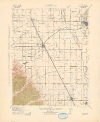
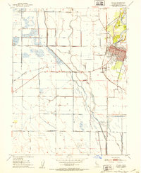
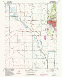
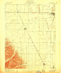 1907 Colusa1907 Print · USGSColusa County at the dawn of the twentieth century shows a landscape shaped by rail expansion and irrigation. Genealogists and historians can trace the early footprints of Colusa, Arbuckle, and College City, alongside the Southern Pacific R R and Sabin Lake.3 unique versions available
 - 1912 Map of Meridian
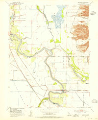
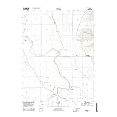
 1912 Meridian1912 Print · USGSThe Sacramento Valley riverlands and the western foothills of the volcanic buttes are captured here just before the era of modern levee and bypass systems. You can locate rural schoolhouses like Farmers School and trace the early boundaries of Butte Sink and the town of Meridian.2 unique versions available
 - 1918 Map of Powell Slough
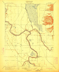
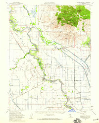
 1918 Powell Slough1918 Print · USGSThe Sacramento Valley's agricultural heart is captured here as the Great War ended, centered on the river town of Colusa. Trace the early irrigation works of the Colusa and Lake Irrigation Company Canal and family-named landmarks like Powell Slough.2 unique versions available
 - 1942 Map of Colusa
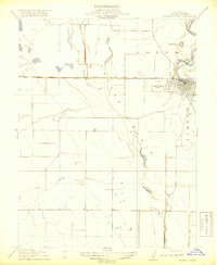
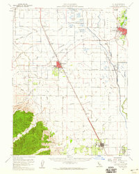
 1942 Colusa1942 Print · USGSColusa County at the start of the 1940s reveals a highly engineered agricultural landscape defined by vital rail lines and irrigation works. Genealogists and local historians can trace the development of Williams, the rural Central Sch, and smaller sidings like Cortena and Delphos along the Southern Pacific.
 - 1952 Map of Colusa, 1953 Print
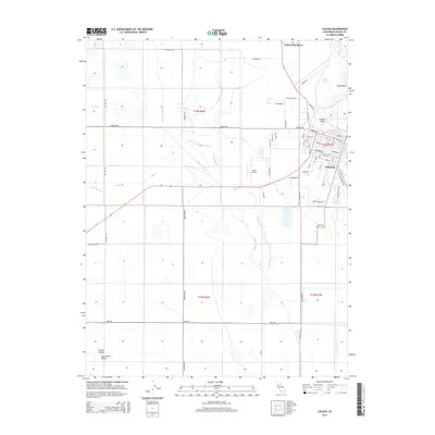
 1952 Colusa1953 Print · USGSColusa sits at a vital river and rail junction in the early fifties, where the Sacramento meanders past a bustling county seat. Genealogists can trace family landmarks like the Union High Sch, find the local Cem, or locate rural outposts such as The Four Corners.4 unique versions available
 - 1952 Map of Meridian, 1955 Print
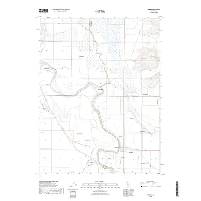
 1952 Meridian1955 Print · USGSThe Sacramento River valley in the early fifties shows a landscape shaped by flood control and rail transport. Genealogists and historians can trace family-named sites like Arbee, locate the Cemetery near Meridian, and study the reach of the Southern Pacific.4 unique versions available
 - 1953 Map of Colusa, 1960 Print
 1953 Colusa1960 Print · USGSColusa County was a thriving agricultural and rail corridor in the early fifties, centered on the Sacramento River. Genealogists can trace family footprints in Arbuckle, locate the Cachil Dehe Rancheria, or find local landmarks like the Arbuckle Golf Club.2 unique versions available
 - 1954 Map of Sutter Buttes, 1959 Print
 1954 Sutter Buttes1959 Print · USGSThe Sacramento Valley landscape in the mid-fifties is defined here by the volcanic profile of the Sutter Buttes and the engineered waterways of the Sutter Bypass. Genealogists and local historians can trace family roots through the Grand Island Cemetery, Winship School, and river landings like Fraziers Landing.3 unique versions available
 - 1957 Map of Ukiah, 1966 Print
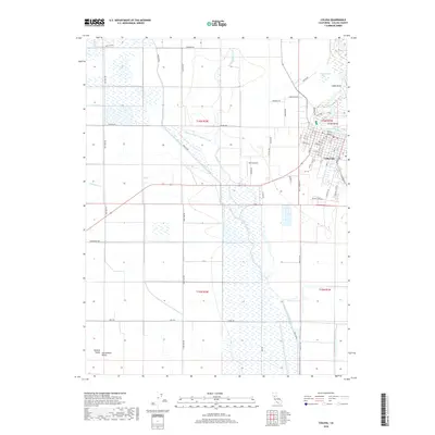
 1957 Ukiah1966 Print · USGSNorthern California's diverse terrain comes into focus in the mid-1950s, from the rugged timberlands of the Jackson State Forest to the productive Sacramento Valley. Genealogists and historians can trace the rail lines of the Northwestern Pacific or locate early valley settlements like Arbuckle and Paskenta.3 unique versions available
 - 1958 Map of Chico, 1962 Print
 1958 Chico1962 Print · USGSMid-century Northern California comes to life across the Central Valley and high Sierras as the postwar economy transformed the landscape. Trace the rail lines of the Southern Pacific RR, locate family roots near Chico Cem, or explore the early layout of Paradise and Beale Air Force Base.4 unique versions available
 - 1960 Map of Ukiah
 1960 Ukiah1960 Print · USGSNorthern California during the late fifties reveals a landscape of deep timber forests and valley agriculture before modern expansion. Trace the historic rail lines of the California Western RR and the Northwestern Pacific RR through settlements like Fort Bragg and Ukiah.2 unique versions available
 - 1960 Map of Chico
 1960 Chico1960 Print · USGSThe Northern California high country and Sacramento Valley meet in this 1960s-era landscape of mining towns and river settlements. Trace the rail-and-water economy of the gold country through the Empire Mine, Beale Air Force Base, and the Western Pacific Railroad.
 - 1991 Map of Colusa, 1995 Print
 1991 Colusa1995 Print · USGSColusa and the Sacramento River bottomlands are captured here in the early nineties, showing a landscape defined by levees and wildlife conservation. Researchers can trace the town grid to find Union High Sch and St Johns Ch, or follow the Old Railroad Grade past the County Fairgrounds.
 - 1993 Map of Yuba City, 1994 Print
 1993 Yuba City1994 Print · USGSThe Sacramento Valley and Sierra Nevada foothills meet in the 1990s, where agricultural bypasses and river networks surround the iconic Sutter Buttes. Researchers can trace the rail corridors of the Southern Pacific and Western Pacific through hubs like Marysville and Gridley.
 - 1994 Map of Lakeport
 1994 Lakeport1994 Print · USGSCoastal mountains meet the fertile Sacramento Valley in the 1990s, where the waters of Clear Lake define the western landscape. Researchers can trace the industrial footprint of the Sulphur Bank Mine, follow the Southern Pacific RR tracks, or locate old settlements like Fouts Springs and Lodoga.
 - 2012 Map of Colusa, 2012 Print
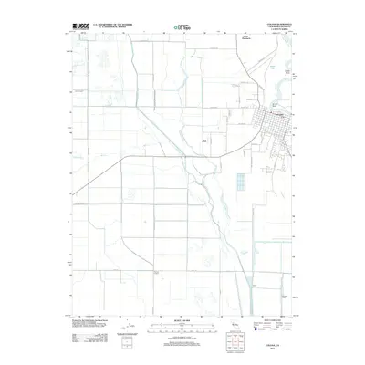 2012 Colusa2012 Print · USGSCovers Colusa, including Williams, Colusa County, and other nearby areas
 - 2012 Map of Meridian, 2012 Print
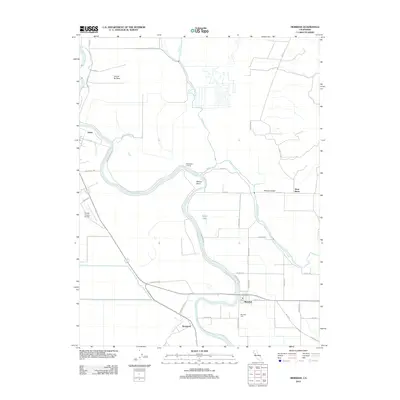 2012 Meridian2012 Print · USGSCovers Colusa, including Arbee, Meridian, and other nearby areas
 - 2015 Map of Colusa, 2015 Print
 2015 Colusa2015 Print · USGSCovers Colusa, including Williams, Colusa County, and other nearby areas
 - 2015 Map of Meridian, 2015 Print
 2015 Meridian2015 Print · USGSCovers Colusa, including Arbee, Meridian, and other nearby areas
 - 2018 Map of Colusa, 2018 Print
 2018 Colusa2018 Print · USGSCovers Colusa, including Williams, Colusa County, and other nearby areas
 - 2018 Map of Meridian, 2018 Print
 2018 Meridian2018 Print · USGSCovers Colusa, including Arbee, Meridian, and other nearby areas
Showing maps 1-25 of 27
Top cities near Colusa
Top neighborhoods of Colusa
Frequently asked questions
- What are the different types of historical maps available for Colusa?
- What is the oldest map of Colusa?
- Where can I purchase historical maps of Colusa for my home or office?
- Where can I download high-res historical maps of Colusa?
- Are there historical topographic maps available for Colusa?
- Is there historical aerial imagery available for Colusa?
- Where are historical maps of Colusa sourced from?