Old Maps of Williams, California
Explore 31 old maps of Williams, spanning from 1907 to today. These high-resolution historic maps reveal how streets, neighborhoods, landmarks, and natural features evolved over time — perfect for genealogy, metal detecting, research, and local history exploration.
What you can do with these maps:
- See how Williams changed over time: Compare historical maps to modern-day views to trace roads, homesites, rail lines & more.
- View detailed metadata: Each map includes creators, publishers, year, scale, and archive source.
- Overlay maps with satellite & LiDAR: Visualize the past alongside modern tools to explore terrain & human change.
- Trusted historical sources: Maps sourced from the USGS, Library of Congress, and other archives.
- Access maps your way: View online, download high-res files, or order prints for personal or research use.
Start exploring old maps of Williams to uncover forgotten places, hidden landmarks, and the deep history beneath your feet.
Williams, CA maps
(31)- 1907 Map of Colusa
 1907 Colusa1907 Print · USGSColusa County at the dawn of the twentieth century shows a landscape shaped by rail expansion and irrigation. Genealogists and historians can trace the early footprints of Colusa, Arbuckle, and College City, alongside the Southern Pacific R R and Sabin Lake.3 unique versions available
 - 1918 Map of Williams
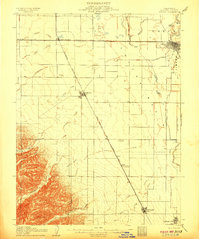
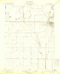
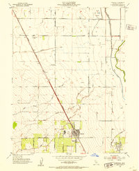
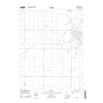
 1918 Williams1918 Print · USGSColusa County at the start of the twentieth century is centered on the railroad hub of Williams. Genealogists and historians can trace the early rail corridor of the Southern Pacific (Woodland Line) and locate the settlements at Colusa Junction and Lurline.
 - 1918 Map of Spring Valley
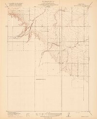 1918 Spring Valley1918 Print · USGSColusa County at the turn of the century remained a landscape of open terrain and winding waterways. Researchers can trace the drainage patterns of Spring Valley and find early water landmarks like Old Cortina Creek and Chamisal Creek.2 unique versions available
 - 1918 Map of Arbuckle
 1918 Arbuckle1918 Print · USGSColusa County at the turn of the century is a landscape of expanding rail and water engineering. Genealogists can trace family footprints in Arbuckle and College City, or locate the specific rail stops at Macy and Berlin Genevra Sta.
 - 1918 Map of Powell Slough
 1918 Powell Slough1918 Print · USGSThe Sacramento Valley's agricultural heart is captured here as the Great War ended, centered on the river town of Colusa. Trace the early irrigation works of the Colusa and Lake Irrigation Company Canal and family-named landmarks like Powell Slough.2 unique versions available
 - 1942 Map of Colusa
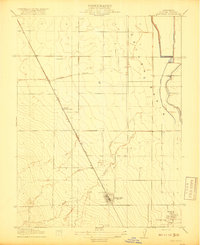
 1942 Colusa1942 Print · USGSColusa County at the start of the 1940s reveals a highly engineered agricultural landscape defined by vital rail lines and irrigation works. Genealogists and local historians can trace the development of Williams, the rural Central Sch, and smaller sidings like Cortena and Delphos along the Southern Pacific.
 - 1952 Map of Colusa, 1953 Print
 1952 Colusa1953 Print · USGSColusa sits at a vital river and rail junction in the early fifties, where the Sacramento meanders past a bustling county seat. Genealogists can trace family landmarks like the Union High Sch, find the local Cem, or locate rural outposts such as The Four Corners.4 unique versions available
 - 1952 Map of Williams, 1953 Print
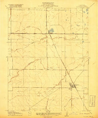
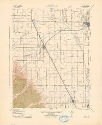
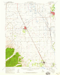
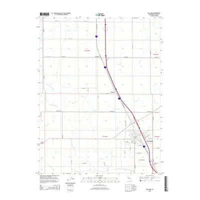
 1952 Williams1953 Print · USGSColusa County's agricultural heartland is documented here in the early fifties, showing the hub of Williams and its surrounding rail-and-canal network. Genealogists and historians can trace local landmarks like Union High School, the town Cem, and rural stops at Cortena and Delphos.4 unique versions available
 - 1952 Map of Arbuckle, 1953 Print
 1952 Arbuckle1953 Print · USGSThe Colusa Basin in the early fifties shows a thriving agricultural landscape defined by the Southern Pacific rail line. Researchers can trace local landmarks like Pierce Union High School, the settlement at College City, and the early boundaries of the Colusa Nat Wildlife Refuge.3 unique versions available
 - 1953 Map of Cortina Creek, 1955 Print
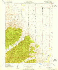 1953 Cortina Creek1955 Print · USGSThe Colusa County foothills in the mid-fifties show a landscape of rising elevations and agricultural reach. Trace old property lines and water rights near Cortina Vineyard, Whisky Creek, and the Arbuckle Golf Club.2 unique versions available
 - 1953 Map of Colusa, 1960 Print
 1953 Colusa1960 Print · USGSColusa County was a thriving agricultural and rail corridor in the early fifties, centered on the Sacramento River. Genealogists can trace family footprints in Arbuckle, locate the Cachil Dehe Rancheria, or find local landmarks like the Arbuckle Golf Club.2 unique versions available
 - 1957 Map of Ukiah, 1966 Print
 1957 Ukiah1966 Print · USGSNorthern California's diverse terrain comes into focus in the mid-1950s, from the rugged timberlands of the Jackson State Forest to the productive Sacramento Valley. Genealogists and historians can trace the rail lines of the Northwestern Pacific or locate early valley settlements like Arbuckle and Paskenta.3 unique versions available
 - 1960 Map of Ukiah
 1960 Ukiah1960 Print · USGSNorthern California during the late fifties reveals a landscape of deep timber forests and valley agriculture before modern expansion. Trace the historic rail lines of the California Western RR and the Northwestern Pacific RR through settlements like Fort Bragg and Ukiah.2 unique versions available
 - 1991 Map of Colusa, 1995 Print
 1991 Colusa1995 Print · USGSColusa and the Sacramento River bottomlands are captured here in the early nineties, showing a landscape defined by levees and wildlife conservation. Researchers can trace the town grid to find Union High Sch and St Johns Ch, or follow the Old Railroad Grade past the County Fairgrounds.
 - 1994 Map of Lakeport
 1994 Lakeport1994 Print · USGSCoastal mountains meet the fertile Sacramento Valley in the 1990s, where the waters of Clear Lake define the western landscape. Researchers can trace the industrial footprint of the Sulphur Bank Mine, follow the Southern Pacific RR tracks, or locate old settlements like Fouts Springs and Lodoga.
 - 2012 Map of Cortina Creek, 2012 Print
 2012 Cortina Creek2012 Print · USGSCovers Williams, including Colusa County, United States, and other nearby areas
 - 2012 Map of Williams, 2012 Print
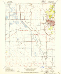
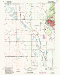
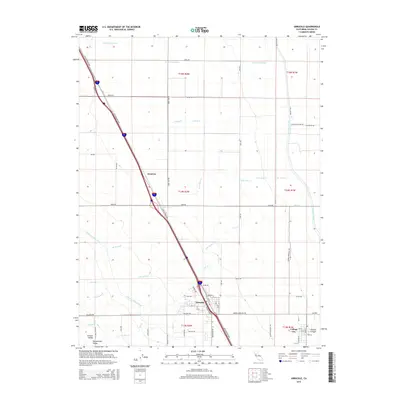
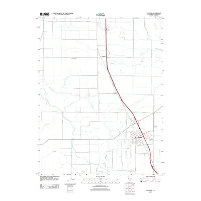 2012 Williams2012 Print · USGSCovers Williams, including Delphos, Colusa County, and other nearby areas
 - 2012 Map of Arbuckle, 2012 Print
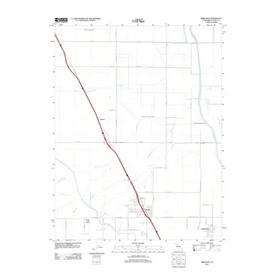 2012 Arbuckle2012 Print · USGSCovers Williams, including College City, Arbuckle, and other nearby areas
 - 2012 Map of Colusa, 2012 Print
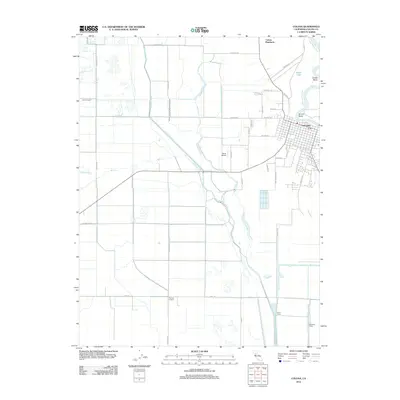 2012 Colusa2012 Print · USGSCovers Williams, including Colusa, Colusa County, and other nearby areas
 - 2015 Map of Williams, 2015 Print
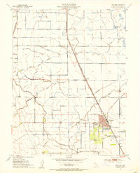
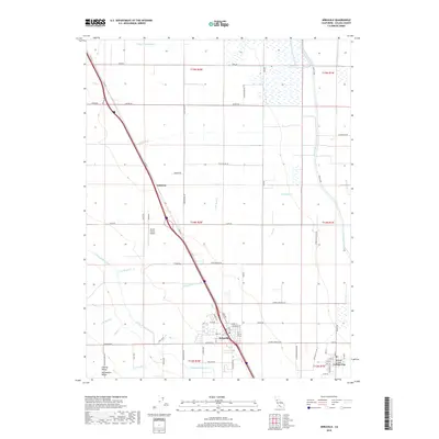
 2015 Williams2015 Print · USGSCovers Williams, including Delphos, Colusa County, and other nearby areas
 - 2015 Map of Cortina Creek, 2015 Print
 2015 Cortina Creek2015 Print · USGSCovers Williams, including Colusa County, United States, and other nearby areas
 - 2015 Map of Colusa, 2015 Print
 2015 Colusa2015 Print · USGSCovers Williams, including Colusa, Colusa County, and other nearby areas
 - 2015 Map of Arbuckle, 2015 Print
 2015 Arbuckle2015 Print · USGSCovers Williams, including College City, Arbuckle, and other nearby areas
 - 2018 Map of Cortina Creek, 2018 Print
 2018 Cortina Creek2018 Print · USGSCovers Williams, including Colusa County, United States, and other nearby areas
 - 2018 Map of Arbuckle, 2018 Print
 2018 Arbuckle2018 Print · USGSCovers Williams, including College City, Arbuckle, and other nearby areas
Showing maps 1-25 of 31
Top cities near Williams
Frequently asked questions
- What are the different types of historical maps available for Williams?
- What is the oldest map of Williams?
- Where can I purchase historical maps of Williams for my home or office?
- Where can I download high-res historical maps of Williams?
- Are there historical topographic maps available for Williams?
- Is there historical aerial imagery available for Williams?
- Where are historical maps of Williams sourced from?