Old Maps of Delevan, California for Hiking & Exploration
Hike through history with 11 historic maps of Delevan. Explore old trails, ghost towns, and forgotten backroads — perfect for outdoor adventurers and local explorers.
- Rediscover forgotten places: Map out old mining camps, roads, and footpaths that no longer exist on modern maps.
- Layer with modern tools: Combine with LiDAR or satellite views to plan hikes through historical terrain.
- Made for exploration: Popular among hikers, overlanders, and local history lovers.
Use these maps to find adventure and explore the hidden past of Delevan.
Delevan, CA maps
(11)- 1906 Map of Maxwell
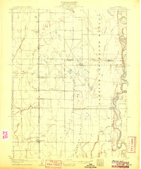 1906 Maxwell1906 Print · USGSColusa and Glenn Counties at the dawn of the century show a landscape defined by massive land grants and new irrigation. Trace family roots and vanished river stops like Boggs Landing and Compton Landing along the Sacramento River.3 unique versions available
 - 1917 Map of Delevan
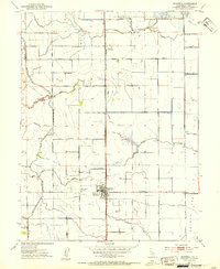
 1917 Delevan1917 Print · USGSColusa County's agricultural heartland was already defined by its rail and water infrastructure in the early twentieth century. Genealogists and local historians can trace the grid of Maxwell, locate the rural Cemetery, and follow the Southern Pacific (Woodland Line) through the valley.
 - 1952 Map of Maxwell, 1953 Print
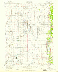
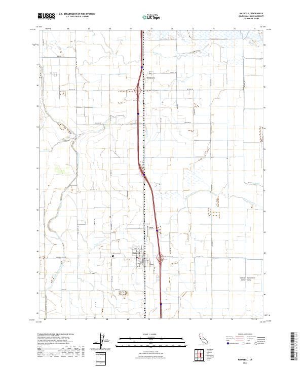
 1952 Maxwell1953 Print · USGSAgricultural life in the early fifties revolves around the railroad towns of the Sacramento Valley. Genealogists and local historians can trace the foundations of Maxwell and Delevan near the Union Church and the Maxwell Cemetery.3 unique versions available
 - 1952 Map of Maxwell, 1958 Print
 1952 Maxwell1958 Print · USGSThe Sacramento Valley comes alive in this mid-century survey of the Maxwell and Princeton areas, showcasing a landscape of river bends and rail sidings. Genealogists can trace family roots through several rural schools like Liberty Sch and Codora Sch, or locate the historic Cachil Dehe Rancheria.2 unique versions available
 - 1957 Map of Ukiah, 1966 Print
 1957 Ukiah1966 Print · USGSNorthern California's diverse terrain comes into focus in the mid-1950s, from the rugged timberlands of the Jackson State Forest to the productive Sacramento Valley. Genealogists and historians can trace the rail lines of the Northwestern Pacific or locate early valley settlements like Arbuckle and Paskenta.3 unique versions available
 - 1960 Map of Ukiah
 1960 Ukiah1960 Print · USGSNorthern California during the late fifties reveals a landscape of deep timber forests and valley agriculture before modern expansion. Trace the historic rail lines of the California Western RR and the Northwestern Pacific RR through settlements like Fort Bragg and Ukiah.2 unique versions available
 - 1994 Map of Lakeport
 1994 Lakeport1994 Print · USGSCoastal mountains meet the fertile Sacramento Valley in the 1990s, where the waters of Clear Lake define the western landscape. Researchers can trace the industrial footprint of the Sulphur Bank Mine, follow the Southern Pacific RR tracks, or locate old settlements like Fouts Springs and Lodoga.
 - 2012 Map of Maxwell, 2012 Print
 2012 Maxwell2012 Print · USGSCovers Delevan, including Maxwell, Colusa County, and other nearby areas
 - 2015 Map of Maxwell, 2015 Print
 2015 Maxwell2015 Print · USGSCovers Delevan, including Maxwell, Colusa County, and other nearby areas
 - 2018 Map of Maxwell, 2018 Print
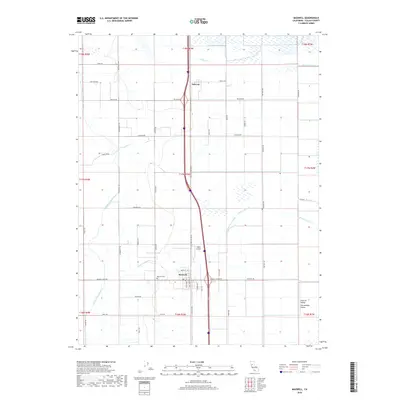 2018 Maxwell2018 Print · USGSCovers Delevan, including Maxwell, Colusa County, and other nearby areas
 - 2022 Map of Maxwell, 2022 Print
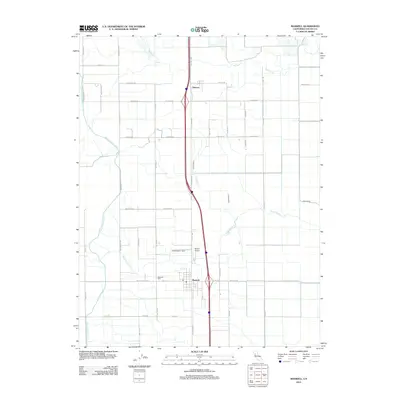
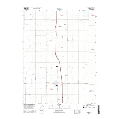
 2022 Maxwell2022 Print · USGSThe northern Sacramento Valley's agricultural grid is on full display here, centered on the community of Maxwell. Genealogists and historians can trace local landmarks like Maxwell Cem, Moller Airport, and the small settlement of Delevan.
End of results
Showing maps 1-11 of 11
Top cities near Delevan
- Willows historical maps
- Colusa historical maps
- Williams historical maps
- Maxwell historical maps
- Butte City historical maps
Frequently asked questions
- What are the different types of historical maps available for Delevan?
- What is the oldest map of Delevan?
- Where can I purchase historical maps of Delevan for my home or office?
- Where can I download high-res historical maps of Delevan?
- Are there historical topographic maps available for Delevan?
- Is there historical aerial imagery available for Delevan?
- Where are historical maps of Delevan sourced from?