Old Maps of Dinsmores, California for Genealogy
Trace your family roots with 11 historic maps of Dinsmores. These high-res maps reveal old neighborhoods, homesites, landmarks, and streets — helping you uncover where your ancestors lived and how the area evolved over time.
- Explore historic neighborhoods: Identify where your relatives may have lived in the 1800s or 1900s.
- Compare maps over time: Trace the changes in streets, buildings, and landmarks for multi-generational research.
- Perfect for genealogy & ancestry research: Used by family historians and researchers to map out lineage and migration.
These maps are an incredible resource for exploring your personal connection to Dinsmores's past.
Dinsmores, CA maps
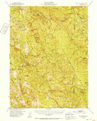
(11)- 1914 Map of Pilot Creek
 1914 Pilot Creek1914 Print · USGSHumboldt and Trinity counties are shown during the early years of the national forest system, before modern road networks penetrated these deep woods. Researchers can trace early infrastructure like Wises Substation and Oak Park R.S. or locate remote landmarks like Durphys Lake.
 - 1915 Map of Big Bar and Vicinity
 1915 Big Bar and Vicinity1915 Print · USGSThe Trinity River wilderness in the early twentieth century was a landscape of isolated mining outposts and river settlements. Genealogists and historians can trace the early footprints of Junction City, Helena, and Hyampom alongside remote landmarks like Keystone Cabin.5 unique versions available
 - 1951 Map of Pilot Creek, 1952 Print
 1951 Pilot Creek1952 Print · USGSHumboldt and Trinity counties are shown during the early fifties, a time when remote cabins and mountain ranches still defined the high country. Genealogists and local historians can locate Ackley Ranch (Site of Fort Baker), Showers Pass, and the Cold Springs Lookout.5 unique versions available
 - 1958 Map of Redding
 1958 Redding1958 Print · USGSNorthern California's valley and mountain landscapes are captured in the late fifties, showing the region as new reservoirs reshaped the river systems. Genealogists and historians can trace rail-side towns like Cottonwood, the military presence at Red Bluff Air Force Station, and mountain outposts like Weaverville.5 unique versions available
 - 1977 Map of Board Camp Mtn
 1977 Board Camp Mtn1977 Print · USGSHumboldt County’s high forest ridges and the Mad River valley are documented here in the late seventies. Researchers can trace the locations of isolated outposts and seasonal camps including Nolan Cabin, Ridge Cabin, and the Deer Creek Ranch.3 unique versions available
 - 1982 Map of Hayfork, 1983 Print
 1982 Hayfork1983 Print · USGSTrinity and Humboldt counties appear here in the early eighties as a landscape of timber and mining. Researchers can trace remote river settlements like Hyampom and Burnt Ranch or locate old operations such as the Yellowstone Mine and Index Mine.
 - 1997 Map of Board Camp Mountain, 2001 Print
 1997 Board Camp Mountain2001 Print · USGSHumboldt County’s high country is captured here in the late 1990s, showcasing the timber and ranching landscape within the Six Rivers National Forest. Researchers can locate remote landmarks like Nolan Cabin, Deer Creek Ranch, and the summit of Board Camp Mountain.
 - 2012 Map of Board Camp Mountain, 2012 Print
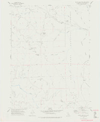
 2012 Board Camp Mountain2012 Print · USGSCovers Dinsmores, including Humboldt County, United States, and other nearby areas
 - 2015 Map of Board Camp Mountain, 2015 Print
 2015 Board Camp Mountain2015 Print · USGSCovers Dinsmores, including Humboldt County, United States, and other nearby areas
 - 2018 Map of Board Camp Mountain, 2018 Print
 2018 Board Camp Mountain2018 Print · USGSCovers Dinsmores, including Humboldt County, United States, and other nearby areas
 - 2022 Map of Board Camp Mountain, 2022 Print
 2022 Board Camp Mountain2022 Print · USGSHumboldt County's steep ridges and forest clearings are captured here in the early twenty-first century. Researchers can trace the remote network of trails and roads like the Whiting Ridge Trl and unique clearings such as Big Opening and Starvation Opening.
End of results
Showing maps 1-11 of 11
Top cities near Dinsmores
Frequently asked questions
- What are the different types of historical maps available for Dinsmores?
- What is the oldest map of Dinsmores?
- Where can I purchase historical maps of Dinsmores for my home or office?
- Where can I download high-res historical maps of Dinsmores?
- Are there historical topographic maps available for Dinsmores?
- Is there historical aerial imagery available for Dinsmores?
- Where are historical maps of Dinsmores sourced from?