Old Maps of Trinidad, California for Academic Research
Study the evolution of Trinidad with 12 high-resolution historic maps. Whether you're teaching, researching, or modeling changes in land use, these maps provide essential visual documentation of urban, environmental, and geographic change.
- Analyze long-term change: Track patterns in development, transportation, and natural features.
- Ideal for environmental or urban studies: Support academic projects with primary historical map data.
- Use in the classroom or lab: Educators and researchers rely on these maps to bring historical context to life.
These maps are a powerful tool for teaching, research, and visualizing how Trinidad has changed over the decades.
Trinidad, CA maps
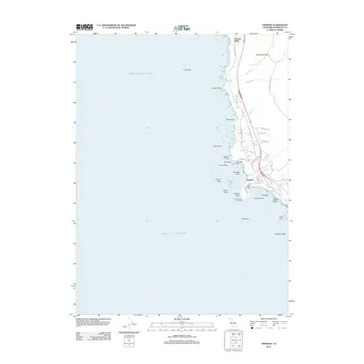
(12)- 1945 Map of Trinidad
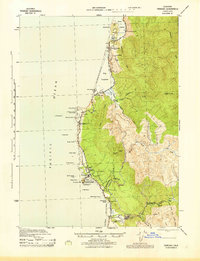 1945 Trinidad1945 Print · USGSThe Humboldt coast during the mid-forties reveals a landscape of maritime safety and redwood-country industry. Trace the locations of family ranches like Reimann Ranch, find the company town at Crannel, or locate the Trinidad Head Lighthouse and a Covered Bridge.
 - 1949 Map of Eureka
 1949 Eureka1949 Print · USGSCoastal Northern California in the late 1940s shows a landscape of timber towns and maritime outposts. You can trace the Northwestern Pacific rail line through Eureka or locate family landmarks like the Tyson Chrome Mine and Crescent City Lighthouse.2 unique versions available
 - 1952 Map of Trinidad, 1954 Print
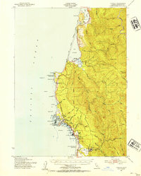 1952 Trinidad1954 Print · USGSThe Humboldt County coast in the early fifties shows a landscape of timber industry and maritime heritage. Genealogists and historians can trace the Hammond Lumber Co rail lines, the community of Crannell, and coastal landmarks like Trinidad Head and the Lighthouse.2 unique versions available
 - 1958 Map of Eureka, 1967 Print
 1958 Eureka1967 Print · USGSNorthern California's rugged redwood coast and timber corridors are captured in the late fifties, from the Oregon border down to Shelter Cove. Researchers can trace the path of the Northwestern Pacific railroad and locate rural landmarks like Grizzly Bluff School or the St Josephs Sch.
 - 1958 Map of Crescent City, 1978 Print
 1958 Crescent City1978 Print · USGSThe northwestern California coast and the Oregon borderlands are shown here during a period of expanding redwood conservation and active military presence. Researchers can trace historic sites from the Yontocket Indian Village Site to Fort Dick and the Klamath Air Force Station.
 - 1961 Map of Eureka
 1961 Eureka1961 Print · USGSThe Northern California coast and its deep redwood forests are mapped here at a time when the timber and rail industries defined the region. Researchers can trace historic family ranches and remote sites like Fort Dick, Table Bluff Lighthouse, and the Copper Creek Mine.2 unique versions available
 - 1966 Map of Trinidad, 1968 Print
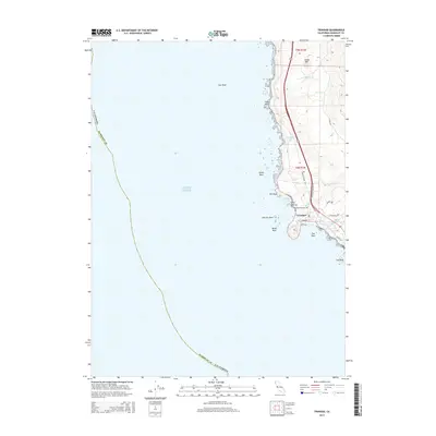
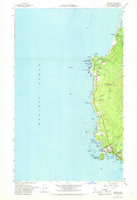 1966 Trinidad1968 Print · USGSThe Humboldt County coast in the mid-sixties reveals a landscape of protected state parks and maritime activity. Genealogists and historians can trace local landmarks like Union Sch, the Trinidad Head Lighthouse, and the community at Big Lagoon.
 - 1982 Map of Orick
 1982 Orick1982 Print · USGSCoastal Humboldt County in the early eighties reveals a landscape of massive redwood preserves and protected lagoons. Genealogists and historians can trace the foundations of Orick and Trinidad alongside the Trinidad Lighthouse and Trinidad Rancheria.
 - 2012 Map of Trinidad, 2012 Print
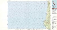
 2012 Trinidad2012 Print · USGSCovers Trinidad, including Patricks Point, Humboldt County, and other nearby areas
 - 2015 Map of Trinidad, 2015 Print
 2015 Trinidad2015 Print · USGSCovers Trinidad, including Patricks Point, Humboldt County, and other nearby areas
 - 2018 Map of Trinidad, 2018 Print
 2018 Trinidad2018 Print · USGSCovers Trinidad, including Patricks Point, Humboldt County, and other nearby areas
 - 2021 Map of Trinidad, 2021 Print
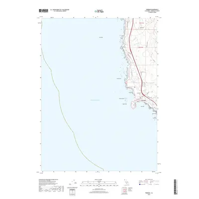
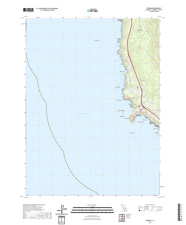 2021 Trinidad2021 Print · USGSThe Humboldt County coast comes alive in this survey of Trinidad, where the rugged Pacific shoreline meets the redwoods. Trace local landmarks like Trinidad Head, the historic Trinidad Cemetery, and coastal features from Patricks Point to Elk Head.
End of results
Showing maps 1-12 of 12
Top cities near Trinidad
Frequently asked questions
- What are the different types of historical maps available for Trinidad?
- What is the oldest map of Trinidad?
- Where can I purchase historical maps of Trinidad for my home or office?
- Where can I download high-res historical maps of Trinidad?
- Are there historical topographic maps available for Trinidad?
- Is there historical aerial imagery available for Trinidad?
- Where are historical maps of Trinidad sourced from?