Old Maps of Charleston View, California for Metal Detecting
Plan your next treasure hunt with 59 historic maps of Charleston View. Find old homesites, ghost towns, trails, and gathering spots that may be lost to time — perfect for identifying promising metal detecting locations.
- Locate forgotten sites: Uncover places like long-lost settlements, abandoned rail lines, or gathering spots.
- Plan better hunts: Use map overlays combined with LiDAR or satellite views to narrow in on historically rich areas.
- Made for detectorists: Thousands of hobbyists use these maps to discover relics, coins, and hidden history.
Use these historic maps to boost your research and find new opportunities beneath the surface of Charleston View.
Charleston View, CA maps
(59)- 1907 Map of Las Vegas, 1956 Print
 1907 Las Vegas1956 Print · USGSSouthern Nevada is shown at a pivotal moment in the early 1900s as the rail network began to transform the desert landscape. Genealogists and historians can locate early homesteads and landmarks like Las Vegas Ranch, Mormon Well, and the Stirling Mine.
 - 1908 Map of Furnace Creek
 1908 Furnace Creek1908 Print · USGSThe California-Nevada borderlands hummed with mining activity in the early twentieth century as new rail lines reached into the desert. Genealogists and historians can trace pioneer outposts like Rhyolite, industrial sites like the Keane Wonder Mine, and the springs of Ash Meadows.
 - 1908 Map of Las Vegas
 1908 Las Vegas1908 Print · USGSSouthern Nevada was a frontier of rail and ranching in the years before major desert expansion. Trace the early footprints of Las Vegas and its surrounding outposts like Arden, Bracken, and the Stirling Mine.4 unique versions available
 - 1910 Map of Furnace Creek
 1910 Furnace Creek1910 Print · USGSThe Nevada and California borderlands thrive during a historic mining boom in this early twentieth-century survey. Researchers can trace the rise of desert settlements like Rhyolite and Gold Center or locate industrial sites such as the Keane Wonder Mine and Borax Mill.5 unique versions available
 - 1910 Map of Ivanpah, 1957 Print
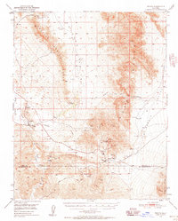
 1910 Ivanpah1957 Print · USGSThe Mojave high desert at the start of the twentieth century was a landscape of remote mining camps and vital railroad junctions. Trace the early industrial footprint of Vanderbilt, the Copper World Mine, and the rail stops at Nipton and Kelso.
 - 1912 Map of Ivanpah
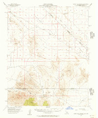
 1912 Ivanpah1912 Print · USGSThe Mojave high desert at the border of California and Nevada was a bustling corridor of mining and transcontinental rail at the start of the century. Genealogists and historians can trace defunct settlements and industrial sites like the abandoned copper smelter, Good Springs, and the Old Traction Road.5 unique versions available
 - 1933 Map of Avawatz Mountains
 1933 Avawatz Mountains1933 Print · USGSThe Mojave Desert and Death Valley transition through a period of mining and rail expansion in the early thirties. Researchers can trace the routes of the Tonopah and Tidewater RR and locate historical sites like Ashford Mill and the Epsom Salts Works.5 unique versions available
 - 1942 Map of Ivanpah
 1942 Ivanpah1942 Print · USGSThe Mojave Desert frontier comes into focus during the early war years, showing a landscape shaped by mining and rail. You can trace the path of the Union Pacific through remote stops like Nipton, Goodsprings, and the junction at Barnwell.
 - 1947 Map of Trona, 1948 Print
 1947 Trona1948 Print · USGSThe Mojave Desert and Southern Sierra foothills come alive in the late 1940s, showing the industrial nodes of the Argus Range and the burgeoning Camp Irwin. Trace the legacy of desert mining and railroading through Trona, the Ashford Mill, and the historic districts of Randsburg and Garlock.
 - 1947 Map of Kingman, 1948 Print
 1947 Kingman1948 Print · USGSThe tri-state Mojave desert region comes into focus during the late 1940s, as post-war travel began to surge along U S 66. Genealogists and historians can trace the mining-and-rail economy through the Atchison Topeka and Santa Fe line, the Copper World Mine, and old settlements like Oatman or Goodsprings.2 unique versions available
 - 1948 Map of Kingman
 1948 Kingman1948 Print · USGSThe Mojave Desert at the dawn of the fifties shows a landscape of deep canyons and booming mines along the Arizona and Nevada border. Genealogists and historians can trace rail-stop towns and mining claims like Oatman, Searchlight, and the Mohawk Mine.
 - 1948 Map of Trona
 1948 Trona1948 Print · USGSThe Mojave Desert and Death Valley frontier appear here during a mid-century era of military expansion and industrial mining. Trace the remnants of the Old Spanish Trail or locate isolated landmarks like Ashford Mill and the mining hub of Randsburg.
 - 1948 Map of Death Valley
 1948 Death Valley1948 Print · USGSIn the late 1940s, this desert frontier was defined by isolated mining camps and military restricted zones. Researchers can trace the routes between Furnace Creek Ranch and Rhyolite, or locate remote sites like the Modoc Mine and Ballarat.2 unique versions available
 - 1950 Map of Tecopa, 1958 Print
 1950 Tecopa1958 Print · USGSThe desert landscape of southeastern California is captured here at mid-century, just as the local mining economy and transportation networks were shifting. Researchers can locate remote industrial sites like the Noonday Mine or trace the historic path of the Old Spanish Trail through the hills.3 unique versions available
 - 1951 Map of Tecopa
 1951 Tecopa1951 Print · USGSThe California desert near the Nevada border in the early fifties reveals a landscape of mining and historic transit routes. Genealogists and historians can trace the Old Spanish Trail and locate remote operations like the Columbia Mine and Mine Camp.
 - 1953 Map of Trona, 1956 Print
 1953 Trona1956 Print · USGSThe high desert of San Bernardino and Inyo counties during the early Cold War reveals a landscape of mineral industry and military expansion. You can trace the Old Spanish Trail, locate the Trona potash works, and find remote outposts like Ashford Mill.
 - 1954 Map of Las Vegas
 1954 Las Vegas1954 Print · USGSLas Vegas and the Mojave Desert are shown in the early fifties as the region's military and recreational footprint expanded. Genealogists and historians can trace the early layout of North Las Vegas, the sites of Indian Springs Air Force Base, and long-established towns like Bunkerville.5 unique versions available
 - 1954 Map of Kingman, 1964 Print
 1954 Kingman1964 Print · USGSThe High Desert borderlands come to life in the mid-fifties, showing the intersection of mining legacies and massive river projects. Researchers can trace old rail stops like Roach Station, mining sites such as Chloride, and river landmarks like Searchlight Ferry.4 unique versions available
 - 1954 Map of Death Valley, 1966 Print
 1954 Death Valley1966 Print · USGSInyo County and the Nevada borderlands are shown during the mid-twentieth century as mining history met the atomic age. Researchers can trace the legacy of desert boomtowns and remote camps like Rhyolite, Darwin Mines, and the isolated Clay Camp.3 unique versions available
 - 1955 Map of Kingman
 1955 Kingman1955 Print · USGSThe Mojave Desert and Colorado River corridor come alive in the mid-fifties, showing a landscape of mining camps and rail junctions. Trace the river to the Searchlight Ferry or locate old desert mining sites like Goldroad and the Great Monster Mine.
 - 1956 Map of Death Valley
 1956 Death Valley1956 Print · USGSInyo County and the Nevada borderlands appear in the mid-fifties as a rugged landscape of mining camps and military reservations. Genealogists and historians can trace the foundations of Furnace Creek Ranch, the desert roads to Ballarat, and active mining sites like the Lila C Mine.
 - 1956 Map of Horse Thief Springs, 1957 Print
 1956 Horse Thief Springs1957 Print · USGSIn the mid-fifties, the rugged desert border between California and Nevada remained a frontier for mineral prospectors and travelers. You can trace the Old Traction Road past numerous mining sites like the Silver Rule Mine and Jupiter Mine.3 unique versions available
 - 1957 Map of Las Vegas
 1957 Las Vegas1957 Print · USGSSouthern Nevada in the mid-fifties is a landscape of massive federal ranges and the early growth of Las Vegas. Researchers can trace the development of McCarran Field, the expansive Lake Mead National Recreation Area, and the industrial footprint of Henderson.
 - 1957 Map of Death Valley
 1957 Death Valley1957 Print · USGSThe High Desert in the mid-fifties reveals a landscape of extreme elevations and deep-seated mining history, from the Panamint Range to the Amargosa River. Trace the remnants of the Tonopah & Tidewater RR and remote sites like Ballarat or the Skidoo Mine.
 - 1957 Map of Trona, 1964 Print
 1957 Trona1964 Print · USGSThe High Desert in the mid-fifties is captured here as a landscape of remote mining outposts and growing military installations. Trace the industrial rail lines to Trona, the mining history of Randsburg, or the isolated expanse of the Naval Ordnance Test Station.5 unique versions available
Showing maps 1-25 of 59
Top neighborhoods of Charleston View
Frequently asked questions
- What are the different types of historical maps available for Charleston View?
- What is the oldest map of Charleston View?
- Where can I purchase historical maps of Charleston View for my home or office?
- Where can I download high-res historical maps of Charleston View?
- Are there historical topographic maps available for Charleston View?
- Is there historical aerial imagery available for Charleston View?
- Where are historical maps of Charleston View sourced from?