Old Maps of Mojave, California for Hiking & Exploration
Hike through history with 58 historic maps of Mojave. Explore old trails, ghost towns, and forgotten backroads — perfect for outdoor adventurers and local explorers.
- Rediscover forgotten places: Map out old mining camps, roads, and footpaths that no longer exist on modern maps.
- Layer with modern tools: Combine with LiDAR or satellite views to plan hikes through historical terrain.
- Made for exploration: Popular among hikers, overlanders, and local history lovers.
Use these maps to find adventure and explore the hidden past of Mojave.
Mojave, CA maps
(58)- 1915 Map of Elizabeth Lake
 1915 Elizabeth Lake1915 Print · USGSAntelope Valley and the northern reaches of the San Gabriel mountains were transforming in the early twentieth century as major water and rail projects arrived. Genealogists can trace family homesteads such as St Anthony Ranch, old desert outposts like Willow Springs, and early mining sites including the Gray Eagle Mine.2 unique versions available
 - 1915 Map of Mojave
 1915 Mojave1915 Print · USGSThe eastern Tehachapi Mountains meet the desert in the early twentieth century as a hub of rail and mining. Trace the historic paths of the Southern Pacific railroad through Tehachapi and Mojave, or locate remote sites like the Joe Walker Mine and Claraville.7 unique versions available
 - 1917 Map of Elizabeth Lake
 1917 Elizabeth Lake1917 Print · USGSThe western Antelope Valley and Sierra Pelona appear here during a period of rapid hydraulic and rail expansion. Researchers can trace the original path of the Los Angeles Aqueduct and locate early landmarks like Willow Springs and the Antelope Valley Pumping Sta.6 unique versions available
 - 1943 Map of Rosamond
 1943 Rosamond1943 Print · USGSThe Mojave Desert comes alive in the early 1940s as a center of mining and rail transit. Researchers can trace the industrial footprint of the Golden Queen Mine, locate the Kern County Union School, and see the early layout of Rosamond.2 unique versions available
 - 1943 Map of Tehachapi
 1943 Tehachapi1943 Print · USGSTehachapi and the surrounding mountain passes are captured in the early 1940s during a period of vital rail and industrial activity. Trace the SOUTHERN PACIFIC line through the Tehachapi Pass or locate rural sites like Jameson Ranch and the Pine Tree Mine.4 unique versions available
 - 1943 Map of Mojave
 1943 Mojave1943 Print · USGSMid-century Kern County comes alive through this detailed survey of the high desert and mountain passes during the war years. Genealogists and historians can trace the rail lines connecting Mojave to outlying points like Gold Town and the Lucky Dog Mine.2 unique versions available
 - 1943 Map of Willow Springs
 1943 Willow Springs1943 Print · USGSThe northern Antelope Valley and Mojave Desert come alive in this wartime survey of the Kern and Los Angeles county line. Researchers can trace historic family holdings like Wagon Wheel Ranch and C Z Ranch or locate the site of the Cactus Mine.3 unique versions available
 - 1947 Map of Plano
 1947 Plano1947 Print · USGSKern County's desert terrain is captured here in the late 1940s as military mapping methods were adapted for civilian use. Genealogists and industrial historians can trace the parallel routes of the Southern Pacific and the Lucky Dog Mine.3 unique versions available
 - 1947 Map of Mojave
 1947 Mojave1947 Print · USGSIn the high desert just after the war, Mojave stands as a vital rail and water hub at the edge of the Tehachapi Mountains. Genealogists and researchers can trace the Los Angeles Aqueduct, the streets of Reefer City, and the layout of the Muroc Naval Air Station (Abandoned).
 - 1947 Map of Bissell
 1947 Bissell1947 Print · USGSThe high desert landscape of Kern County in the late 1940s is defined here by its solitary rail lines and remote outposts. Researchers can trace the path of the Atchison Topeka and Santa Fe railroad and locate family landmarks like De Stazo Ranch and E Brown Ranch.3 unique versions available
 - 1947 Map of Soledad Mountain
 1947 Soledad Mountain1947 Print · USGSThe western Mojave Desert comes alive in the late 1940s, highlighting a landscape defined by gold mining and rail transport. Researchers can trace historic operations at the Golden Queen Mine or follow the Southern Pacific line through Gloster and Actis.
 - 1948 Map of Bakersfield
 1948 Bakersfield1948 Print · USGSBakersfield and the southern San Joaquin Valley appear in the late 1940s, showing a landscape of burgeoning oil towns, rail junctions, and early irrigation canals. Genealogists and historians can trace the foundations of local industry through Gardner Field, the Sunset Railway, and the shores of Buena Vista Lake.2 unique versions available
 - 1949 Map of Los Angeles
 1949 Los Angeles1949 Print · USGSSouthern California and the South Coast appear at the onset of the post-war boom, from the Channel Islands to the Mojave Desert. Trace early aviation sites like Lockheed Air Terminal and mining history at the Redrock Quicksilver Mine and Redrover Mine.2 unique versions available
 - 1955 Map of Los Angeles
 1955 Los Angeles1955 Print · USGSThe mid-century transformation of Southern California comes into focus as the urban sprawl of Los Angeles meets the wilderness of the Santa Monica Mountains. Researchers can trace the development of post-war suburbs alongside historic landmarks like the Santa Barbara Lighthouse and early industrial sites such as the Good Luck Mine.
 - 1955 Map of Bakersfield
 1955 Bakersfield1955 Print · USGSThe southern San Joaquin Valley in the mid-fifties shows an era of massive oil production and industrial irrigation. Trace family roots in Allensworth, the oil fields of Oildale, or the shorelines of Tulare Lake and Buena Vista Lake.
 - 1956 Map of Bakersfield
 1956 Bakersfield1956 Print · USGSThe southern San Joaquin Valley and High Sierra come alive in the mid-fifties, showing the region's complex agricultural and rail networks. Genealogists and historians can trace family roots in towns like Bakersfield, Taft, and Delano, or locate early infrastructure along the Sunset Railway.
 - 1956 Map of Rosamond, 1957 Print
 1956 Rosamond1957 Print · USGSThe High Desert in the mid-fifties shows a unique transition from a hard-rock mining hub to an aerospace frontier. Researchers can trace deep-shaft gold mines like the Golden Queen Mine and Elephant Eagle Mine alongside the early footprint of EDWARDS AIR FORCE BASE.2 unique versions available
 - 1956 Map of Mojave, 1957 Print
 1956 Mojave1957 Print · USGSThe high desert rail hub of Mojave comes alive in the mid-fifties as a vital intersection for the Southern Pacific and Santa Fe lines. Genealogists and historians can trace local life through the Marine Corps Auxiliary Air Station, the Los Angeles Aqueduct, and outposts like Reefer City and Neuralia.3 unique versions available
 - 1959 Map of Los Angeles
 1959 Los Angeles1959 Print · USGSCoastal California and the high desert met in a period of booming growth after the war. Researchers can trace early aviation and military history at the Point Mugu Air Missile Test Ctr or locate desert mining sites like the Double Eagle Mine.3 unique versions available
 - 1960 Map of Bakersfield
 1960 Bakersfield1960 Print · USGSThe Southern San Joaquin Valley at mid-century reveals a complex landscape of petroleum development and massive irrigation projects. Researchers can trace the rail lines of the Southern Pacific, explore oil-era landmarks like Oil City, and locate early settlements including Allensworth and Pixley.2 unique versions available
 - 1962 Map of Bakersfield, 1969 Print
 1962 Bakersfield1969 Print · USGSThe Southern San Joaquin Valley is shown in the 1960s as a bustling intersection of petroleum production, irrigation agriculture, and mountain recreation. Researchers can trace the rail lines of the Southern Pacific through the valley or locate early desert developments like California City and Tehachapi.4 unique versions available
 - 1965 Map of Willow Springs, 1967 Print
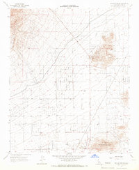 1965 Willow Springs1967 Print · USGSThe Antelope Valley foothills in the mid-sixties reveal a landscape shaped by gold mining and the essential water of the California desert. Genealogists and historians can trace family-named sites like Wagon Wheel Ranch and mining operations such as Cactus Queen Mine.2 unique versions available
 - 1966 Map of Los Angeles
 1966 Los Angeles1966 Print · USGSSouthern California underwent a mid-century transformation as suburban grids reached the base of the San Gabriel Mountains. Researchers can trace the path of the Los Angeles Aqueduct or locate defense landmarks like Edwards Air Force Base.
 - 1966 Map of Bakersfield
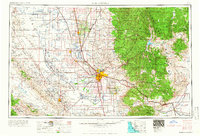 1966 Bakersfield1966 Print · USGSThe southern San Joaquin Valley in the mid-sixties reveals a massive industrial and agricultural landscape shaped by water and oil. Genealogists and historians can trace the growth of Bakersfield and Oildale, or locate remote airfields like Minter Field and Mojave-Kern County No. 7 Airport.
 - 1966 Map of Monolith, 1967 Print
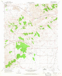 1966 Monolith1967 Print · USGSThe high mountain passes of Kern County are seen here in the mid-1960s, as heavy rail and water infrastructure carve through the Tehachapi Valley. Trace the dual paths of the Southern Pacific and Atchison Topeka and Santa Fe railroads past Monolith and Cameron.3 unique versions available
Showing maps 1-25 of 58
Top cities near Mojave
Top neighborhoods of Mojave
Frequently asked questions
- What are the different types of historical maps available for Mojave?
- What is the oldest map of Mojave?
- Where can I purchase historical maps of Mojave for my home or office?
- Where can I download high-res historical maps of Mojave?
- Are there historical topographic maps available for Mojave?
- Is there historical aerial imagery available for Mojave?
- Where are historical maps of Mojave sourced from?