Old Maps of Lake Hughes, California for Genealogy
Trace your family roots with 33 historic maps of Lake Hughes. These high-res maps reveal old neighborhoods, homesites, landmarks, and streets — helping you uncover where your ancestors lived and how the area evolved over time.
- Explore historic neighborhoods: Identify where your relatives may have lived in the 1800s or 1900s.
- Compare maps over time: Trace the changes in streets, buildings, and landmarks for multi-generational research.
- Perfect for genealogy & ancestry research: Used by family historians and researchers to map out lineage and migration.
These maps are an incredible resource for exploring your personal connection to Lake Hughes's past.
Lake Hughes, CA maps
(33)- 1903 Map of Tejon
 1903 Tejon1903 Print · USGSThe high passes and desert fringes of the Tehachapis come alive in this survey of the early twentieth-century frontier. Genealogists and historians can trace the foundations of Old Fort Tejon, follow the trail through Tejon Pass, or locate early mining sites like Frazier Mine.7 unique versions available
 - 1915 Map of Elizabeth Lake
 1915 Elizabeth Lake1915 Print · USGSAntelope Valley and the northern reaches of the San Gabriel mountains were transforming in the early twentieth century as major water and rail projects arrived. Genealogists can trace family homesteads such as St Anthony Ranch, old desert outposts like Willow Springs, and early mining sites including the Gray Eagle Mine.2 unique versions available
 - 1917 Map of Elizabeth Lake
 1917 Elizabeth Lake1917 Print · USGSThe western Antelope Valley and Sierra Pelona appear here during a period of rapid hydraulic and rail expansion. Researchers can trace the original path of the Los Angeles Aqueduct and locate early landmarks like Willow Springs and the Antelope Valley Pumping Sta.6 unique versions available
 - 1931 Map of Warm Spring
 1931 Warm Spring1931 Print · USGSThe northern reaches of Los Angeles County are captured here in the early 1930s as part of the Angeles National Forest. Researchers can trace the rugged topography of Burnt Peak and the deep cuts of Elizabeth Lake Canyon and Sawmill Canyon.
 - 1932 Map of Hughes Lake
 1932 Hughes Lake1932 Print · USGSThe high canyons of the Angeles National Forest are captured here in the early 1930s as the regional water system expanded. Researchers can trace the path of the Los Angeles Aqueduct and locate family landmarks like Munz Ranch and the La Joya Ranger Sta.
 - 1932 Map of Fairmont
 1932 Fairmont1932 Print · USGSAntelope Valley and the northern Angeles National Forest transition here in the early thirties. Genealogists and historians can trace the local infrastructure of Fairmont, including the Fairmont Sch and the vital path of the Los Angeles Aqueduct.
 - 1933 Map of Manzana
 1933 Manzana1933 Print · USGSLos Angeles County ranching and water engineering intersect in the early 1930s along the southern edge of the Antelope Valley. Researchers can trace early settlements and social hubs like Pecks Ranch, the Pine Canyon Sch, and the Tweedy Lake Club.
 - 1936 Map of Warm Spring
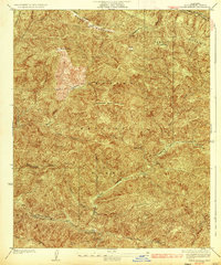 1936 Warm Spring1936 Print · USGSLos Angeles County's northern mountain frontier is documented in the mid-1930s, showcasing the early management of the forest and the clear traces of seismic geology. Researchers can trace the San Andreas Rift Zone and locate mountain infrastructure like the Sawmill Firebreak and the Lookout on Sawmill Mountain.3 unique versions available
 - 1937 Map of Fairmont
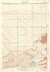 1937 Fairmont1937 Print · USGSThe northern edge of Los Angeles County is captured here in the 1930s, showing the early intersection of high desert ranching and massive water infrastructure. Researchers can trace the path of the Los Angeles Aqueduct into the Fairmont Reservoir and locate old homesteads near Fairmont and Myrick.4 unique versions available
 - 1937 Map of Hughes Lake
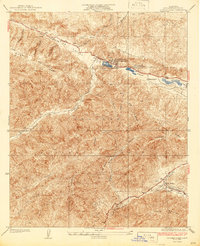 1937 Hughes Lake1937 Print · USGSThe high canyons of Los Angeles County appear here in the late 1930s, showing the early settlements and ranches along the fault line. Genealogists and historians can trace the foundations of Munz Ranch, Juday Flat, and the post office at Hughes Lake Lake Hughes P O.2 unique versions available
 - 1938 Map of Manzana
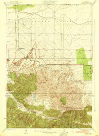 1938 Manzana1938 Print · USGSThe northern reaches of Los Angeles County and the Antelope Valley come alive in this mid-1930s survey of ranch lands and mountain canyons. Trace the historical path of the Los Angeles Aqueduct and locate family landmarks like Manzana Ranch, Spencer Ranch, and the Big Chief Mine.3 unique versions available
 - 1949 Map of Los Angeles
 1949 Los Angeles1949 Print · USGSSouthern California and the South Coast appear at the onset of the post-war boom, from the Channel Islands to the Mojave Desert. Trace early aviation sites like Lockheed Air Terminal and mining history at the Redrock Quicksilver Mine and Redrover Mine.2 unique versions available
 - 1950 Map of Fairmont
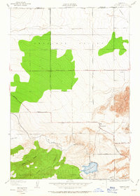 1950 Fairmont1950 Print · USGSThe northern edge of the Antelope Valley comes into focus mid-century at the boundary of Los Angeles and Kern counties. Researchers can trace the path of the Los Angeles Aqueduct and locate local landmarks like Fairmont, Fairmont Butte, and the Fairmont Reservoir.
 - 1950 Map of Manzana, 1957 Print
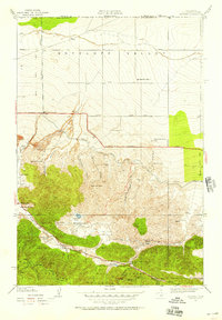 1950 Manzana1957 Print · USGSAntelope Valley and the Liebre Mountains at mid-century reveal a landscape defined by the San Andreas Rift and high-desert ranching. Genealogists can locate family holdings like Gorrindo Ranch, the Pine Canyon Sch, and the Big Chief Mine.
 - 1955 Map of Los Angeles
 1955 Los Angeles1955 Print · USGSThe mid-century transformation of Southern California comes into focus as the urban sprawl of Los Angeles meets the wilderness of the Santa Monica Mountains. Researchers can trace the development of post-war suburbs alongside historic landmarks like the Santa Barbara Lighthouse and early industrial sites such as the Good Luck Mine.
 - 1957 Map of Lake Hughes, 1959 Print
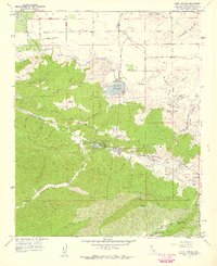 1957 Lake Hughes1959 Print · USGSUpper Los Angeles County in the late fifties was a landscape of high desert ranches and deep fault-line valleys. Genealogists and local historians can trace the foundations of Munz Ranch, find the Shoe Castle, or locate the Hughes-Elizabeth Lakes School.3 unique versions available
 - 1958 Map of Burnt Peak, 1959 Print
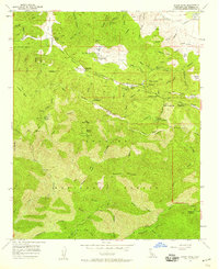 1958 Burnt Peak1959 Print · USGSIn the late 1950s, this rugged section of Los Angeles County was defined by the San Andreas Rift Zone and the high elevations of the Angeles National Forest. Genealogists and local historians can trace legacy holdings like Sawmill Mtn Ranch or investigate old mining sites such as the Big Chief Mine and Maxwell Mine.5 unique versions available
 - 1958 Map of Bouquet Reservoir, 1960 Print
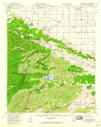 1958 Bouquet Reservoir1960 Print · USGSThe high desert and mountains of Los Angeles County appear here in the late fifties, showcasing a landscape defined by water infrastructure and rural ranching. Trace old family boundaries and landmarks like Eric Munz Ranch, the Gray Eagle Mine, and Del Sur School.2 unique versions available
 - 1959 Map of Los Angeles
 1959 Los Angeles1959 Print · USGSCoastal California and the high desert met in a period of booming growth after the war. Researchers can trace early aviation and military history at the Point Mugu Air Missile Test Ctr or locate desert mining sites like the Double Eagle Mine.3 unique versions available
 - 1966 Map of Los Angeles
 1966 Los Angeles1966 Print · USGSSouthern California underwent a mid-century transformation as suburban grids reached the base of the San Gabriel Mountains. Researchers can trace the path of the Los Angeles Aqueduct or locate defense landmarks like Edwards Air Force Base.
 - 1975 Map of Los Angeles, 1977 Print
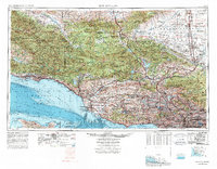 1975 Los Angeles1977 Print · USGSSouthern California is captured in a period of significant growth during the mid-seventies, showing the urban sprawl from the coast to the high desert. Researchers can trace the development of the Pacific Coast Hwy and find aerospace landmarks like Edwards Air Force Base and the Flight Test Center (NASA).2 unique versions available
 - 1978 Map of Burnt Peak
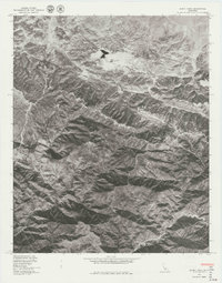 1978 Burnt Peak1978 Print · USGSCovers Lake Hughes, including Three Points, Los Angeles County, and other nearby areas
 - 1981 Map of Lancaster, 1984 Print
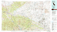 1981 Lancaster1984 Print · USGSThe high desert and mountain passes of northern Los Angeles County come alive in this early eighties survey. Researchers can trace the San Andreas Rift Zone past remote outposts like Gorman or locate the historic Golden Queen Mine near the Mojave edge.2 unique versions available
 - 1995 Map of Burnt Peak, 1999 Print
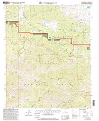 1995 Burnt Peak1999 Print · USGSThe Angeles National Forest highlands and the San Andreas Rift Zone are detailed in the mid-nineties. Researchers can locate remote mining sites like the Big Chief Mine or trace the Pacific Crest National Scenic Trail past Three Points.
 - 1995 Map of Lake Hughes, 1999 Print
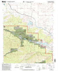 1995 Lake Hughes1999 Print · USGSThe Lake Hughes area in the mid-1990s showcases the rugged intersection of the San Andreas fault line and the high desert. Researchers can trace rural settlement patterns at Munz Ranch, the Hughes-Elizabeth Lakes School, and the waters of Elizabeth Lake.
Showing maps 1-25 of 33
Top cities near Lake Hughes
- Santa Clarita historical maps
- Palmdale historical maps
- Lancaster historical maps
- Rosamond historical maps
- Antelope Acres historical maps
- Val Verde historical maps
Frequently asked questions
- What are the different types of historical maps available for Lake Hughes?
- What is the oldest map of Lake Hughes?
- Where can I purchase historical maps of Lake Hughes for my home or office?
- Where can I download high-res historical maps of Lake Hughes?
- Are there historical topographic maps available for Lake Hughes?
- Is there historical aerial imagery available for Lake Hughes?
- Where are historical maps of Lake Hughes sourced from?