1960s Maps of Monrovia, California
Explore 6 historic maps of Monrovia from the 1960s. These maps offer a rare glimpse into what life looked like during the 1960s — showing old roads, neighborhoods, homes, and landmarks that have changed or disappeared over time.
Whether you're researching your family's past, planning a metal detecting trip, or studying how Monrovia's landscape evolved across the 1960s, these high-resolution maps are a powerful tool for exploring the history of this region.
- Focus on a specific era: All maps on this page are from the 1960s, giving you a focused view of this time period.
- See what’s changed: Compare century-old streets, trails, and buildings to today's modern landscape using overlays and satellite layers.
- Research with precision: Use these maps for genealogy, historical research, land use analysis, or educational projects.
- View, download, or print: Maps are fully viewable online in high resolution, and can be downloaded or printed for your own records.
Start exploring Monrovia's history through authentic maps from the 1960s. This is your window into the past.
Monrovia, CA maps
(6)- 1966 Map of Los Angeles
 1966 Los Angeles1966 Print · USGSSouthern California underwent a mid-century transformation as suburban grids reached the base of the San Gabriel Mountains. Researchers can trace the path of the Los Angeles Aqueduct or locate defense landmarks like Edwards Air Force Base.
 - 1966 Map of San Bernardino
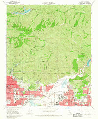
 1966 San Bernardino1966 Print · USGSThe San Bernardino Valley and Mojave Desert met during a period of massive military and suburban growth in the mid-sixties. Genealogists and historians can trace the development of Edwards Air Force Base, old desert mines like the Bagdad Chase Mine, and mountain communities near Big Bear Lake.
 - 1966 Map of Baldwin Park, 1967 Print
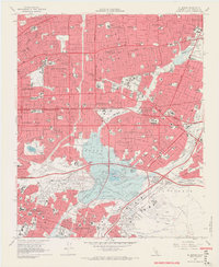
 1966 Baldwin Park1967 Print · USGSThe San Gabriel Valley is captured during its mid-century transition from industrial riverbed to suburban expanse. Researchers can trace the development of La Puente and Covina alongside specialized sites like the El Encanto Sanitarium and Oakdale Memorial Park.5 unique versions available
 - 1966 Map of Mt. Wilson, 1967 Print
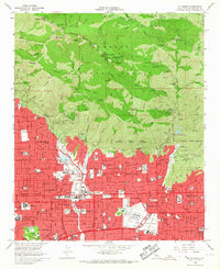 1966 Mt. Wilson1967 Print · USGSThe San Gabriel Valley and its mountain backdrop are captured in the mid-sixties during a period of significant suburban growth. Researchers can trace the layout of the Calif Institute of Technology, the historic Mt Lowe Railway path, and the landmark Mount Wilson Observatory.4 unique versions available
 - 1966 Map of El Monte, 1968 Print
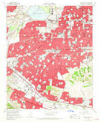
 1966 El Monte1968 Print · USGSThe San Gabriel Valley is shown here at the height of its mid-century suburban boom, before the final build-out of its freeway network. Researchers can trace the heritage of San Gabriel Mission, the grounds of Rose Hills Memorial Park, and the industrial footprint of the Montebello Oil Field.8 unique versions available
 - 1966 Map of Azusa, 1968 Print
 1966 Azusa1968 Print · USGSThe San Gabriel Valley was rapidly suburbanizing in the mid-1960s as residential tracts filled the space between old rail lines and the mountains. You can trace the growth of local institutions like Azusa Pacific College and the City of Hope National Medical Center near Irwindale.5 unique versions available
End of results
Showing maps 1-6 of 6
Top cities near Monrovia
- Los Angeles historical maps
- Glendale historical maps
- Pomona historical maps
- Pasadena historical maps
- Fullerton historical maps
- Downey historical maps
See more
Frequently asked questions
- What are the different types of historical maps available for Monrovia?
- What is the oldest map of Monrovia?
- Where can I purchase historical maps of Monrovia for my home or office?
- Where can I download high-res historical maps of Monrovia?
- Are there historical topographic maps available for Monrovia?
- Is there historical aerial imagery available for Monrovia?
- Where are historical maps of Monrovia sourced from?