2020s Maps of Pasadena, California
Explore 4 historic maps of Pasadena from the 2020s. These maps offer a rare glimpse into what life looked like during the 2020s — showing old roads, neighborhoods, homes, and landmarks that have changed or disappeared over time.
Whether you're researching your family's past, planning a metal detecting trip, or studying how Pasadena's landscape evolved across the 2020s, these high-resolution maps are a powerful tool for exploring the history of this region.
- Focus on a specific era: All maps on this page are from the 2020s, giving you a focused view of this time period.
- See what’s changed: Compare century-old streets, trails, and buildings to today's modern landscape using overlays and satellite layers.
- Research with precision: Use these maps for genealogy, historical research, land use analysis, or educational projects.
- View, download, or print: Maps are fully viewable online in high resolution, and can be downloaded or printed for your own records.
Start exploring Pasadena's history through authentic maps from the 2020s. This is your window into the past.
Pasadena, CA maps
(4)- 2022 Map of Los Angeles, 2022 Print
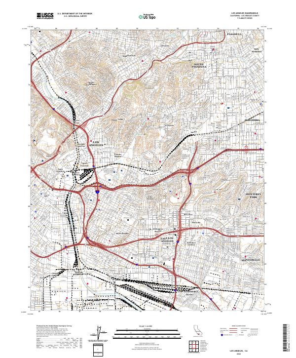 2022 Los Angeles2022 Print · USGSLos Angeles and its eastern neighborhoods appear at the start of the 2020s, showing a dense network of modern freeways and historic districts. Trace local landmarks from Chavez Ravine to the sprawling grounds of Calvary Cem and East Los Angeles College.
 - 2022 Map of Pasadena, 2022 Print
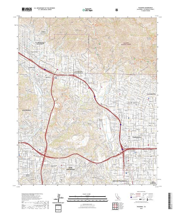 2022 Pasadena2022 Print · USGSGreater Los Angeles is seen here in the early 2020s, showing the dense suburban development meeting the steep slopes of the San Gabriel range. Researchers can locate established landmarks like the Dawn Mine, Occidental College, and the Mountain View Cem and Mausoleum.
 - 2022 Map of Mount Wilson, 2022 Print
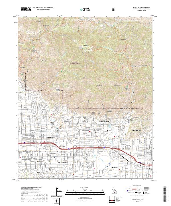 2022 Mount Wilson2022 Print · USGSThe foothills of the San Gabriel Mountains meet the San Gabriel Valley in the early 2020s, showcasing the high-density suburbs of Pasadena and Monrovia. Researchers can trace historic trails near Echo Mtn, find the Sierra Madre Pioneer Cem, or locate landmarks like Baldwin Lake.
 - 2022 Map of Condor Peak, 2022 Print
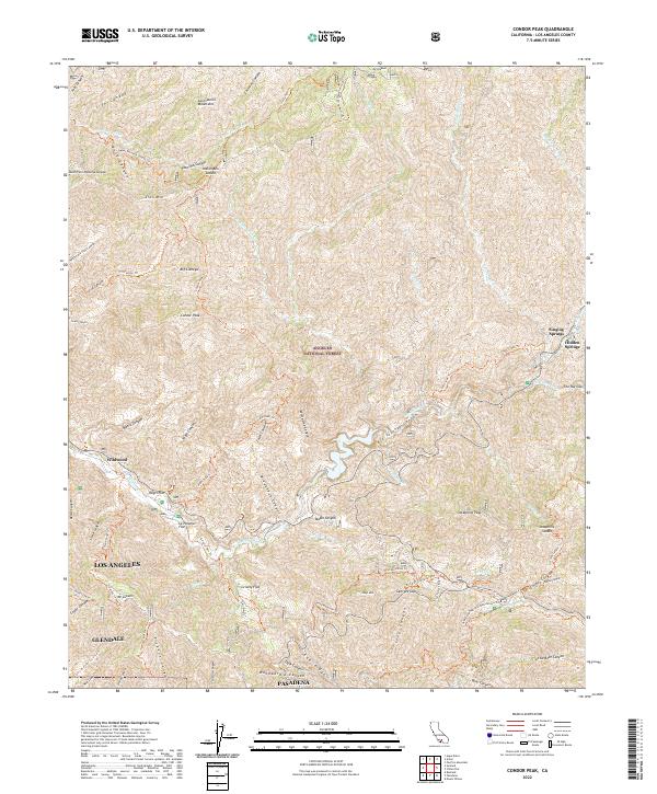 2022 Condor Peak2022 Print · USGSThe high peaks and deep canyons of the San Gabriel Mountains rise above the Los Angeles basin in this modern survey of the National Forest. Hikers and historians can trace the paths of the Gabrielino National Recreation Trl and locate mountain enclaves like Vogel Flat or Singing Springs.
End of results
Showing maps 1-4 of 4
Top cities near Pasadena
- Los Angeles historical maps
- Glendale historical maps
- Inglewood historical maps
- Downey historical maps
- El Monte historical maps
- West Covina historical maps
See more
Top neighborhoods of Pasadena
- Science Village historical maps
- Linda Vista historical maps
- Old Pasadena historical maps
- Lamanda Park historical maps
- Madison Heights historical maps
- Bungalow Heaven historical maps
See more
Frequently asked questions
- What are the different types of historical maps available for Pasadena?
- What is the oldest map of Pasadena?
- Where can I purchase historical maps of Pasadena for my home or office?
- Where can I download high-res historical maps of Pasadena?
- Are there historical topographic maps available for Pasadena?
- Is there historical aerial imagery available for Pasadena?
- Where are historical maps of Pasadena sourced from?