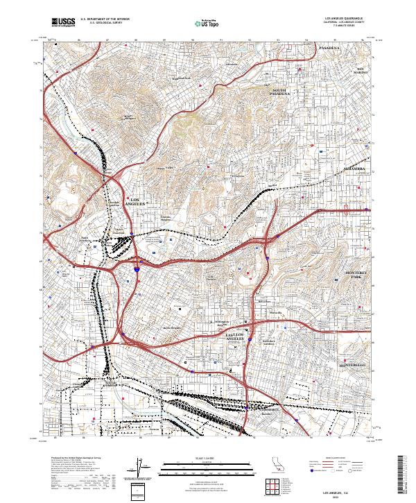
2022 Map of Los Angeles
USGS Topo · Published 2022About this map
Arroyo Seco carves through the northern hills of this urban landscape, marking the transition between Mount Washington and the neighborhoods of Garvanza and Highland Park. This modern study illustrates the dense convergence of major transit corridors where the Pasadena Fwy, Golden State Fwy, and San Bernardino Fwy meet near the historic core of Los Angeles. The map provides a detailed view of the extensive institutional and cemetery districts in the east, including the massive Calvary Cem and the adjacent Home of Peace Memorial Park.
Find a feature on this map
78 named features on this map. Tap any name to fly to it.
Don’t see what you’re looking for? This feature index may not catch every label — zoom into the map to look around manually.
Map Details
Editions of this 2022 Los Angeles Map
This is the sole edition of this map. No revisions or reprints were ever made.
Other maps of this area

1894 · Los Angeles
USGS Topo · 1:62,500

1896 · Pasadena
USGS Topo · 1:62,500

1896 · Redondo
USGS Topo · 1:62,500

1896 · Santa Monica
USGS Topo · 1:62,500

1896 · Downey
USGS Topo · 1:62,500

1898 · Santa Monica
USGS Topo · 1:62,500

1899 · Downey
USGS Topo · 1:62,500

1900 · Pasadena
USGS Topo · 1:62,500

1900 · Los Angeles
USGS Topo · 1:62,500

1901 · Southern California Sheet No. 1
USGS Topo · 1:250,000