Old Maps of Santa Clarita, California for Metal Detecting
Plan your next treasure hunt with 55 historic maps of Santa Clarita. Find old homesites, ghost towns, trails, and gathering spots that may be lost to time — perfect for identifying promising metal detecting locations.
- Locate forgotten sites: Uncover places like long-lost settlements, abandoned rail lines, or gathering spots.
- Plan better hunts: Use map overlays combined with LiDAR or satellite views to narrow in on historically rich areas.
- Made for detectorists: Thousands of hobbyists use these maps to discover relics, coins, and hidden history.
Use these historic maps to boost your research and find new opportunities beneath the surface of Santa Clarita.
Santa Clarita, CA maps
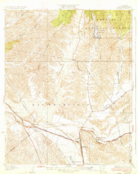
(55)- 1900 Map of Fernando
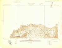
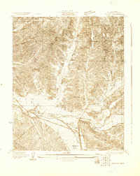
 1900 Fernando1900 Print · USGSThe San Fernando Valley and San Gabriel mountains appear here in the final years of the nineteenth century, showing the early town site of Fernando and the San Fernando Mission. Genealogists and historians can trace the Southern Pacific RR through Soledad Canyon or locate early settlements like Lang and Honby.6 unique versions available
 - 1901 Map of Southern California Sheet No. 1
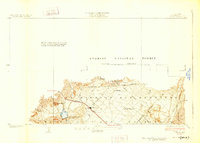
 1901 Southern California Sheet No. 11901 Print · USGSGreater Los Angeles at the dawn of the twentieth century is a landscape of growing citrus towns and a burgeoning rail network. Genealogists and historians can trace the early gridded streets of Hollywood and Pasadena or locate landmarks like Bear Lake and the Cahuilla Indian Reservation.6 unique versions available
 - 1903 Map of Camulos
 1903 Camulos1903 Print · USGSSouthern California at the dawn of the twentieth century shows a landscape of ranchos and early rail towns. Trace the old routes through Simi and Camulos, or locate vanished stops like Ternez Siding and the coastal piers at Port Los Angeles.5 unique versions available
 - 1903 Map of Santa Susana
 1903 Santa Susana1903 Print · USGSNorthern Los Angeles and Ventura counties are captured here at the start of the twentieth century, as the railroad transformed the frontier. Trace early rail hubs at Newhall and Saugus, and find the engineering feats of the Santa Susana Tunnel and Fernando Tunnel.8 unique versions available
 - 1904 Map of Southern California Sheet No. 1, 1905 Print
 1904 Southern California Sheet No. 11905 Print · USGSSouthern California at the dawn of the twentieth century shows a landscape of citrus groves and coastal towns connected by rail. Genealogists and historians can trace early settlements like San Juan Capistrano, find remote sites like the Rose Mine, and study the original water systems of the Santa Ana River.2 unique versions available
 - 1925 Map of Sylmar
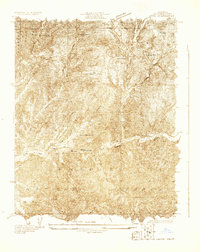
 1925 Sylmar1925 Print · USGSThe northern San Fernando Valley is captured here in the mid-twenties, showing a landscape of emerging infrastructure and public institutions. Trace early water and power networks at the Upper San Fernando Reservoir or locate local landmarks like the El Retiro School for Girls and Sylmar.
 - 1928 Map of Sylmar
 1928 Sylmar1928 Print · USGSThe northern reaches of Los Angeles are seen here in the late 1920s, still bounded by the old lines of the Ex Mission San Fernando. Genealogists and historians can trace institutional sites like the Olive View Sanatorium and the San Fernando Cemetery along the Southern Pacific rail line.
 - 1929 Map of Sylmar
 1929 Sylmar1929 Print · USGSThe foothills of the San Gabriel Mountains are captured here in the late 1920s, showing a landscape defined by forest terrain and early public health infrastructure. Researchers can locate specialized sites like the Olive View Sanatorium and trace the paths of the early Aqueduct and Transmission Line.
 - 1929 Map of Newhall
 1929 Newhall1929 Print · USGSNorthern Los Angeles during the late 1920s shows a landscape of deep canyons and the historic Ex Mission San Fernando boundary. Genealogists and hikers can trace old routes through San Fernando Pass and along Placerita Creek.
 - 1929 Map of Saugus
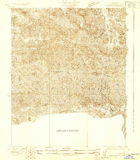
 1929 Saugus1929 Print · USGSThe Santa Clarita Valley was a vital rail and aviation crossroads in the late 1920s as the suburbs began to push north. Researchers can trace the early Southern Pacific rail stops at Saugus and Pardee or locate the early Department of Commerce Field.
 - 1929 Map of Lang
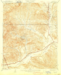
 1929 Lang1929 Print · USGSThe Soledad Canyon corridor comes to life in the late 1920s as a hub of mining and ranching. Researchers can trace the Southern Pacific line past Lang to find the Borax Mine, Soledad Sulphur Springs, and Vasquez Rock.
 - 1931 Map of Castaic
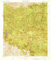
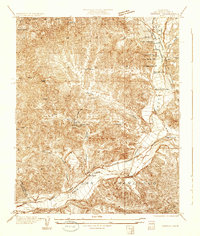 1931 Castaic1931 Print · USGSCastaic and the Santa Clara River valley appear here in the early 1930s, caught between the era of ranching and the rise of the oil industry. Researchers can find family landmarks like Sloane Ranch and the Val Verde Lodge, or trace the old U S Highway No 99.
 - 1932 Map of Humphreys
 1932 Humphreys1932 Print · USGSCanyon country north of Los Angeles comes into focus in the early 1930s as the Sierra Highway and Southern Pacific drive development. Researchers can trace the layout of rural crossroads like Solamint and locate early landmarks such as New Era Sch and Honby Sch.3 unique versions available
 - 1933 Map of Saugus
 1933 Saugus1933 Print · USGSThe Santa Clarita Valley area appears here during the early automotive era, showing the intersection of vital rail lines and mountain highways. Genealogists and historians can trace Saugus and Baker Ranch alongside early aviation landmarks like the Dept. of Commerce Landing Field.4 unique versions available
 - 1933 Map of Newhall
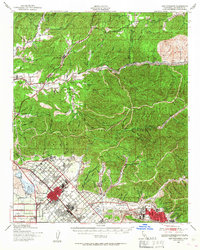
 1933 Newhall1933 Print · USGSNewhall and the northern Santa Susana Mountains are shown in the early thirties as vital transit corridors for rail and road. Researchers can trace the path of the Southern Pacific through the Tunnel or locate the Dept of Commerce Landing Field.4 unique versions available
 - 1933 Map of Lang
 1933 Lang1933 Print · USGSUpper Los Angeles County in the early thirties centers on the vital rail and road corridors through the Santa Clarita Valley. Genealogists and historians can trace the footprint of early mountain life at Sunny Slope Ranch, the rail stop at Lang, and the Champion Mine.3 unique versions available
 - 1934 Map of Little Tujunga
 1934 Little Tujunga1934 Print · USGSThe San Gabriel canyons come alive in the 1930s, showing a rugged landscape of high-altitude sanatoriums and family ranches. Trace the locations of De Mille Ranch, the Acme Mine, and the sprawling grounds of the Fairview Sanatorium.
 - 1935 Map of Sylmar
 1935 Sylmar1935 Print · USGSThe San Fernando Valley meets the mountains in the 1930s as the suburbs began to climb into the foothills. Genealogists and historians can trace the early streets of Sylmar, the grounds of the El Retiro School for Girls, and the sprawling Ex Mission San Fernando lands.3 unique versions available
 - 1939 Map of Little Tujunga
 1939 Little Tujunga1939 Print · USGSLos Angeles County's front range was a landscape of remote ranches and fire lookouts in the late 1930s. Researchers can locate canyon homesteads such as De Mille Ranch and Watts Ranch, or trace early health retreats like Fairview Sanatorium.3 unique versions available
 - 1940 Map of Castaic
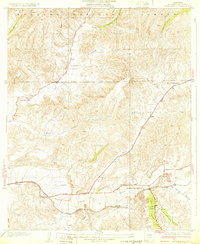
 1940 Castaic1940 Print · USGSNorth of Los Angeles in the 1940s, the canyons around the Santa Clara River supported a network of isolated waystations and small schools. Genealogists can trace family footprints at Liveoak Sch, Valverde Lodge, or the agricultural Wayside Farm No 1.3 unique versions available
 - 1940 Map of San Fernando, 1955 Print
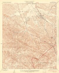
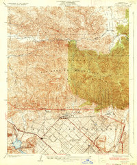
 1940 San Fernando1955 Print · USGSThe northern Los Angeles basin is shown here just before the postwar housing boom, as the valley floor transitioned from rural estates to suburban centers. Genealogists can trace family footprints near the San Fernando Mission or follow the rail lines through Solemint and Sylmar.2 unique versions available
 - 1941 Map of Santa Susana, 1964 Print
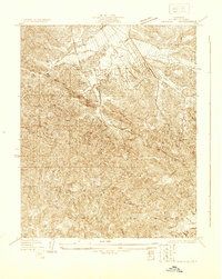
 1941 Santa Susana1964 Print · USGSVentura and Los Angeles counties meet in this 1940s landscape of steep canyons and early oil development. Researchers can trace the ranching history of Brandeis Ranch and Iverson Ranch or locate industrial sites like the Newhall-Potrero Oil Field.2 unique versions available
 - 1943 Map of Santa Susana
 1943 Santa Susana1943 Print · USGSSouthern California ranching and oil industries intersect in the early 1940s along the Santa Susana Mountains. Trace historic boundaries and sites like Tapo Ranch, the Newhall-Potrero Oil Field, and the Southern Pacific rail line.
 - 1945 Map of San Fernando
 1945 San Fernando1945 Print · USGSThe northern reaches of Los Angeles County appear in the mid-1940s, just as suburban growth began to meet the steep canyon walls. Researchers can trace the path of the Southern Pacific through the mountain passes or locate landmarks like the San Fernando Mission and Sunland.
 - 1949 Map of Los Angeles
 1949 Los Angeles1949 Print · USGSSouthern California and the South Coast appear at the onset of the post-war boom, from the Channel Islands to the Mojave Desert. Trace early aviation sites like Lockheed Air Terminal and mining history at the Redrock Quicksilver Mine and Redrover Mine.2 unique versions available
Showing maps 1-25 of 55
Top cities near Santa Clarita
- Los Angeles historical maps
- Glendale historical maps
- Palmdale historical maps
- Lancaster historical maps
- Simi Valley historical maps
- Burbank historical maps
See more
Top neighborhoods of Santa Clarita
- Pardee historical maps
- Humphreys historical maps
- Bouquet Junction historical maps
- Rancho Santa Clarita historical maps
- Waltz historical maps
- Elayon historical maps
See more
Frequently asked questions
- What are the different types of historical maps available for Santa Clarita?
- What is the oldest map of Santa Clarita?
- Where can I purchase historical maps of Santa Clarita for my home or office?
- Where can I download high-res historical maps of Santa Clarita?
- Are there historical topographic maps available for Santa Clarita?
- Is there historical aerial imagery available for Santa Clarita?
- Where are historical maps of Santa Clarita sourced from?