2020s Maps of Santa Clarita, California
Explore 4 historic maps of Santa Clarita from the 2020s. These maps offer a rare glimpse into what life looked like during the 2020s — showing old roads, neighborhoods, homes, and landmarks that have changed or disappeared over time.
Whether you're researching your family's past, planning a metal detecting trip, or studying how Santa Clarita's landscape evolved across the 2020s, these high-resolution maps are a powerful tool for exploring the history of this region.
- Focus on a specific era: All maps on this page are from the 2020s, giving you a focused view of this time period.
- See what’s changed: Compare century-old streets, trails, and buildings to today's modern landscape using overlays and satellite layers.
- Research with precision: Use these maps for genealogy, historical research, land use analysis, or educational projects.
- View, download, or print: Maps are fully viewable online in high resolution, and can be downloaded or printed for your own records.
Start exploring Santa Clarita's history through authentic maps from the 2020s. This is your window into the past.
Santa Clarita, CA maps
(4)- 2022 Map of Newhall, 2022 Print
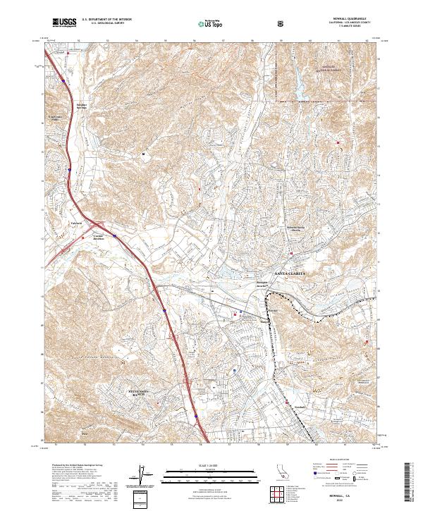 2022 Newhall2022 Print · USGSSanta Clarita and the Santa Clara River valley appear in this recent survey during a period of significant suburban development. Researchers can trace the modern layout of Stevenson Ranch and Valencia or locate landmarks like the California Institute of the Arts.
 - 2022 Map of Mint Canyon, 2022 Print
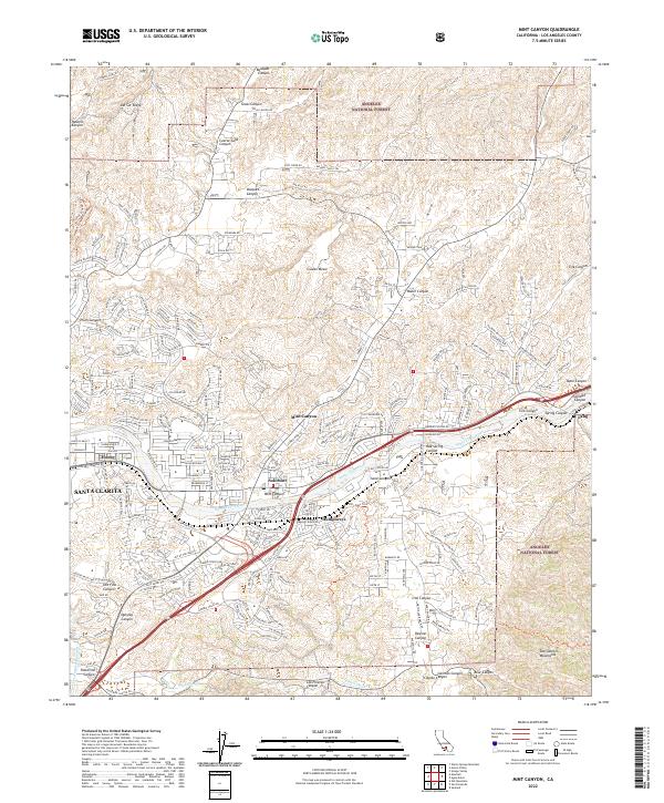 2022 Mint Canyon2022 Print · USGSThe northern Santa Clarita Valley is shown here in the early 2020s as residential growth climbs into the San Gabriel foothills. Trace the development of Solemint, follow the Metrolink corridor to Lang, and locate the path of the Los Angeles Aqueduct.
 - 2022 Map of Oat Mountain, 2022 Print
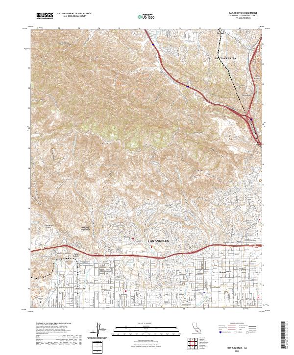 2022 Oat Mountain2022 Print · USGSNorthern Los Angeles and the Santa Susana Mountains are captured here in 2022 during a period of continued suburban expansion. Researchers can trace infrastructure and landmarks from the Los Angeles Aqueduct to the distinctive Stony Point and Garden of the Gods.
 - 2022 Map of San Fernando, 2022 Print
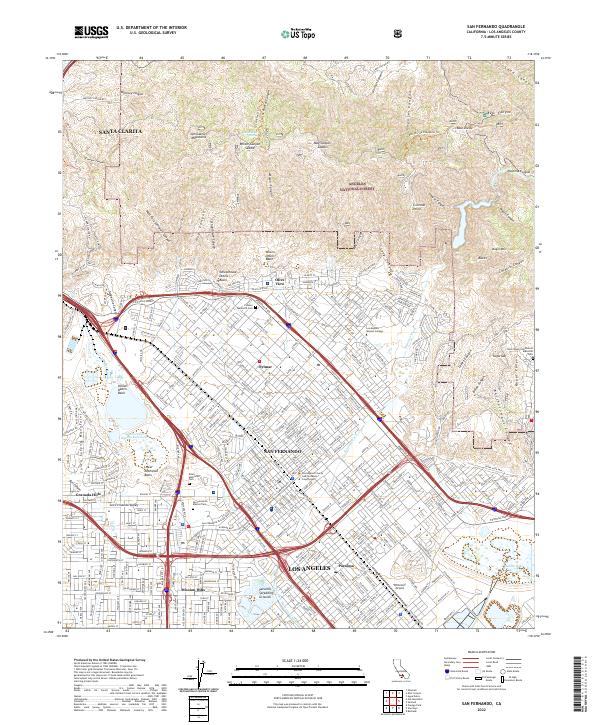 2022 San Fernando2022 Print · USGSThe northern San Fernando Valley is documented here just as modern infrastructure and mountain wilderness intersect. Researchers can trace local history through the San Fernando Mission Cem, identify landmarks like Whiteman Airport, or explore the canyons of the Angeles National Forest.
End of results
Showing maps 1-4 of 4
Top cities near Santa Clarita
- Los Angeles historical maps
- Glendale historical maps
- Palmdale historical maps
- Lancaster historical maps
- Simi Valley historical maps
- Burbank historical maps
See more
Top neighborhoods of Santa Clarita
- Pardee historical maps
- Humphreys historical maps
- Bouquet Junction historical maps
- Rancho Santa Clarita historical maps
- Waltz historical maps
- Elayon historical maps
See more
Frequently asked questions
- What are the different types of historical maps available for Santa Clarita?
- What is the oldest map of Santa Clarita?
- Where can I purchase historical maps of Santa Clarita for my home or office?
- Where can I download high-res historical maps of Santa Clarita?
- Are there historical topographic maps available for Santa Clarita?
- Is there historical aerial imagery available for Santa Clarita?
- Where are historical maps of Santa Clarita sourced from?