1900s (20th Century) Maps of Jerseydale, California
Explore 12 historic maps of Jerseydale from the 1900s (20th Century). These maps offer a rare glimpse into what life looked like during the 1900s — showing old roads, neighborhoods, homes, and landmarks that have changed or disappeared over time.
Whether you're researching your family's past, planning a metal detecting trip, or studying how Jerseydale's landscape evolved across the 1900s, these high-resolution maps are a powerful tool for exploring the history of this region.
- Focus on a specific era: All maps on this page are from the 1900s, giving you a focused view of this time period.
- See what’s changed: Compare century-old streets, trails, and buildings to today's modern landscape using overlays and satellite layers.
- Research with precision: Use these maps for genealogy, historical research, land use analysis, or educational projects.
- View, download, or print: Maps are fully viewable online in high resolution, and can be downloaded or printed for your own records.
Start exploring Jerseydale's history through authentic maps from the 1900s. This is your window into the past.
Jerseydale, CA maps
(12)- 1900 Map of Yosemite
 1900 Yosemite1900 Print · USGSThe central Sierra Nevada appears here in the late nineteenth century, prior to the major damming projects that reshaped the river valleys. Genealogists and historians can trace pioneer outposts like Harden Ranch and Hite Cove, or the early tourism hub at Yosemite.
 - 1903 Map of Yosemite
 1903 Yosemite1903 Print · USGSThe High Sierra and foothills of Mariposa County appear here in the early 1900s, documenting the early ranching and travel networks of the region. Local historians and genealogists can trace family holdings at Harden Ranch, the mining hub of Hite Cove, and the isolated Stage Station.2 unique versions available
 - 1909 Map of Yosemite
 1909 Yosemite1909 Print · USGSMariposa and Tuolumne counties are shown here at the turn of the century, prior to the damming of the Tuolumne River. Researchers can trace early ranching and mining sites like Hog Ranch, Hite Cove, and the historic Stage Station.7 unique versions available
 - 1947 Map of Mariposa, 1948 Print
 1947 Mariposa1948 Print · USGSThe High Sierra and Owens Valley transition is captured here in the late 1940s, just as the region’s hydroelectric and tourism infrastructure was maturing. Genealogists and historians can trace old ranger stations, the Casa Diablo Mine, and rail stops along the Southern Pacific like Benton Station and Zurich.2 unique versions available
 - 1947 Map of El Portal, 1953 Print
 1947 El Portal1953 Print · USGSMariposa County in the late 1940s serves as the rugged threshold to Yosemite, defined by deep river canyons and early forest service outposts. Genealogists and historians can trace the foundations of mountain life at the Colorado Sch, Buffalo Mine, and the McCauley Ranch (Old Stage Sta).4 unique versions available
 - 1947 Map of Buckingham Mtn, 1964 Print
 1947 Buckingham Mtn1964 Print · USGSMariposa County settlement and industry are captured here in the late 1940s as mountain communities like Jerseydale thrived. Trace the legacy of timber and gold through sites like the Buckingham Mtn Sch, Early Mine, and several local sawmills.5 unique versions available
 - 1948 Map of Mariposa, 1951 Print
 1948 Mariposa1951 Print · USGSThe High Sierra and Mariposa foothills are shown here in the late 1940s as the post-war tourism and water infrastructure expanded. Genealogists and historians can locate vanished waypoints like Mormon Bar, the Glacier Point Hotel, and the granite quarries of Knowles.
 - 1949 Map of Buckingham Mtn
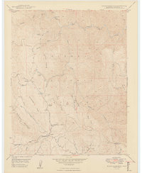 1949 Buckingham Mtn1949 Print · USGSMariposa County timber and mining lands are recorded here just after the war, showing the mountain communities and industrial outposts of the Sierra foothills. Researchers can locate the Buckingham Mtn Sch, the settlement of Jerseydale, and several working Sawmill sites.2 unique versions available
 - 1957 Map of Mariposa, 1966 Print
 1957 Mariposa1966 Print · USGSThe High Sierra and Owens Valley appear in the mid-fifties, showing the intersection of conservation, hydroelectric power, and mountain industry. Genealogists and researchers can trace local landmarks like Yosemite Cemetery, the remote Kinsley Station, and the Pine Creek Mine.4 unique versions available
 - 1963 Map of Mariposa
 1963 Mariposa1963 Print · USGSThe High Sierra and Owens Valley meet in the early sixties, showing a landscape defined by gold-rush history and massive post-war water projects. Genealogists and researchers can trace old mining routes near Mariposa, locate the Glacier Point Hotel, and find small settlements like Coarse Gold or Knowles Junction.
 - 1976 Map of Yosemite Valley, 1994 Print
 1976 Yosemite Valley1994 Print · USGSThe High Sierra and the iconic Yosemite Valley are captured here during the 1970s, showing the primary road networks and backcountry trails of the day. Researchers can trace the layout of Yosemite Village or locate historic mining sites like Schroeder Mine and Buffalo Mine.2 unique versions available
 - 1992 Map of Buckingham Mtn, 1995 Print
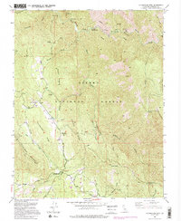 1992 Buckingham Mtn1995 Print · USGSMariposa County in the early 1990s reflects a landscape of remote ridges and mining history within the Sierra National Forest. Genealogists and historians can trace the foundations of local life at Jerseydale, the Buckingham Mtn Sch, and the Early Mine.2 unique versions available
End of results
Showing maps 1-12 of 12
Frequently asked questions
- What are the different types of historical maps available for Jerseydale?
- What is the oldest map of Jerseydale?
- Where can I purchase historical maps of Jerseydale for my home or office?
- Where can I download high-res historical maps of Jerseydale?
- Are there historical topographic maps available for Jerseydale?
- Is there historical aerial imagery available for Jerseydale?
- Where are historical maps of Jerseydale sourced from?