Old Maps of King City, California for Academic Research
Study the evolution of King City with 21 high-resolution historic maps. Whether you're teaching, researching, or modeling changes in land use, these maps provide essential visual documentation of urban, environmental, and geographic change.
- Analyze long-term change: Track patterns in development, transportation, and natural features.
- Ideal for environmental or urban studies: Support academic projects with primary historical map data.
- Use in the classroom or lab: Educators and researchers rely on these maps to bring historical context to life.
These maps are a powerful tool for teaching, research, and visualizing how King City has changed over the decades.
King City, CA maps
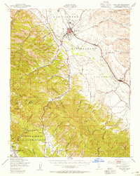
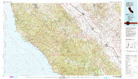
(21)- 1919 Map of King City
 1919 King City1919 Print · USGSMonterey County's Salinas Valley is captured here just after the Great War, showing the agricultural corridor's reliance on the river and rail. Trace family roots at the Oasis School and Argyle School, or locate the historic San Antonio Mission.4 unique versions available
 - 1939 Map of King City
 1939 King City1939 Print · USGSThe Salinas Valley and surrounding Santa Lucia Range come alive in the late 1930s as a landscape of cattle ranchos and military growth. Genealogists can trace family landmarks like Sweetwater School or locate the San Antonio Mission within the Hunter Liggett Military Reservation.
 - 1948 Map of Santa Cruz
 1948 Santa Cruz1948 Print · USGSThe Central Coast and San Joaquin Valley meet in this mid-century look at the region's agricultural and military geography. Genealogists and historians can trace the paths of El Camino Real, locate family farms near Hollister, or study the footprint of the Fort Ord Military Reservation.2 unique versions available
 - 1948 Map of King City, 1955 Print
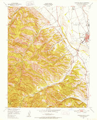
 1948 King City1955 Print · USGSThe Salinas River valley and the rugged southern Coast Ranges are captured here in the late 1940s during a period of significant military and agricultural activity. Genealogists and historians can trace old homesteads near Argyle, the historic San Antonio Mission, and the early layout of King City.2 unique versions available
 - 1949 Map of San Lucas
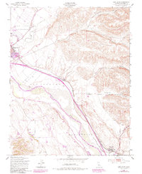 1949 San Lucas1949 Print · USGSThe Salinas Valley thrives as a rail and ranching hub in the late 1940s, anchored by the growth of the Southern Pacific line. Researchers can trace the layout of King City, locate the Mesa Del Rey Airport, and find smaller stops like Welby and San Lucas.5 unique versions available
 - 1949 Map of Thompson Canyon, 1952 Print
 1949 Thompson Canyon1952 Print · USGSThe Salinas Valley transitions from fertile river plains to deep canyons in this late 1940s survey. Researchers can trace the mid-century growth of King City along the Southern Pacific line and locate the Cem and Ruins near the canyon floors.4 unique versions available
 - 1955 Map of Santa Cruz
 1955 Santa Cruz1955 Print · USGSCoastal Monterey Bay and the fertile Salinas Valley are captured here during the post-war expansion of the mid-fifties. Researchers can trace the era's rail-and-road network via the Southern Pacific lines and find landmarks like Fort Ord or the Lonoak School.
 - 1957 Map of Santa Cruz
 1957 Santa Cruz1957 Print · USGSCentral California comes into sharp focus during the late fifties, from the fog-swept Monterey Bay to the sun-drenched San Joaquin Valley. Genealogists and historians can trace the mid-century footprints of Fort Ord Military Reservation, the Southern Pacific line, and the historic streets of San Juan Bautista.
 - 1958 Map of Santa Cruz
 1958 Santa Cruz1958 Print · USGSCoastal California and the central valleys are shown during the mid-fifties, capturing a landscape of massive military reserves and vital rail arteries. Genealogists and historians can trace the Southern Pacific line through Salinas or explore the early footprints of the Fort Ord Military Reservation and San Juan Bautista.2 unique versions available
 - 1961 Map of King City, 1968 Print
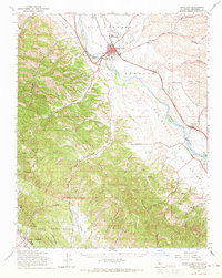 1961 King City1968 Print · USGSThe Salinas River valley in the early 1960s shows a landscape of rail-connected agriculture and expanding military installations. Genealogists and historians can trace the Southern Pacific line through King City down to San Lucas, or locate family landmarks in Quinado Canyon and the Hunter Liggett Military Reservation.
 - 1965 Map of Santa Cruz, 1968 Print
 1965 Santa Cruz1968 Print · USGSThe Central Coast and San Joaquin Valley meet here during the mid-sixties, capturing the growth of agricultural and coastal hubs. Trace the historic Southern Pacific RR lines and locate sites like the Presidio of Monterey or Pinnacles National Monument.
 - 1974 Map of Monterey, 1977 Print
 1974 Monterey1977 Print · USGSThe Central Coast and San Joaquin Valley meet in this mid-seventies survey of the Monterey region. Genealogists and historians can locate Spanish-era sites like the San Antonio de Padua Mission, early industrial markers such as the New Idria Mine, and coastal landmarks like the Point Sur Lighthouse.
 - 1982 Map of Point Sur, 1980 Print
 1982 Point Sur1980 Print · USGSCoastal mountains and fertile valleys meet in the early eighties as the Southern Pacific railroad links Monterey County's growing agricultural towns. Trace remote landmarks like Tassajara Hot Springs, the Soledad State Prison, and the sprawling Fort Hunter Liggett Military Reservation.3 unique versions available
 - 2012 Map of San Lucas, 2012 Print
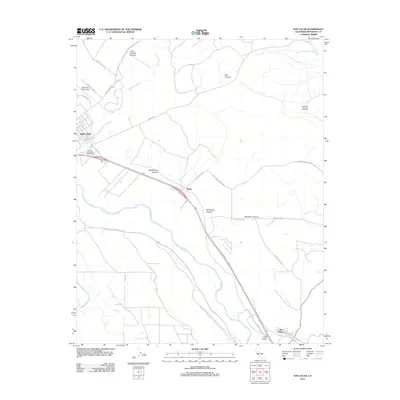 2012 San Lucas2012 Print · USGSCovers King City, including Welby, San Lucas, and other nearby areas
 - 2012 Map of Thompson Canyon, 2012 Print
 2012 Thompson Canyon2012 Print · USGSCovers King City, including Pine Canyon, Monterey County, and other nearby areas
 - 2015 Map of Thompson Canyon, 2015 Print
 2015 Thompson Canyon2015 Print · USGSCovers King City, including Pine Canyon, Monterey County, and other nearby areas
 - 2015 Map of San Lucas, 2015 Print
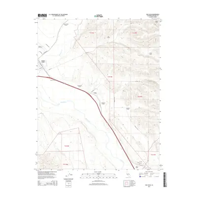 2015 San Lucas2015 Print · USGSCovers King City, including Welby, San Lucas, and other nearby areas
 - 2018 Map of San Lucas, 2018 Print
 2018 San Lucas2018 Print · USGSCovers King City, including Welby, San Lucas, and other nearby areas
 - 2018 Map of Thompson Canyon, 2018 Print
 2018 Thompson Canyon2018 Print · USGSCovers King City, including Pine Canyon, Monterey County, and other nearby areas
 - 2021 Map of San Lucas, 2021 Print
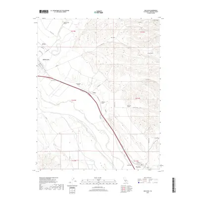
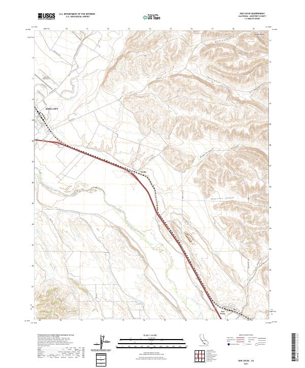 2021 San Lucas2021 Print · USGSThe Salinas Valley comes into focus in this contemporary survey, capturing the agricultural and transit artery of Monterey County. Genealogists and local historians can trace property lines and roads from the streets of King City to the quiet blocks of San Lucas and the airfield at Mesa Del Rey Airport.
 - 2021 Map of Thompson Canyon, 2021 Print
 2021 Thompson Canyon2021 Print · USGSThe Salinas Valley meets the foothills of the Santa Lucia Range during this recent era of Monterey County history. Genealogists and researchers can trace the growth of King City and Pine Canyon, alongside landmarks like King City Cem and Mesa Del Rey Airport.
End of results
Showing maps 1-21 of 21
Top cities near King City
Frequently asked questions
- What are the different types of historical maps available for King City?
- What is the oldest map of King City?
- Where can I purchase historical maps of King City for my home or office?
- Where can I download high-res historical maps of King City?
- Are there historical topographic maps available for King City?
- Is there historical aerial imagery available for King City?
- Where are historical maps of King City sourced from?