Old Maps of Laguna Beach, California for Academic Research
Study the evolution of Laguna Beach with 43 high-resolution historic maps. Whether you're teaching, researching, or modeling changes in land use, these maps provide essential visual documentation of urban, environmental, and geographic change.
- Analyze long-term change: Track patterns in development, transportation, and natural features.
- Ideal for environmental or urban studies: Support academic projects with primary historical map data.
- Use in the classroom or lab: Educators and researchers rely on these maps to bring historical context to life.
These maps are a powerful tool for teaching, research, and visualizing how Laguna Beach has changed over the decades.
Laguna Beach, CA maps
(43)- 1896 Map of Santa Ana
 1896 Santa Ana1896 Print · USGSOrange County was still a land of vast ranchos and emerging citrus towns in the 1890s, well before the post-war suburban boom. You can trace early rail lines like the SANTA ANA AND NEWPORT R. R. and locate vanished coastal landmarks near Arch Beach and Newport Bay.2 unique versions available
 - 1901 Map of Southern California Sheet No. 1
 1901 Southern California Sheet No. 11901 Print · USGSGreater Los Angeles at the dawn of the twentieth century is a landscape of growing citrus towns and a burgeoning rail network. Genealogists and historians can trace the early gridded streets of Hollywood and Pasadena or locate landmarks like Bear Lake and the Cahuilla Indian Reservation.6 unique versions available
 - 1901 Map of Santa Ana
 1901 Santa Ana1901 Print · USGSThe Orange County coast and plains appear here at the dawn of the twentieth century, during a period of agricultural and rail expansion. Genealogists can trace early homesteads near Fairview or locate early rail stops at Smeltzer and Wintersburg.6 unique versions available
 - 1902 Map of Capistrano
 1902 Capistrano1902 Print · USGSThe Orange County coast and its expansive ranchos are captured here just before the twentieth century's rapid changes. Researchers can trace the early Southern California rail line past Capistrano and explore old canyon routes like Cristianitos.4 unique versions available
 - 1902 Map of Corona
 1902 Corona1902 Print · USGSThe Orange County and Riverside borderlands at the start of the 1900s show an era of rapid rail expansion and water engineering. Researchers can trace the early footprints of Anaheim and Orange or find vanished industry at the Santiago Coal Mine.7 unique versions available
 - 1904 Map of Southern California Sheet No. 2
 1904 Southern California Sheet No. 21904 Print · USGSSouthern California during the early 1900s shows the transition from vast ranchos to coastal rail towns. Genealogists and researchers can trace the Southern California R.R. through Oceanside, explore old land grants like Mission Viejo, and locate early settlements from Fallbrook to Julian.5 unique versions available
 - 1904 Map of Southern California Sheet No. 1, 1905 Print
 1904 Southern California Sheet No. 11905 Print · USGSSouthern California at the dawn of the twentieth century shows a landscape of citrus groves and coastal towns connected by rail. Genealogists and historians can trace early settlements like San Juan Capistrano, find remote sites like the Rose Mine, and study the original water systems of the Santa Ana River.2 unique versions available
 - 1906 Map of Capistrano, 1921 Print
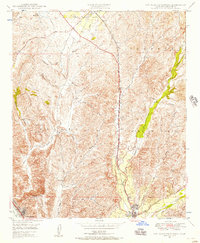
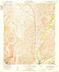
 1906 Capistrano1921 Print · USGSThe Orange and San Diego county borderlands appear here just before the turn of the century, when large land grants still defined the coast. You can trace the Southern California railroad line through San Juan down to the remote shores of San Onofre.
 - 1942 Map of San Juan Capistrano
 1942 San Juan Capistrano1942 Print · USGSCoastal Orange and San Diego counties are captured here in the early 1940s as the classic California beach towns began to take shape. Genealogists and local historians can trace early settlements and transit hubs from San Juan Capistrano to the Villa Auto Camp and the CCC Camp near San Clemente.
 - 1942 Map of Santa Ana
 1942 Santa Ana1942 Print · USGSOrange County was still a landscape of coastal towns and sprawling citrus groves during the early years of the war. Genealogists and researchers can trace the early footprints of Costa Mesa, the rail-side industry of Sugar, and the distinct shorelines of Newport Bay.2 unique versions available
 - 1942 Map of Santiago Peak, 1943 Print
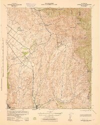 1942 Santiago Peak1943 Print · USGSOrange County and the inland canyons appear here in the early 1940s, showing a landscape of small settlements and rugged mountain reaches. Genealogists and local historians can trace early holdings near San Juan Capistrano, the station at El Toro, and mountain landmarks like Modjeska.3 unique versions available
 - 1947 Map of Santa Ana, 1949 Print
 1947 Santa Ana1949 Print · USGSSouthern California is depicted here in the late forties, showing the expansion of the Inland Empire and the Orange County coast. Researchers can trace the early layout of Palm Springs or locate long-standing tribal lands like the Pala Indian Reservation and Rincon Indian Res.
 - 1948 Map of Laguna Beach, 1957 Print
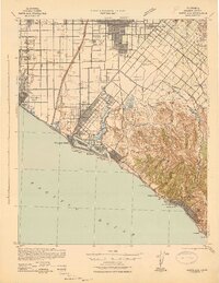
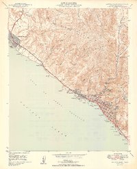
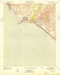
 1948 Laguna Beach1957 Print · USGSPost-war Orange County comes to life as Laguna Beach and Corona del Mar begin their modern growth along the Pacific. Researchers can trace the development of coastal coves and interior landmarks like Top of the World, Crystal Cove, and Canyon Acres.2 unique versions available
 - 1948 Map of San Juan Capistrano, 1957 Print
 1948 San Juan Capistrano1957 Print · USGSSouthern Orange County appears in the late 1940s as a land of expansive ranching grants and quiet valley settlements. You can trace the historic Mission at San Juan Capistrano, the winding Atchison Topeka and Santa Fe rail line, and early coastal life near South Laguna.3 unique versions available
 - 1948 Map of Dana Point, 1959 Print
 1948 Dana Point1959 Print · USGSThe Orange County coastline was transitioning into a modern residential hub in the late 1940s. Genealogists and historians can trace the early layout of Dana Point, the grounds of Doheny Beach State Park, and the site of the Capistrano Airport.3 unique versions available
 - 1949 Map of San Juan Capistrano
 1949 San Juan Capistrano1949 Print · USGSCoastal Orange County in the late 1940s retains its pastoral character, centered on the historic Mission at San Juan Capistrano. Genealogists and local historians can trace the early rail-and-road corridor of the Atchison Topeka and Santa Fe and the original Ortega Highway.
 - 1949 Map of Laguna Beach
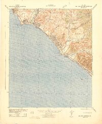
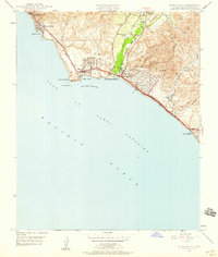
 1949 Laguna Beach1949 Print · USGSThe Orange County coast appears in its postwar infancy, where the cliffs and canyons of the SAN JOAQUIN HILLS meet the Pacific. Researchers can trace early residential growth at Corona del Mar and locate local landmarks like the Art Gallery and Rancho Laguna Sch.2 unique versions available
 - 1949 Map of Dana Point
 1949 Dana Point1949 Print · USGSThe Orange County coast in the late forties shows the early development of Dana Point and San Clemente before the era of major freeway expansion. Researchers can trace the original Atchison Topeka and Santa Fe rail line and identify vanished landmarks like the Capistrano Airport.
 - 1949 Map of Santa Ana
 1949 Santa Ana1949 Print · USGSSouthern California underwent a profound transformation in the late 1940s as military installations and citrus groves shared the landscape. Researchers can trace early coastal growth at Laguna Beach, military history at Camp Pendleton, and the rail corridors of the Pacific Electric.
 - 1956 Map of Santa Ana
 1956 Santa Ana1956 Print · USGSSouthern California underwent massive mid-century transformation as suburban growth met major military and water projects. Trace the postwar expansion of Santa Ana and Riverside, the layout of Camp Pendleton, and the path of the Colorado River Aqueduct.
 - 1959 Map of Santa Ana, 1971 Print
 1959 Santa Ana1971 Print · USGSSouthern California is captured in a decade of transformation, from the Orange County coast to the desert floor. Researchers can trace the mid-century footprints of Camp Pendleton, March Air Force Base, and the original Ortega Highway.3 unique versions available
 - 1960 Map of Santa Ana
 1960 Santa Ana1960 Print · USGSSouthern California's coastal plains and inland deserts meet in this mid-century survey of the burgeoning Orange and Riverside county corridors. Researchers can trace the layout of early freeway systems, find tribal lands like the Soboba Indian Reservation, and locate military landmarks such as March Field.2 unique versions available
 - 1965 Map of Santa Ana
 1965 Santa Ana1965 Print · USGSSouthern California is captured in a decade of rapid growth, showing the coastal expansion from Santa Ana down to Oceanside. Genealogists and historians can trace the mid-century development of places like Garden Grove or the rural reaches of Escondido and the Palomar Observatory.
 - 1965 Map of Laguna Beach, 1967 Print
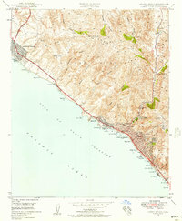
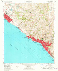 1965 Laguna Beach1967 Print · USGSCoastal Orange County is captured here during the mid-sixties growth surge, showing the transition from open hills to modern shorefront communities. Researchers can trace local development through landmarks like Crystal Cove, Top of the World, and St Catherine of Siena Sch.4 unique versions available
 - 1968 Map of San Juan Capistrano, 1969 Print
 1968 San Juan Capistrano1969 Print · USGSCoastal Orange County in the late sixties shows the emergence of iconic master-planned communities and the infrastructure of the postwar boom. Genealogists and local historians can trace early neighborhood layouts in Laguna Hills and Laguna Niguel or locate landmarks like the Paz Landing Strip.4 unique versions available
Showing maps 1-25 of 43
Top cities near Laguna Beach
- Santa Ana historical maps
- Irvine historical maps
- Huntington Beach historical maps
- Garden Grove historical maps
- Costa Mesa historical maps
- Mission Viejo historical maps
See more
Top neighborhoods of Laguna Beach
- Three Arch Bay historical maps
- South Laguna historical maps
- Top of the World historical maps
- Canyon Acres historical maps
Frequently asked questions
- What are the different types of historical maps available for Laguna Beach?
- What is the oldest map of Laguna Beach?
- Where can I purchase historical maps of Laguna Beach for my home or office?
- Where can I download high-res historical maps of Laguna Beach?
- Are there historical topographic maps available for Laguna Beach?
- Is there historical aerial imagery available for Laguna Beach?
- Where are historical maps of Laguna Beach sourced from?