1990s Maps of Mission Viejo, California
Explore 2 historic maps of Mission Viejo from the 1990s. These maps offer a rare glimpse into what life looked like during the 1990s — showing old roads, neighborhoods, homes, and landmarks that have changed or disappeared over time.
Whether you're researching your family's past, planning a metal detecting trip, or studying how Mission Viejo's landscape evolved across the 1990s, these high-resolution maps are a powerful tool for exploring the history of this region.
- Focus on a specific era: All maps on this page are from the 1990s, giving you a focused view of this time period.
- See what’s changed: Compare century-old streets, trails, and buildings to today's modern landscape using overlays and satellite layers.
- Research with precision: Use these maps for genealogy, historical research, land use analysis, or educational projects.
- View, download, or print: Maps are fully viewable online in high resolution, and can be downloaded or printed for your own records.
Start exploring Mission Viejo's history through authentic maps from the 1990s. This is your window into the past.
Mission Viejo, CA maps
(2)- 1997 Map of Santiago Peak, 2000 Print
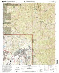 1997 Santiago Peak2000 Print · USGSThe Santa Ana Mountains stand over a period of rapid suburban transition in the late nineties. Researchers can trace the legacy of old land grants and canyon life through landmarks like Ramakrishna Monastery, Trabuco Sch, and the Santiago Peak Lookout.
 - 1997 Map of El Toro, 2000 Print
 1997 El Toro2000 Print · USGSOrange County's transformation into a suburban and military hub is on full display in the late nineties. Genealogists and historians can trace the expansive El Toro Marine Corps Air Station alongside local landmarks like El Toro Cem and Modjeska.
End of results
Showing maps 1-2 of 2
Top cities near Mission Viejo
- Anaheim historical maps
- Santa Ana historical maps
- Irvine historical maps
- Corona historical maps
- Orange historical maps
- Costa Mesa historical maps
See more
Top neighborhoods of Mission Viejo
- Canyon Crest historical maps
- Pinecrest historical maps
- Casta del Sol historical maps
- Mallorca historical maps
Frequently asked questions
- What are the different types of historical maps available for Mission Viejo?
- What is the oldest map of Mission Viejo?
- Where can I purchase historical maps of Mission Viejo for my home or office?
- Where can I download high-res historical maps of Mission Viejo?
- Are there historical topographic maps available for Mission Viejo?
- Is there historical aerial imagery available for Mission Viejo?
- Where are historical maps of Mission Viejo sourced from?