1900s (20th Century) Maps of Blythe, California
Explore 14 historic maps of Blythe from the 1900s (20th Century). These maps offer a rare glimpse into what life looked like during the 1900s — showing old roads, neighborhoods, homes, and landmarks that have changed or disappeared over time.
Whether you're researching your family's past, planning a metal detecting trip, or studying how Blythe's landscape evolved across the 1900s, these high-resolution maps are a powerful tool for exploring the history of this region.
- Focus on a specific era: All maps on this page are from the 1900s, giving you a focused view of this time period.
- See what’s changed: Compare century-old streets, trails, and buildings to today's modern landscape using overlays and satellite layers.
- Research with precision: Use these maps for genealogy, historical research, land use analysis, or educational projects.
- View, download, or print: Maps are fully viewable online in high resolution, and can be downloaded or printed for your own records.
Start exploring Blythe's history through authentic maps from the 1900s. This is your window into the past.
Blythe, CA maps
(14)- 1942 Map of Blythe
 1942 Blythe1942 Print · USGSThe Lower Colorado River valley appears here in the early 1940s, showcasing the agricultural development of the Palo Verde Mesa alongside a booming mining industry. Researchers can locate remote desert outposts and extraction sites like Midland, the U S Gypsum Mine, and Nortons Landing.2 unique versions available
 - 1951 Map of Blythe, 1952 Print
 1951 Blythe1952 Print · USGSThe Palo Verde Valley thrives as a desert agricultural hub in the early fifties, anchored by the river and the rail. Genealogists can trace the early footprints of Blythe and Ehrenberg, while researchers can follow the Atchison Topeka and Santa Fe line and the intricate levees of the Colorado River.6 unique versions available
 - 1951 Map of McCoy Wash, 1952 Print
 1951 McCoy Wash1952 Print · USGSThe Palo Verde Valley was undergoing significant agricultural expansion in the early fifties as desert mesas were reclaimed through complex irrigation. Researchers can trace the original footprint of Mesaville, the Palo Verde High School and Junior College, and the sprawling Blythe Airport.6 unique versions available
 - 1951 Map of Blythe NE, 1952 Print
 1951 Blythe NE1952 Print · USGSThe Palo Verde Valley meets the Arizona border at mid-century, where desert agriculture depends entirely on the proximity of the river. Genealogists and researchers can trace the remnants of Fertilla (Ruins), visit the Palo Verde Cemetery, and locate the Palo Verde Intake along the Colorado River.4 unique versions available
 - 1952 Map of Mc Coy Spring, 1953 Print
 1952 Mc Coy Spring1953 Print · USGSThe Riverside County desert comes into focus during the early fifties, showing the vital watering holes of the Chuckwalla Valley. Researchers can trace the locations of Hopkins Well, the Roosevelt Mine, and the high ridges of the Mc Coy Mountains.3 unique versions available
 - 1952 Map of Ripley, 1953 Print
 1952 Ripley1953 Print · USGSMid-century Riverside County irrigation is captured here as a sprawling network of desert canals and rail lines. Trace the development of Ripley and Nicholls Warm Springs alongside landmarks like the Neighbors Community Farm Center and the Atchison Topeka and Santa Fe railway.3 unique versions available
 - 1954 Map of Salton Sea
 1954 Salton Sea1954 Print · USGSThe Colorado River and Imperial Valley desert frontiers are captured here in the 1950s. Trace the irrigation networks of Calipatria and mining sites like Eagle Mountain Mine.
 - 1955 Map of Salton Sea
 1955 Salton Sea1955 Print · USGSThe Colorado River and Imperial Valley desert basins appear here during the mid-fifties, revealing a landscape of remote mines and agricultural irrigation. Genealogists and researchers can trace locations like the Parker Alien Reception Center Unit No 1, Blythe, and the Kane Springs School.2 unique versions available
 - 1959 Map of Salton Sea, 1968 Print
 1959 Salton Sea1968 Print · USGSThe Colorado River and Salton Sea basin are shown here during a decade of intense military and agricultural activity. Trace family roots in Blythe or Niland, and locate historical mining operations like the Eagle Mountain Mine and Red Cloud Mine.4 unique versions available
 - 1963 Map of Salton Sea
 1963 Salton Sea1963 Print · USGSThe Colorado Desert during the early sixties shows a landscape defined by massive water projects and Cold War military ranges. Trace the growth of Salton City and Brawley, or locate remote desert outposts like the Paymaster Mine and Desert Center.
 - 1965 Map of Salton Sea
 1965 Salton Sea1965 Print · USGSThe Colorado Desert and Imperial Valley are caught in a period of intense irrigation and military expansion during the mid-sixties. Researchers can trace the desert's industrial footprint through the Eagle Mountain Mine, the remote Desert Center, and the Salton Sea Test Base.
 - 1970 Map of Blythe, 1975 Print
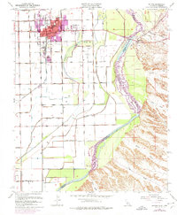 1970 Blythe1975 Print · USGSThe Colorado River valley transitioned into a modern agricultural and transit hub during the early seventies. Genealogists and local historians can trace the growth of Blythe and Ehrenberg near the Ehrenberg Cemetery and the vital Palo Verde Intake.
 - 1983 Map of Hopkins Well
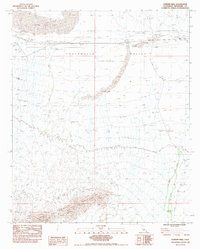 1983 Hopkins Well1983 Print · USGSRiverside County’s desert corridor is captured here in the early eighties as utility and travel infrastructure expanded. Trace the locations of historic desert waypoints like Hopkins Well and Teague Well alongside the arid expanse of Ford Dry Lake.
 - 1986 Map of Blythe
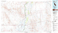 1986 Blythe1986 Print · USGSThe Colorado River valley at the California and Arizona border in the mid-1980s shows a landscape of intensive desert farming and remote mining. Trace the rail lines of the Atchison Topeka and Santa Fe or locate historical workings like the Arlington Mine and Victor Mine.3 unique versions available
End of results
Showing maps 1-14 of 14
Top cities near Blythe
Top neighborhoods of Blythe
Frequently asked questions
- What are the different types of historical maps available for Blythe?
- What is the oldest map of Blythe?
- Where can I purchase historical maps of Blythe for my home or office?
- Where can I download high-res historical maps of Blythe?
- Are there historical topographic maps available for Blythe?
- Is there historical aerial imagery available for Blythe?
- Where are historical maps of Blythe sourced from?