1900s (20th Century) Maps of Copper Canyone, California
Explore 10 historic maps of Copper Canyone from the 1900s (20th Century). These maps offer a rare glimpse into what life looked like during the 1900s — showing old roads, neighborhoods, homes, and landmarks that have changed or disappeared over time.
Whether you're researching your family's past, planning a metal detecting trip, or studying how Copper Canyone's landscape evolved across the 1900s, these high-resolution maps are a powerful tool for exploring the history of this region.
- Focus on a specific era: All maps on this page are from the 1900s, giving you a focused view of this time period.
- See what’s changed: Compare century-old streets, trails, and buildings to today's modern landscape using overlays and satellite layers.
- Research with precision: Use these maps for genealogy, historical research, land use analysis, or educational projects.
- View, download, or print: Maps are fully viewable online in high resolution, and can be downloaded or printed for your own records.
Start exploring Copper Canyone's history through authentic maps from the 1900s. This is your window into the past.
Copper Canyone, CA maps
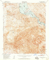
(10)- 1911 Map of Parker
 1911 Parker1911 Print · USGSThe Arizona-California borderlands are captured here in the early twentieth century as the river and rail networks began to transform the desert. Researchers can trace the development of the Colorado River Indian Reservation, the rail hub at Parker, and early mining sites like the Billy Mack Mine.3 unique versions available
 - 1943 Map of Whipple Mts.
 1943 Whipple Mts.1943 Print · USGSThe Colorado River borderlands come into focus during the early years of the Second World War. Researchers can trace historic river access points and desert water sources like Liverpool Landing, Pittsburg Flat, and Whipple Well.
 - 1950 Map of Whipple Mts, 1958 Print
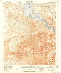
 1950 Whipple Mts1958 Print · USGSThe Colorado River and Whipple Mountains define this mid-century desert borderland between California and Arizona. Researchers can trace remote mining history and early lakefront settlements through landmarks like Needles Boat Landing, Roulette Mine, and Chambers Well.3 unique versions available
 - 1952 Map of Whipple Mts
 1952 Whipple Mts1952 Print · USGSThe Lower Colorado River borderlands are captured here in the early fifties as desert mining gave way to new shoreline developments. You can trace the locations of numerous historic prospects like the Roulette Mine and Islander Mine, alongside early river landings such as Needles Boat Landing.
 - 1954 Map of Needles
 1954 Needles1954 Print · USGSThe Mojave Desert at the height of the mid-century era shows a landscape defined by the Atchison Topeka and Santa Fe railroad and the legendary U S Highway 66. Genealogists and historians can trace rail stops like Goffs, mining sites such as the Bonanza King Mine, and the early borders of the Chemehuevi Indian Reservation.
 - 1956 Map of Needles
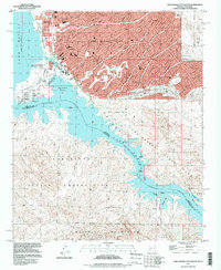
 1956 Needles1956 Print · USGSThe Mojave Desert and Colorado River come alive in the mid-fifties, showing the intersection of vital rail lines and massive water projects. Trace the Atchison Topeka and Santa Fe line through Amboy or locate remote sites like the Copper World Mine and Rio Vista Guest Ranch.7 unique versions available
 - 1970 Map of Lake Havasu City South, 1973 Print
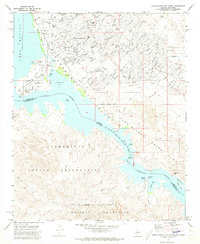 1970 Lake Havasu City South1973 Print · USGSArizona's desert landscape meets the rising waters of the Colorado River during the early 1970s expansion of Lake Havasu City. Genealogists and local historians can trace the early suburban footprint near Thompson Bay and locate landmarks like the Roulette Mine and Lake Havasu City Airport.3 unique versions available
 - 1981 Map of Needles, 1987 Print
 1981 Needles1987 Print · USGSThe High Desert and Colorado River valley are seen here in the early 1980s through the unique lens of satellite imagery. Trace the isolated outposts of the AT & SF railroad at Goffs and Essex, or explore the sprawling shores of Lake Havasu.
 - 1985 Map of Parker
 1985 Parker1985 Print · USGSThe Colorado River valley in the mid-eighties was a hub of desert transit, mining, and water management. Researchers can trace the path of the Atchison Topeka and Santa Fe railroad through Vidal Junction and locate numerous historic diggings like the Gold Hill Mine or Billy Mack Mine.2 unique versions available
 - 1994 Map of Lake Havasu City South, 1997 Print
 1994 Lake Havasu City South1997 Print · USGSLake Havasu City enters a period of modern expansion in the mid-nineties, centering on the relocated London Bridge and the developing waterfront. Genealogists and researchers can trace the city's growth alongside older desert landmarks like the Roulette Mine and the Lake Havasu City Airport (Abandoned).
End of results
Showing maps 1-10 of 10
Top cities near Copper Canyone
Frequently asked questions
- What are the different types of historical maps available for Copper Canyone?
- What is the oldest map of Copper Canyone?
- Where can I purchase historical maps of Copper Canyone for my home or office?
- Where can I download high-res historical maps of Copper Canyone?
- Are there historical topographic maps available for Copper Canyone?
- Is there historical aerial imagery available for Copper Canyone?
- Where are historical maps of Copper Canyone sourced from?