Old Maps of Houze Place, California
Explore 18 old maps of Houze Place, spanning from 1931 to today. These high-resolution historic maps reveal how streets, neighborhoods, landmarks, and natural features evolved over time — perfect for genealogy, metal detecting, research, and local history exploration.
What you can do with these maps:
- See how Houze Place changed over time: Compare historical maps to modern-day views to trace roads, homesites, rail lines & more.
- View detailed metadata: Each map includes creators, publishers, year, scale, and archive source.
- Overlay maps with satellite & LiDAR: Visualize the past alongside modern tools to explore terrain & human change.
- Trusted historical sources: Maps sourced from the USGS, Library of Congress, and other archives.
- Access maps your way: View online, download high-res files, or order prints for personal or research use.
Start exploring old maps of Houze Place to uncover forgotten places, hidden landmarks, and the deep history beneath your feet.
Houze Place, CA maps
(18)- 1931 Map of Adobe
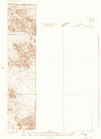 1931 Adobe1931 Print · USGSThe northern reaches of the Antelope Valley come into focus during the early 1930s, showing a landscape defined by county borders and early road grids. Researchers can trace the intersection of the Los Angeles Kern Co Bdy Line and local routes like Ave B.
 - 1934 Map of Adobe
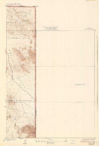 1934 Adobe1934 Print · USGSThe Antelope Valley high desert meets the county lines in the early 1930s, documenting a time when the eastern terrain remained largely unmapped. Researchers can trace early road developments like Avenue B and the landmark Adobe Mountain.2 unique versions available
 - 1937 Map of Kramer
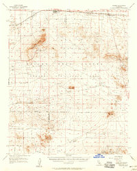
 1937 Kramer1937 Print · USGSHigh desert life in the late thirties centered on the rail lines and early highways crossing the Mojave Desert. Researchers can trace the early layout of Kramer, Rich, and Blake Ranch alongside the Atchison Topeka and Santa Fe railroad.
 - 1942 Map of Kramer
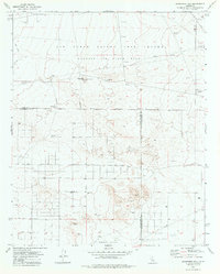
 1942 Kramer1942 Print · USGSThe high desert comes into focus in the 1930s and 40s as rail transit and early aviation began to shape this corner of San Bernardino. You can trace the Atchison Topeka and Santa Fe tracks through Amargo or find the remote Blake Ranch and Kramer.2 unique versions available
 - 1947 Map of Kramer SW
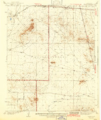
 1947 Kramer SW1947 Print · USGSLos Angeles County's high desert reveals its early military footprint in the years just after the war. Researchers can trace the boundaries of Muroc Army Airfield Military Reservation and locate specific features like Jackrabbit Hill and the northern Target area.3 unique versions available
 - 1953 Map of San Bernardino
 1953 San Bernardino1953 Print · USGSSouthern California underwent massive post-war growth as suburban sprawl reached the foothills of the San Bernardino Mountains. Genealogists and historians can trace the rail-and-road roots of the Inland Empire through the Union Pacific RR and Lake Arrowhead resorts.2 unique versions available
 - 1956 Map of San Bernardino
 1956 San Bernardino1956 Print · USGSSouthern California's Inland Empire and High Desert come into focus in the mid-fifties as agriculture gives way to suburban and military growth. Trace early rail lines like the Pacific Electric or find remote landmarks like Camp Rock Mine and George AFB.
 - 1956 Map of Kramer, 1958 Print
 1956 Kramer1958 Print · USGSThe Mojave Desert at the height of the Cold War reveals a landscape of flight test ranges and mining hubs. Genealogists and historians can trace the foundations of Boron, the rail crossroads at Kramer Junction, and early industrial sites like the Clay Plant.2 unique versions available
 - 1957 Map of San Bernardino
 1957 San Bernardino1957 Print · USGSSouthern California's Inland Empire and High Desert met during the postwar expansion of the late fifties. Genealogists and historians can trace the growth of San Bernardino and Redlands alongside remote landmarks like Edwards AFB and the Camp Rock Mine.
 - 1958 Map of San Bernardino, 1975 Print
 1958 San Bernardino1975 Print · USGSSouthern California’s Inland Empire and High Desert come into focus during the mid-century boom, showing the rise of suburbs and massive military installations. Researchers can trace the rail networks of the Union Pacific RR or locate landmarks like Norton AFB and Big Bear Lake.
 - 1959 Map of San Bernardino
 1959 San Bernardino1959 Print · USGSSouthern California underwent a massive transformation in the late fifties as suburban growth and military power reshaped the desert and valley. Researchers can trace the legacy of the Union Pacific Railroad and locate early footprints of Joshua Tree National Monument and Edwards Air Force Base.
 - 1966 Map of San Bernardino
 1966 San Bernardino1966 Print · USGSThe San Bernardino Valley and Mojave Desert met during a period of massive military and suburban growth in the mid-sixties. Genealogists and historians can trace the development of Edwards Air Force Base, old desert mines like the Bagdad Chase Mine, and mountain communities near Big Bear Lake.
 - 1973 Map of Jackrabbit Hill, 1977 Print
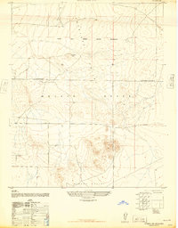
 1973 Jackrabbit Hill1977 Print · USGSIn the early 1970s, this desert landscape at the intersection of Kern, Los Angeles, and San Bernardino Counties was a hub for aerospace testing. Researchers can trace military infrastructure from Observation Tower sites to specific family-named landmarks like Houne Place and Jackrabbit Hill.
 - 1982 Map of Victorville
 1982 Victorville1982 Print · USGSThe High Desert during the early eighties reveals a landscape of massive aerospace installations and growing desert communities. Researchers can trace the sprawling boundaries of Edwards Air Force Base alongside the vital California Aqueduct and the rail hub at Barstow.2 unique versions available
 - 2012 Map of Jackrabbit Hill, 2012 Print
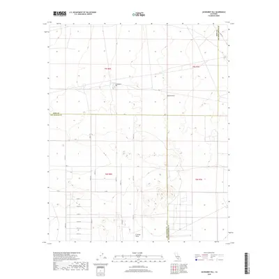
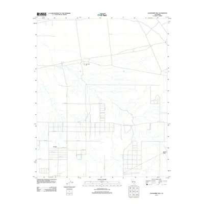 2012 Jackrabbit Hill2012 Print · USGSCovers Houze Place, including San Bernardino County, Kern County, and other nearby areas
 - 2015 Map of Jackrabbit Hill, 2015 Print
 2015 Jackrabbit Hill2015 Print · USGSCovers Houze Place, including San Bernardino County, Kern County, and other nearby areas
 - 2018 Map of Jackrabbit Hill, 2018 Print
 2018 Jackrabbit Hill2018 Print · USGSCovers Houze Place, including San Bernardino County, Kern County, and other nearby areas
 - 2021 Map of Jackrabbit Hill, 2021 Print
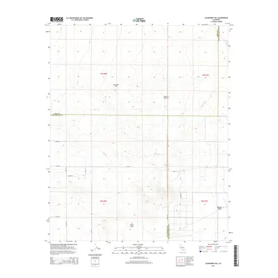
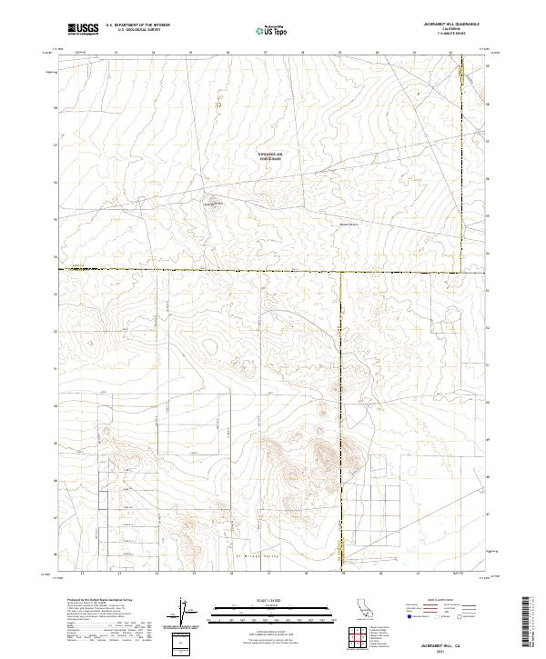 2021 Jackrabbit Hill2021 Print · USGSThe high desert at the tri-county corner of Kern, Los Angeles, and San Bernardino comes into focus in this recent survey. Trace the geographic intersection of Jackrabbit Hill and the El Mirage Valley along roads like Mars Blvd and Ave B.
End of results
Showing maps 1-18 of 18
Top cities near Houze Place
Frequently asked questions
- What are the different types of historical maps available for Houze Place?
- What is the oldest map of Houze Place?
- Where can I purchase historical maps of Houze Place for my home or office?
- Where can I download high-res historical maps of Houze Place?
- Are there historical topographic maps available for Houze Place?
- Is there historical aerial imagery available for Houze Place?
- Where are historical maps of Houze Place sourced from?