2020s Maps of Needles, California
Explore 5 historic maps of Needles from the 2020s. These maps offer a rare glimpse into what life looked like during the 2020s — showing old roads, neighborhoods, homes, and landmarks that have changed or disappeared over time.
Whether you're researching your family's past, planning a metal detecting trip, or studying how Needles's landscape evolved across the 2020s, these high-resolution maps are a powerful tool for exploring the history of this region.
- Focus on a specific era: All maps on this page are from the 2020s, giving you a focused view of this time period.
- See what’s changed: Compare century-old streets, trails, and buildings to today's modern landscape using overlays and satellite layers.
- Research with precision: Use these maps for genealogy, historical research, land use analysis, or educational projects.
- View, download, or print: Maps are fully viewable online in high resolution, and can be downloaded or printed for your own records.
Start exploring Needles's history through authentic maps from the 2020s. This is your window into the past.
Needles, CA maps
(5)- 2021 Map of Whale Mountain, 2021 Print
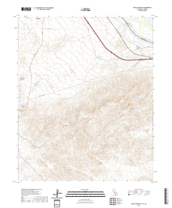 2021 Whale Mountain2021 Print · USGSThe California-Arizona borderlands come alive in this recent survey of the Mojave Desert. Researchers can trace the path of HST RTE 66 and find topographic landmarks like Whale Mtn, Lobecks Pass, and the shoreline of Lost Lake.
 - 2021 Map of Needles, 2021 Print
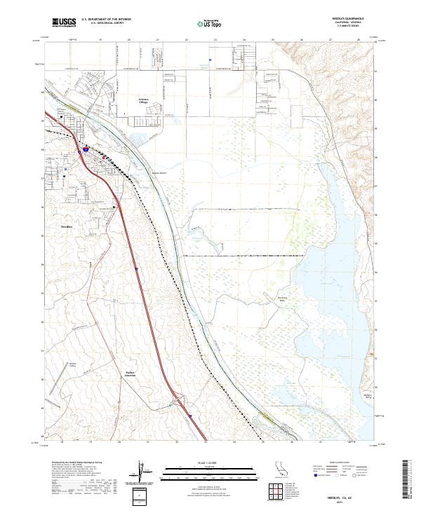 2021 Needles2021 Print · USGSThe California-Arizona borderlands come alive in this recent survey of the Colorado River corridor. Genealogists and historians can trace the Fort Mojave Burial Grounds, Needles Riverview Cem, and the tracks of the BNSF Railway.
 - 2021 Map of Needles SW, 2021 Print
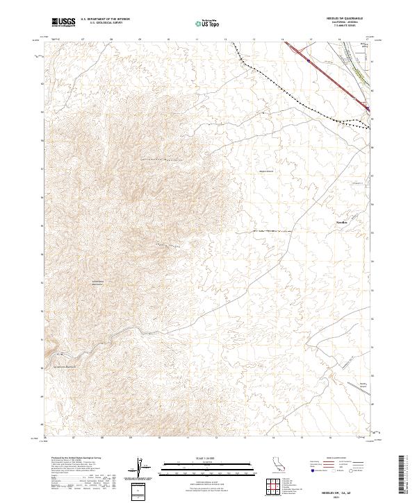 2021 Needles SW2021 Print · USGSSan Bernardino County at the California-Arizona border is captured here in the early twenty-first century as the Mojave landscape meets the Colorado River valley. Researchers can trace the legacy of the mother road along Hst Rte 66 and locate local landmarks like the Needles Airport and Shadow Canyon.
 - 2021 Map of Monumental Pass, 2021 Print
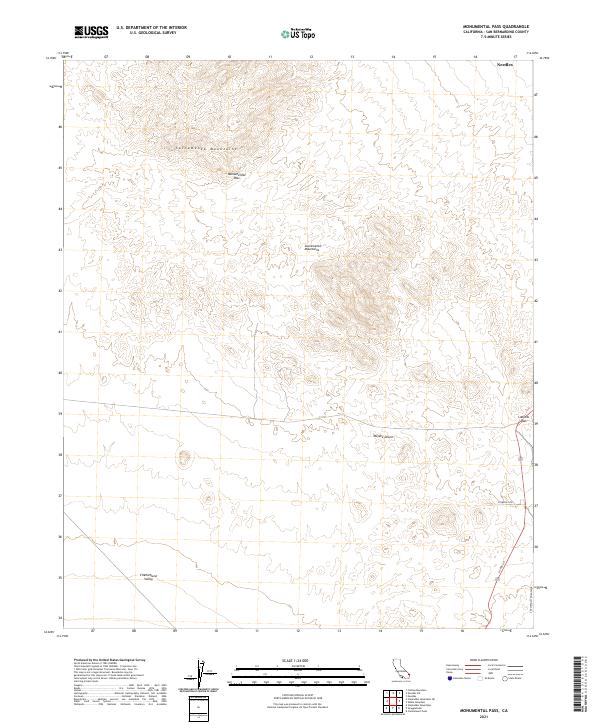 2021 Monumental Pass2021 Print · USGSThe high desert of eastern San Bernardino County is captured here in the early twenty-first century, showcasing the dramatic transition from mountain peaks to valley floors. Researchers can trace the modern paths of US Rte 95 and Stonehill Rd as they navigate the natural gaps at Monumental Pass and Lobecks Pass.
 - 2021 Map of Needles NW, 2021 Print
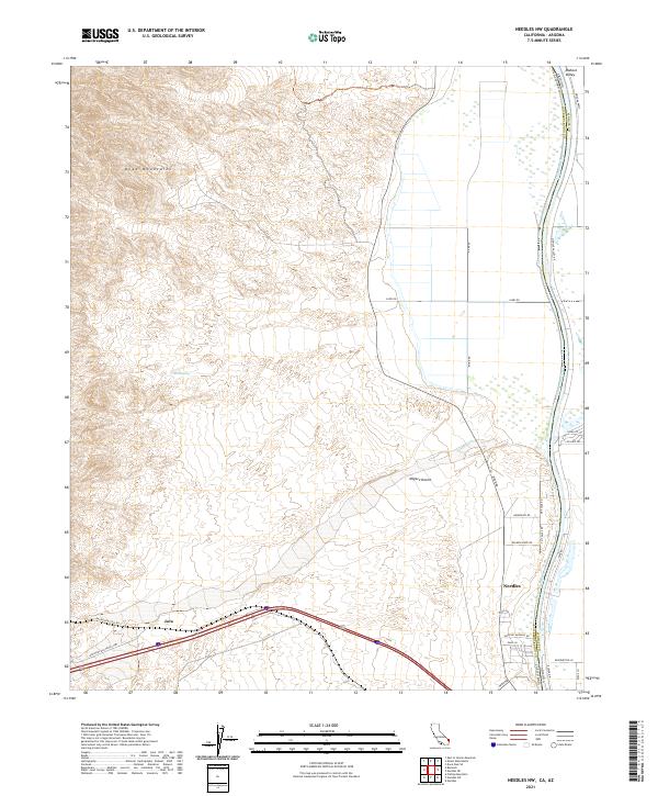 2021 Needles NW2021 Print · USGSThe high desert landscape near the California-Arizona border is captured here in the early twenty-first century. Researchers can trace the path of the National Old Trails Hwy and locate desert landmarks like Red Spring, Piute Wash, and the settlement of Java.
End of results
Showing maps 1-5 of 5
Top cities near Needles
- Bullhead City historical maps
- Fort Mohave historical maps
- Mohave Valley historical maps
- Golden Shores historical maps
- Willow Valley historical maps
- Arizona Village historical maps
See more
Top neighborhoods of Needles
Frequently asked questions
- What are the different types of historical maps available for Needles?
- What is the oldest map of Needles?
- Where can I purchase historical maps of Needles for my home or office?
- Where can I download high-res historical maps of Needles?
- Are there historical topographic maps available for Needles?
- Is there historical aerial imagery available for Needles?
- Where are historical maps of Needles sourced from?