Old Maps of Santee, California
Explore 30 old maps of Santee, spanning from 1893 to today. These high-resolution historic maps reveal how streets, neighborhoods, landmarks, and natural features evolved over time — perfect for genealogy, metal detecting, research, and local history exploration.
What you can do with these maps:
- See how Santee changed over time: Compare historical maps to modern-day views to trace roads, homesites, rail lines & more.
- View detailed metadata: Each map includes creators, publishers, year, scale, and archive source.
- Overlay maps with satellite & LiDAR: Visualize the past alongside modern tools to explore terrain & human change.
- Trusted historical sources: Maps sourced from the USGS, Library of Congress, and other archives.
- Access maps your way: View online, download high-res files, or order prints for personal or research use.
Start exploring old maps of Santee to uncover forgotten places, hidden landmarks, and the deep history beneath your feet.
Santee, CA maps
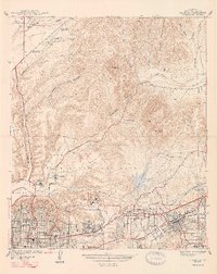
(30)- 1893 Map of El Cajon
 1893 El Cajon1893 Print · USGSCovers Santee, including San Diego, El Cajon, and other nearby areas2 unique versions available
 - 1901 Map of Elcajon
 1901 Elcajon1901 Print · USGSCovers Santee, including San Diego, El Cajon, and other nearby areas
 - 1903 Map of Cuyamaca
 1903 Cuyamaca1903 Print · USGSCovers Santee, including San Diego, Chula Vista, and other nearby areas6 unique versions available
 - 1903 Map of La Jolla
 1903 La Jolla1903 Print · USGSCovers Santee, including San Diego, El Cajon, and other nearby areas9 unique versions available
 - 1903 Map of Elcajon
 1903 Elcajon1903 Print · USGSCovers Santee, including San Diego, El Cajon, and other nearby areas5 unique versions available
 - 1904 Map of Southern California Sheet No. 2
 1904 Southern California Sheet No. 21904 Print · USGSCovers Santee, including Tijuana, San Diego, and other nearby areas5 unique versions available
 - 1930 Map of La Jolla, 1955 Print
 1930 La Jolla1955 Print · USGSCovers Santee, including San Diego, El Cajon, and other nearby areas2 unique versions available
 - 1939 Map of El Cajon, 1955 Print
 1939 El Cajon1955 Print · USGSCovers Santee, including San Diego, El Cajon, and other nearby areas2 unique versions available
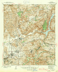
 - 1942 Map of Poway Valley
 1942 Poway Valley1942 Print · USGSCovers Santee, including San Diego, Poway, and other nearby areas2 unique versions available
 - 1942 Map of La Mesa
 1942 La Mesa1942 Print · USGSCovers Santee, including San Diego, El Cajon, and other nearby areas
 - 1942 Map of El Cajon
 1942 El Cajon1942 Print · USGSCovers Santee, including San Diego, El Cajon, and other nearby areas
 - 1947 Map of La Mesa
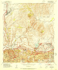
 1947 La Mesa1947 Print · USGSCovers Santee, including San Diego, El Cajon, and other nearby areas2 unique versions available
 - 1947 Map of El Cajon
 1947 El Cajon1947 Print · USGSCovers Santee, including San Diego, El Cajon, and other nearby areas
 - 1950 Map of San Diego, 1954 Print
 1950 San Diego1954 Print · USGSCovers Santee, including Tijuana, San Diego, and other nearby areas
 - 1952 Map of Poway Valley, 1954 Print
 1952 Poway Valley1954 Print · USGSCovers Santee, including San Diego, Poway, and other nearby areas3 unique versions available
 - 1953 Map of La Mesa, 1955 Print
 1953 La Mesa1955 Print · USGSCovers Santee, including San Diego, El Cajon, and other nearby areas3 unique versions available
 - 1954 Map of San Diego
 1954 San Diego1954 Print · USGSCovers Santee, including Tijuana, San Diego, and other nearby areas
 - 1955 Map of San Diego
 1955 San Diego1955 Print · USGSCovers Santee, including Tijuana, San Diego, and other nearby areas
 - 1955 Map of San Vicente Reservoir, 1956 Print
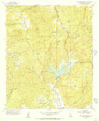 1955 San Vicente Reservoir1956 Print · USGSCovers Santee, including San Diego, Poway, and other nearby areas4 unique versions available
 - 1955 Map of El Cajon, 1956 Print
 1955 El Cajon1956 Print · USGSCovers Santee, including El Cajon, La Mesa, and other nearby areas2 unique versions available
 - 1958 Map of San Diego, 1961 Print
 1958 San Diego1961 Print · USGSCovers Santee, including Tijuana, San Diego, and other nearby areas4 unique versions available
 - 1967 Map of El Cajon, 1969 Print
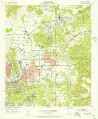
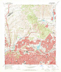
 1967 El Cajon1969 Print · USGSCovers Santee, including El Cajon, La Mesa, and other nearby areas7 unique versions available
 - 1967 Map of La Mesa, 1969 Print
 1967 La Mesa1969 Print · USGSCovers Santee, including San Diego, El Cajon, and other nearby areas4 unique versions available
 - 1967 Map of Poway, 1970 Print
 1967 Poway1970 Print · USGSCovers Santee, including San Diego, Poway, and other nearby areas5 unique versions available
 - 1979 Map of El Cajon
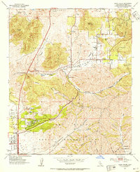
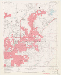
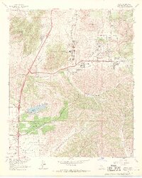
 1979 El Cajon1979 Print · USGSCovers Santee, including San Diego, Chula Vista, and other nearby areas2 unique versions available
Showing maps 1-25 of 30
Top cities near Santee
- San Diego historical maps
- Chula Vista historical maps
- Escondido historical maps
- El Cajon historical maps
- San Marcos historical maps
- Encinitas historical maps
See more
Top neighborhoods of Santee
Frequently asked questions
- What are the different types of historical maps available for Santee?
- What is the oldest map of Santee?
- Where can I purchase historical maps of Santee for my home or office?
- Where can I download high-res historical maps of Santee?
- Are there historical topographic maps available for Santee?
- Is there historical aerial imagery available for Santee?
- Where are historical maps of Santee sourced from?