Old Maps of Santee, California for Hiking & Exploration
Hike through history with 46 historic maps of Santee. Explore old trails, ghost towns, and forgotten backroads — perfect for outdoor adventurers and local explorers.
- Rediscover forgotten places: Map out old mining camps, roads, and footpaths that no longer exist on modern maps.
- Layer with modern tools: Combine with LiDAR or satellite views to plan hikes through historical terrain.
- Made for exploration: Popular among hikers, overlanders, and local history lovers.
Use these maps to find adventure and explore the hidden past of Santee.
Santee, CA maps
(46)- 1893 Map of El Cajon
 1893 El Cajon1893 Print · USGSEastern San Diego County was a landscape of ambitious water engineering and early rail expansion in the 1890s. Genealogists can trace the rural roots of El Cajon, Lakeside, and Santee while following the path of the San Diego Flume.2 unique versions available
 - 1901 Map of Elcajon
 1901 Elcajon1901 Print · USGSSan Diego's eastern valleys are shown at the turn of the century as agriculture and water infrastructure began to reshape the landscape. Trace the path of the San Diego Flume and its tunnels or the rail line serving Foster, Lakeside, and Elcajon.
 - 1903 Map of Cuyamaca
 1903 Cuyamaca1903 Print · USGSInland San Diego County at the turn of the century reveals a landscape defined by new water infrastructure and rail lines. Genealogists and historians can trace early settlements like Lakeside, Dulzura, and the remote Honey Springs Ranch along the international border.6 unique versions available
 - 1903 Map of La Jolla
 1903 La Jolla1903 Print · USGSCoastal San Diego at the turn of the century shows a landscape of deep canyons and emerging rail towns before the rapid expansion of the modern city. Genealogists and historians can trace early settlements like Old Town, Pacific Beach, and the inland community of Poway along the Southern California R. R.9 unique versions available
 - 1903 Map of Elcajon
 1903 Elcajon1903 Print · USGSSan Diego's interior transitions from rail-linked valleys to high reservations at the turn of the century. Trace the path of the San Diego Flume and find vanished railroad stops like Foster and Moreno alongside the growing Elcajon Valley.5 unique versions available
 - 1904 Map of Southern California Sheet No. 2
 1904 Southern California Sheet No. 21904 Print · USGSSouthern California during the early 1900s shows the transition from vast ranchos to coastal rail towns. Genealogists and researchers can trace the Southern California R.R. through Oceanside, explore old land grants like Mission Viejo, and locate early settlements from Fallbrook to Julian.5 unique versions available
 - 1930 Map of La Jolla, 1955 Print
 1930 La Jolla1955 Print · USGSCoastal San Diego was undergoing a rapid transformation in the early 1930s as military footprints and rail lines reshaped the landscape. Researchers can trace the early development of La Jolla and Pacific Beach or locate old sites like Camp Kearney and Merton.2 unique versions available
 - 1939 Map of El Cajon, 1955 Print
 1939 El Cajon1955 Print · USGSEl Cajon and the San Diego River valleys appear in the late thirties as a network of citrus groves, cattle ranches, and tribal lands. Genealogists and researchers can trace the early footprints of Santee, the Edgemoor County Farm, and the Daly Mine.2 unique versions available
 - 1942 Map of Poway Valley
 1942 Poway Valley1942 Print · USGSCoastal San Diego's interior valleys and ranch lands are shown in the early 1940s as rural communities began to coalesce. Genealogists and researchers can trace the early layout of Poway, the site of Pomerado Sch, and the Emergency Landing Field at Scripps Ranch.2 unique versions available
 - 1942 Map of La Mesa
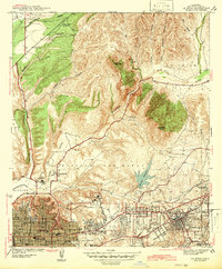 1942 La Mesa1942 Print · USGSSan Diego and La Mesa appear here in the early 1940s, showing a landscape of growing residential neighborhoods and rugged canyon terrain. Genealogists and historians can trace numerous early schools like Hoover High Sch, the grounds of State College, and the historic Mission San Diego.
 - 1942 Map of El Cajon
 1942 El Cajon1942 Print · USGSInland San Diego County unfolds in the early 1940s, showing a landscape of working ranches and river valleys before modern development. Genealogists and historians can trace family-named lands like Peale Ranch and early institutions such as Dehesa Sch and the Daky Mine.
 - 1947 Map of La Mesa
 1947 La Mesa1947 Print · USGSSan Diego's eastern suburbs were rapidly expanding in the late 1930s and 1940s as residential blocks pushed toward the foothills. Trace the early development of Normal Hts and State College alongside landmarks like the Murray Reservoir and Grantville.2 unique versions available
 - 1947 Map of El Cajon
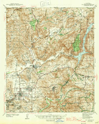 1947 El Cajon1947 Print · USGSThe San Diego River valley and its surrounding foothills appear in the late thirties, centered on the growing community of El Cajon. Genealogists and historians can trace family holdings like Fanita Ranch or locate the Indian Cem and Dehesa Sch in the southern hills.
 - 1950 Map of San Diego, 1954 Print
 1950 San Diego1954 Print · USGSCoastal San Diego and the Baja California border region come alive in this mid-century survey. Trace the early layout of National City and Chula Vista, or locate historic landmarks like the San Diego and Arizona Eastern RR and Fort Rosecrans.
 - 1952 Map of Poway Valley, 1954 Print
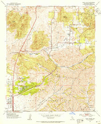 1952 Poway Valley1954 Print · USGSThe Poway Valley of the early fifties is captured here as a rural landscape beginning its transition into a major suburban and military hub. Genealogists and local historians can trace early school sites like Pomerado Sch and Midland Sch alongside the expansive Miramar Naval Air Station Reservation.3 unique versions available
 - 1953 Map of La Mesa, 1955 Print
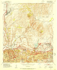 1953 La Mesa1955 Print · USGSThe eastern edge of San Diego and La Mesa are captured during a period of mid-century suburban expansion. Genealogists and local historians can trace neighborhood growth through San Diego State College and local schools like Hoover High Sch.3 unique versions available
 - 1954 Map of San Diego
 1954 San Diego1954 Print · USGSSan Diego and the northern reaches of Baja California are captured here during a decade of rapid post-war growth and military expansion. Researchers can trace the mid-century shoreline of Mission Beach, find established tribal lands like Capitan Grande Indian Reservation, and follow the border crossing into Tijuana.
 - 1955 Map of San Diego
 1955 San Diego1955 Print · USGSSouthern California underwent massive growth in the post-war years, as suburban development pushed into the canyons and foothills. Researchers can trace the mid-century infrastructure of Lindbergh Field, the Otay River, and numerous sites like Lemon Grove.
 - 1955 Map of San Vicente Reservoir, 1956 Print
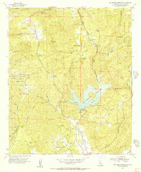 1955 San Vicente Reservoir1956 Print · USGSSan Diego's backcountry in the mid-1950s is defined by its deep canyons and the early footprints of major water infrastructure. Local historians can trace family landholdings like Goodan Ranch and Wildwood Ranch alongside the vast Camp Elliott Naval Reservation.4 unique versions available
 - 1955 Map of El Cajon, 1956 Print
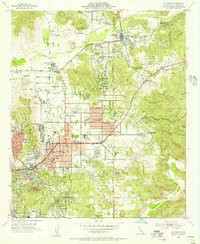 1955 El Cajon1956 Print · USGSEl Cajon and the San Diego River valley are shown here in the mid-fifties, capturing a period of suburban growth among established ranches. Researchers can trace the San Diego and Arizona Eastern RR, locate the El Cajon Cemetery, or find long-standing landmarks like GILLESPIE FIELD.2 unique versions available
 - 1958 Map of San Diego, 1961 Print
 1958 San Diego1961 Print · USGSSan Diego and its inland mountain ranges are captured here in the late fifties as coastal suburbs began to climb the mesas. Researchers can trace the mid-century footprint of Miramar Naval Air Station, the winding San Diego & Arizona Eastern Ry, and local landmarks like Cabrillo Nat Mon.4 unique versions available
 - 1967 Map of El Cajon, 1969 Print
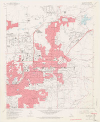 1967 El Cajon1969 Print · USGSEl Cajon and Santee are shown here during a period of rapid mid-century suburban expansion across the San Diego River valley. Researchers can trace the development of local landmarks like Gillespie Field, the El Cajon Cem, and Edgemoor Hospital.7 unique versions available
 - 1967 Map of La Mesa, 1969 Print
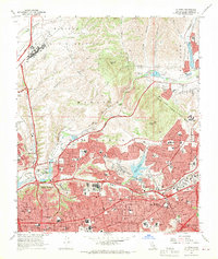 1967 La Mesa1969 Print · USGSSan Diego and La Mesa expand rapidly into the canyons and mesas during the late sixties. Genealogists and historians can locate dozens of neighborhood schools, the newly built San Diego Stadium, and the historic Mission San Diego de Alcala.4 unique versions available
 - 1967 Map of Poway, 1970 Print
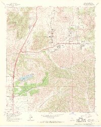 1967 Poway1970 Print · USGSPoway was transitioning from a rural valley into a suburban center in the late sixties. Genealogists and locals can locate several district schools and landmarks like Dearborn Memorial Park and the Miramar Naval Air Station.5 unique versions available
 - 1979 Map of El Cajon
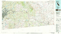 1979 El Cajon1979 Print · USGSSouthern San Diego County and its mountain-to-desert transition are captured here in the late seventies. Researchers can trace the winding San Diego & Arizona Eastern RR, locate rural settlements like Jacumba, and explore the sprawling Cleveland National Forest.2 unique versions available
Showing maps 1-25 of 46
Top cities near Santee
- San Diego historical maps
- Chula Vista historical maps
- Escondido historical maps
- El Cajon historical maps
- San Marcos historical maps
- Encinitas historical maps
See more
Top neighborhoods of Santee
Frequently asked questions
- What are the different types of historical maps available for Santee?
- What is the oldest map of Santee?
- Where can I purchase historical maps of Santee for my home or office?
- Where can I download high-res historical maps of Santee?
- Are there historical topographic maps available for Santee?
- Is there historical aerial imagery available for Santee?
- Where are historical maps of Santee sourced from?