Old Maps of The Arnold Ranch, California
Explore 16 old maps of The Arnold Ranch, spanning from 1897 to today. These high-resolution historic maps reveal how streets, neighborhoods, landmarks, and natural features evolved over time — perfect for genealogy, metal detecting, research, and local history exploration.
What you can do with these maps:
- See how The Arnold Ranch changed over time: Compare historical maps to modern-day views to trace roads, homesites, rail lines & more.
- View detailed metadata: Each map includes creators, publishers, year, scale, and archive source.
- Overlay maps with satellite & LiDAR: Visualize the past alongside modern tools to explore terrain & human change.
- Trusted historical sources: Maps sourced from the USGS, Library of Congress, and other archives.
- Access maps your way: View online, download high-res files, or order prints for personal or research use.
Start exploring old maps of The Arnold Ranch to uncover forgotten places, hidden landmarks, and the deep history beneath your feet.
The Arnold Ranch, CA maps
(16)- 1897 Map of Mt. Hamilton
 1897 Mt. Hamilton1897 Print · USGSThe peaks and ridges of the Diablo Range are documented here in the mid-1890s, centered on the newly established Lick Observatory. Local historians can trace the early road up Mt Hamilton past the lone Hotel and remote outposts like Mowry Camp.6 unique versions available
 - 1942 Map of Mt. Hamilton
 1942 Mt. Hamilton1942 Print · USGSThe Diablo Range heights above San Jose appear here in the early 1940s, centered on the high scientific outpost at Lick Observatory. Researchers can trace old mountain roads and family-held land grants such as the Grant Ranch and Evergreen Ranch.
 - 1943 Map of Mt. Hamilton
 1943 Mt. Hamilton1943 Print · USGSSanta Clara County during the early forties was a land of high-altitude science and isolated ranching outposts. Researchers can trace the winding route to Lick Observatory or locate family landmarks like the Fisher Homestead and Evergreen Ranch.
 - 1947 Map of Mt. Hamilton
 1947 Mt. Hamilton1947 Print · USGSThe Diablo Range rises east of San Jose in the late 1940s, centered on the heights of the Lick Observatory. Genealogists and local historians can trace legacy landholdings such as Evergreen Ranch, Rancho Arroyo Bayo, and the Fisher Homestead.
 - 1947 Map of San Jose, 1948 Print
 1947 San Jose1948 Print · USGSNorthern California's heartland is captured here just after the war, showing the rapid growth of the Santa Clara and Central Valleys. Researchers can trace the legacy of rail and water at Castle Air Force Base, Stockton, and the Hetch Hetchy Aqueduct.
 - 1955 Map of Isabel Valley, 1957 Print
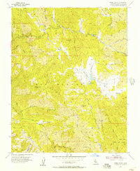 1955 Isabel Valley1957 Print · USGSThe Diablo Range east of San Jose is shown here in the mid-fifties, dominated by high ridges and the scientific outpost at Lick Observatory. Researchers can trace old mountain access routes through Isabel Valley to remote spots like Indian Springs and Grizzly Flats.3 unique versions available
 - 1956 Map of San Jose
 1956 San Jose1956 Print · USGSCentral California in the mid-fifties reveals the transition from sprawling orchards to growing urban hubs like San Jose and Stockton. Genealogists and historians can trace the rail-era landscape of the Mother Lode through Chinese Camp and Tuttletown, or follow the water through the Joaquin River and Calaveras Reservoir.
 - 1962 Map of San Jose
 1962 San Jose1962 Print · USGSCentral California in the early sixties showcases the expansion of the San Joaquin and Santa Clara valleys. Researchers can trace the rail-to-road transition along the Southern Pacific RR or locate landmarks like Castle USAF Base and Loma Prieta.4 unique versions available
 - 1963 Map of Mt. Hamilton
 1963 Mt. Hamilton1963 Print · USGSThe Diablo Range heights of Santa Clara County are captured here just after the war, showing the mountain ranching life and scientific outposts. Genealogists and local historians can trace family lands like Patton Ranch, the Halls Valley Sch, and the high-altitude Lick Observatory.
 - 1966 Map of San Jose
 1966 San Jose1966 Print · USGSCentral California in the mid-1960s reveals a landscape of massive irrigation projects and expanding Cold War military footprints. Researchers can trace the rail-and-river network of the San Joaquin Valley or locate specialized sites like Castle Air Force Base and the Sharp General Depot (Military).
 - 1967 Map of Mt. Hamilton
 1967 Mt. Hamilton1967 Print · USGSSanta Clara County’s eastern ridges are captured here in the mid-1960s, centered on the high-altitude research outpost at Lick Observatory. Researchers can trace old family holdings and remote landmarks like Grant Ranch, Evergreen Ranch, and Copernicus Pk.
 - 1978 Map of San Jose
 1978 San Jose1978 Print · USGSSanta Clara County and the East Bay hills are captured in the late seventies, showing the suburban sprawl of San Jose alongside the rural Central Valley. Trace the paths of the Southern Pacific railroad and find landmarks like New Almaden and Lick Observatory.
 - 2012 Map of Isabel Valley, 2012 Print
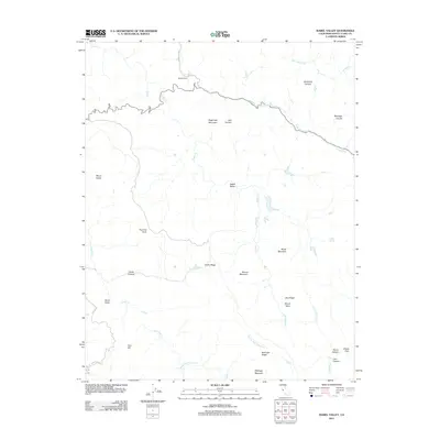 2012 Isabel Valley2012 Print · USGSCovers The Arnold Ranch, including Santa Clara County, United States, and other nearby areas
 - 2015 Map of Isabel Valley, 2015 Print
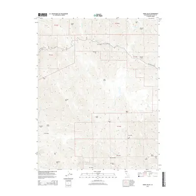 2015 Isabel Valley2015 Print · USGSCovers The Arnold Ranch, including Santa Clara County, United States, and other nearby areas
 - 2018 Map of Isabel Valley, 2018 Print
 2018 Isabel Valley2018 Print · USGSCovers The Arnold Ranch, including Santa Clara County, United States, and other nearby areas
 - 2021 Map of Isabel Valley, 2021 Print
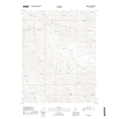
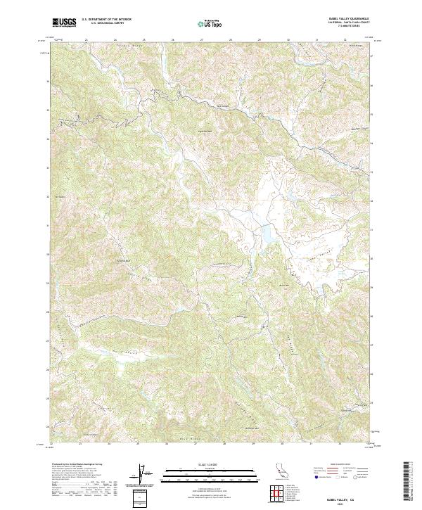 2021 Isabel Valley2021 Print · USGSThe high ridges of the Diablo Range come into focus in this recent study of the Santa Clara County backcountry. Researchers can trace historical paths like the Mule Trl or locate landmarks such as Grizzly Flats and the isolated Indian Springs.
End of results
Showing maps 1-16 of 16
Top cities near The Arnold Ranch
Frequently asked questions
- What are the different types of historical maps available for The Arnold Ranch?
- What is the oldest map of The Arnold Ranch?
- Where can I purchase historical maps of The Arnold Ranch for my home or office?
- Where can I download high-res historical maps of The Arnold Ranch?
- Are there historical topographic maps available for The Arnold Ranch?
- Is there historical aerial imagery available for The Arnold Ranch?
- Where are historical maps of The Arnold Ranch sourced from?