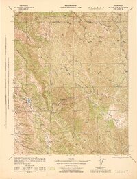
1943 Map of Mt. Hamilton
USGS Topo · Published 1943About this map
Lick Observatory stands as the crowning landmark of this high-elevation landscape, situated atop Mt Hamilton and reached by the winding Lick Road. Surveyed just before the mid-century, the map reveals a rugged interior of the Diablo Range where large-scale ranching dominated the terrain. From the Evergreen Ranch in the west to the Fisher Homestead in the east, family holdings were scattered across a complex network of ridges like Valpe Ridge and Poverty Ridge.
Find a feature on this map
73 named features on this map. Tap any name to fly to it.
Don’t see what you’re looking for? This feature index may not catch every label — zoom into the map to look around manually.
Map Details
Editions of this 1943 Mt. Hamilton Map
This is the sole edition of this map. No revisions or reprints were ever made.
Other maps of this area

1889 · San Jose
USGS Topo · 1:62,500

1897 · San Jose
USGS Topo · 1:62,500

1897 · Mt. Hamilton
USGS Topo · 1:62,500

1899 · San Jose
USGS Topo · 1:62,500

1906 · Pleasanton
USGS Topo · 1:62,500

1907 · Tesla
USGS Topo · 1:62,500

1916 · New Almaden
USGS Topo · 1:48,000

1917 · Morgan Hill
USGS Topo · 1:62,500

1919 · New Almaden
USGS Topo · 1:62,500

1921 · Gilroy Hot Springs
USGS Topo · 1:62,500