1950s Maps of Santa Cruz, California
Explore 25 historic maps of Santa Cruz from the 1950s. These maps offer a rare glimpse into what life looked like during the 1950s — showing old roads, neighborhoods, homes, and landmarks that have changed or disappeared over time.
Whether you're researching your family's past, planning a metal detecting trip, or studying how Santa Cruz's landscape evolved across the 1950s, these high-resolution maps are a powerful tool for exploring the history of this region.
- Focus on a specific era: All maps on this page are from the 1950s, giving you a focused view of this time period.
- See what’s changed: Compare century-old streets, trails, and buildings to today's modern landscape using overlays and satellite layers.
- Research with precision: Use these maps for genealogy, historical research, land use analysis, or educational projects.
- View, download, or print: Maps are fully viewable online in high resolution, and can be downloaded or printed for your own records.
Start exploring Santa Cruz's history through authentic maps from the 1950s. This is your window into the past.
Santa Cruz, CA maps
(25)- 1953 Map of Los Gatos, 1955 Print
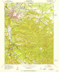 1953 Los Gatos1955 Print · USGSLos Gatos and the surrounding Santa Cruz Mountains are shown here in the mid-fifties as new reservoirs began to reshape the local geography. Researchers can trace the legacy of mountain settlements like Holy City, locate the Wrights site, and find historic mining operations at the Senator Mine.8 unique versions available
 - 1953 Map of Cupertino, 1955 Print
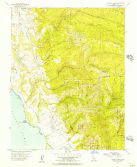
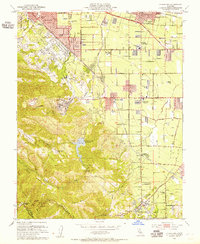 1953 Cupertino1955 Print · USGSThe Santa Clara Valley is seen here in the early fifties, still balanced between its agricultural roots and industrial growth. Genealogists and historians can trace the footprint of Loyola Corners, the historic Madronia Cem, and the massive Permanente Cement Plant.
 - 1954 Map of Soquel, 1955 Print
 1954 Soquel1955 Print · USGSThe Santa Cruz coastline was a vibrant string of beach communities in the mid-1950s, linked by the rail-and-road corridor. Genealogists and local historians can trace the early layouts of Capitola, Aptos, and Rio Del Mar, alongside landmarks like Holy Cross Cem and the Southern Pacific tracks.5 unique versions available
 - 1954 Map of Watsonville West, 1955 Print
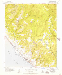
 1954 Watsonville West1955 Print · USGSCoastal Santa Cruz County thrived as an agricultural and rail center in the mid-1950s, bridging the gap between the Pajaro River and the Monterey Bay bluffs. Genealogists and local historians can trace the growth of Watsonville and Freedom, locating family-named landmarks like the Monte Vista Christian Sch and the McQuiddy Sch.6 unique versions available
 - 1954 Map of Moss Landing, 1955 Print
 1954 Moss Landing1955 Print · USGSThe Monterey Bay coastline in the mid-fifties is a study in tidal wetlands and maritime industry centered on the deep waters of Monterey Canyon. Genealogists and local historians can locate the Castroville Moss Ldg Cem, the Moss Landing Union School, and the early layout of Castroville.7 unique versions available
 - 1954 Map of Santa Cruz, 1955 Print
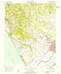
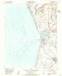
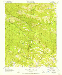
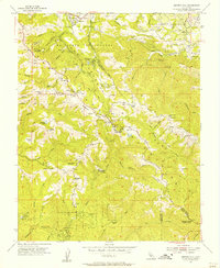
 1954 Santa Cruz1955 Print · USGSSanta Cruz and the Monterey Bay coastline are captured in the mid-fifties, showing a growing coastal city and its industrial rail connections. Genealogists and researchers can locate neighborhood schools like Gault Sch and trace the original Southern Pacific line past Table Rock to Majors.8 unique versions available
 - 1955 Map of San Francisco
 1955 San Francisco1955 Print · USGSThe San Francisco Bay Area and central coast are captured during the postwar boom as suburbs and infrastructure expanded rapidly. Trace the development of local communities and military installations like the Presidio and Fort Mason, or follow the Southern Pacific rail lines.
 - 1955 Map of Santa Cruz
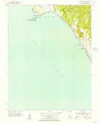
 1955 Santa Cruz1955 Print · USGSCoastal Monterey Bay and the fertile Salinas Valley are captured here during the post-war expansion of the mid-fifties. Researchers can trace the era's rail-and-road network via the Southern Pacific lines and find landmarks like Fort Ord or the Lonoak School.
 - 1955 Map of Chittenden, 1956 Print
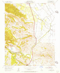 1955 Chittenden1956 Print · USGSThe junction of Santa Clara, Santa Cruz, and San Benito counties comes alive in this mid-fifties study of the Pajaro River corridor. Researchers can trace the Southern Pacific rail line through Pajaro Gap to find early settlements like Sargent and Chittenden.10 unique versions available
 - 1955 Map of Laurel, 1956 Print
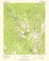
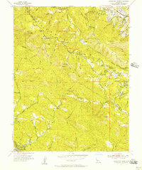
 1955 Laurel1956 Print · USGSThe Santa Cruz Mountains are shown during the mid-fifties, detailing the rugged terrain along the San Andreas Rift Zone. Researchers can trace the path of the Southern Pacific RR (Abandoned) and locate centers of community life like Hester Creek Church and Skyland.7 unique versions available
 - 1955 Map of Mt. Madonna, 1956 Print
 1955 Mt. Madonna1956 Print · USGSThe Santa Clara Valley and Santa Cruz Mountains meet in this mid-fifties study of growing towns and rugged parklands. Genealogists and local historians can trace the foundations of Morgan Hill, the secluded Redwood Retreat, and historic rural landmarks like Machado School.6 unique versions available
 - 1955 Map of Loma Prieta, 1956 Print
 1955 Loma Prieta1956 Print · USGSThe Santa Cruz Mountains in the mid-fifties are captured here as a mix of high-altitude technology and deep canyon settlements. Researchers can find old landmarks like the Eureka Sch (Aband), the Future Farmers of America Camp, and the secluded cabins at Sveadal.6 unique versions available
 - 1955 Map of Watsonville East, 1956 Print
 1955 Watsonville East1956 Print · USGSThe fertile Pajaro Valley and southern Santa Cruz Mountains are seen here in the mid-fifties, centered on a vital agricultural and rail corridor. Genealogists and local historians can trace family sites near Johnston Corner, the Pajaro Valley Memorial Park, and the Southern Pacific hub at Watsonville Junction.6 unique versions available
 - 1955 Map of Ano Nuevo, 1956 Print
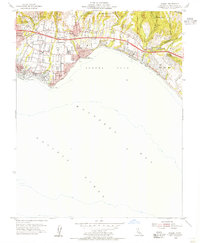
 1955 Ano Nuevo1956 Print · USGSCoastal Santa Cruz County comes into sharp focus during the mid-fifties, capturing the rugged coastline from the sand dunes to the redwood forests. You can trace the Lighthouse (Abandoned) on Año Nuevo Island and early mountain routes like Last Chance Road.6 unique versions available
 - 1955 Map of Franklin Point, 1957 Print
 1955 Franklin Point1957 Print · USGSThe rugged San Mateo coastline meets the redwoods in the mid-1950s, a time when fire lookouts and old land grants still defined the backwoods. Researchers can locate the Yankee Jim Lookout Station, trace the Butano Grant Bdy, or find the secluded Cemetery near the coast.5 unique versions available
 - 1955 Map of Felton, 1957 Print
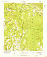
 1955 Felton1957 Print · USGSThe San Lorenzo River valley in the mid-fifties is a landscape of redwood forests, mountain retreats, and early suburban growth. Local historians can trace the Southern Pacific line and find vanished landmarks like the Sky Park Airport and Alba Sch.6 unique versions available
 - 1955 Map of Mindego Hill, 1957 Print
 1955 Mindego Hill1957 Print · USGSThe Santa Cruz Mountains ridge-top communities are captured here in the mid-fifties, showing the intersection of old ranches and early state parklands. Researchers can trace historic sites like the Page Mill (Site), Big Dipper Ranch, and several former rural schoolhouses.2 unique versions available
 - 1955 Map of Davenport, 1957 Print
 1955 Davenport1957 Print · USGSThe Santa Cruz coast and the steep ridges of Ben Lomond Mountain are captured here during the mid-fifties. Researchers can trace the industrial footprint of the Cement Plant in Davenport or locate rural landmarks like Seaside School and Bonnie Doon School.6 unique versions available
 - 1955 Map of Castle Rock Ridge, 1957 Print
 1955 Castle Rock Ridge1957 Print · USGSThe Santa Cruz Mountains were a blend of remote camps and rural schools in the mid-1950s. Genealogists and hikers can trace old landmarks like Uncle Billys Cabin, Montezuma School, and the grounds of Alma College along the ridge.7 unique versions available
 - 1955 Map of Big Basin, 1957 Print
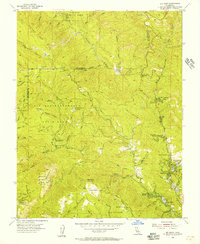 1955 Big Basin1957 Print · USGSThe Santa Cruz Mountains were a blend of deep redwood preservation and mid-century recreation in the 1950s. Genealogists and historians can trace the development of settlements like Riverside Grove and Wildwood, or locate local landmarks such as Locatelli Ranch and the Hilton Airport.6 unique versions available
 - 1956 Map of San Jose
 1956 San Jose1956 Print · USGSCentral California in the mid-fifties reveals the transition from sprawling orchards to growing urban hubs like San Jose and Stockton. Genealogists and historians can trace the rail-era landscape of the Mother Lode through Chinese Camp and Tuttletown, or follow the water through the Joaquin River and Calaveras Reservoir.
 - 1956 Map of San Francisco
 1956 San Francisco1956 Print · USGSThe San Francisco Bay Area is captured in the mid-fifties, showing a landscape of rapid post-war growth and massive military installations. Researchers can trace the sprawling rail lines of the Southern Pacific and locate historic sites like Stanford University or the Hunters Point Naval Shipyard.4 unique versions available
 - 1957 Map of San Francisco
 1957 San Francisco1957 Print · USGSThe Bay Area in the mid-fifties reveals a rapidly growing metropolitan landscape connected by its iconic spans and rail networks. Researchers can trace the layout of military sites like the Presidio and the extent of the Southern Pacific and Western Pacific railroads.
 - 1957 Map of Santa Cruz
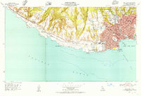
 1957 Santa Cruz1957 Print · USGSCentral California comes into sharp focus during the late fifties, from the fog-swept Monterey Bay to the sun-drenched San Joaquin Valley. Genealogists and historians can trace the mid-century footprints of Fort Ord Military Reservation, the Southern Pacific line, and the historic streets of San Juan Bautista.
 - 1958 Map of Santa Cruz
 1958 Santa Cruz1958 Print · USGSCoastal California and the central valleys are shown during the mid-fifties, capturing a landscape of massive military reserves and vital rail arteries. Genealogists and historians can trace the Southern Pacific line through Salinas or explore the early footprints of the Fort Ord Military Reservation and San Juan Bautista.2 unique versions available
End of results
Showing maps 1-25 of 25
Top cities of Santa Cruz
- Santa Cruz historical maps
- Watsonville historical maps
- Scotts Valley historical maps
- Capitola historical maps
- Live Oak historical maps
- Boulder Creek historical maps
Frequently asked questions
- What are the different types of historical maps available for Santa Cruz?
- What is the oldest map of Santa Cruz?
- Where can I purchase historical maps of Santa Cruz for my home or office?
- Where can I download high-res historical maps of Santa Cruz?
- Are there historical topographic maps available for Santa Cruz?
- Is there historical aerial imagery available for Santa Cruz?
- Where are historical maps of Santa Cruz sourced from?