1950s Maps of Shasta County, California
Explore 34 historic maps of Shasta County from the 1950s. These maps offer a rare glimpse into what life looked like during the 1950s — showing old roads, neighborhoods, homes, and landmarks that have changed or disappeared over time.
Whether you're researching your family's past, planning a metal detecting trip, or studying how Shasta County's landscape evolved across the 1950s, these high-resolution maps are a powerful tool for exploring the history of this region.
- Focus on a specific era: All maps on this page are from the 1950s, giving you a focused view of this time period.
- See what’s changed: Compare century-old streets, trails, and buildings to today's modern landscape using overlays and satellite layers.
- Research with precision: Use these maps for genealogy, historical research, land use analysis, or educational projects.
- View, download, or print: Maps are fully viewable online in high resolution, and can be downloaded or printed for your own records.
Start exploring Shasta County's history through authentic maps from the 1950s. This is your window into the past.
Shasta County, CA maps
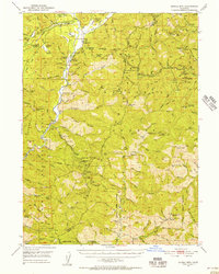
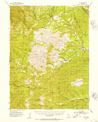
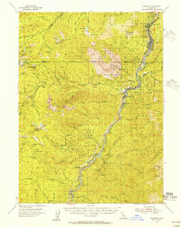
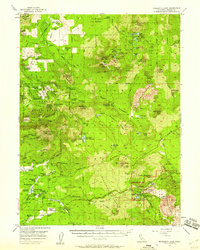
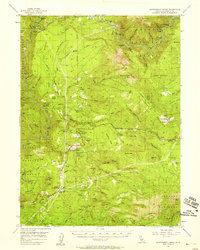
(34)- 1950 Map of Weed
 1950 Weed1950 Print · USGSSiskiyou County and the surrounding Klamath mountains appear in the mid-century before extensive modern development. Genealogists and local historians can locate remote outposts like the Lee Brown Ranch and the specialized settlement of Darlingtonia.
 - 1950 Map of Schell Mtn, 1956 Print
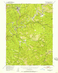
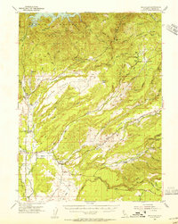
 1950 Schell Mtn1956 Print · USGSThe Trinity River backcountry in the early 1950s reveals a landscape of isolated mountain ranches and active mining claims. Researchers can trace family-held lands like Norwegian Ranch and find old extraction sites such as Star Mine and Catherine Mine.2 unique versions available
 - 1950 Map of Weaverville, 1957 Print
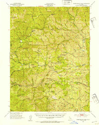
 1950 Weaverville1957 Print · USGSTrinity County's gold mining heritage remains prominent in the 1950s, centered on the historic town of Weaverville. Genealogists and historians can trace the cultural landscape through the Chinese Cem, La Grange Mine, and the remote Blanchard Flat School.2 unique versions available
 - 1951 Map of Chanchelulla Peak, 1953 Print
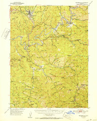
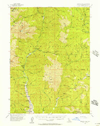
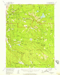
 1951 Chanchelulla Peak1953 Print · USGSNorthern California's interior mountains at the midpoint of the century reveal a landscape of isolated forest stations and family ranches. Researchers can locate the Midas Mine and trace early road networks connecting Platina with the Harrison Gulch Ranger Station and Deer Lick Springs.5 unique versions available
 - 1952 Map of Schell Mtn.
 1952 Schell Mtn.1952 Print · USGSThe high timber and river bars of the Trinity and Shasta county line are shown here in the early fifties. Genealogists and historians can trace old homesteads like Scott Ranch and remote sites such as the Lamoine Mill Site or Giddings Bar.2 unique versions available
 - 1952 Map of Weaverville
 1952 Weaverville1952 Print · USGSTrinity County in the early fifties remains a landscape defined by its mining roots and river-canyon settlements. Genealogists and historians can trace family locations from the Blanchard Flat School and Lowden Ranch to early industry at the La Grange Mine.2 unique versions available
 - 1952 Map of Ono, 1954 Print
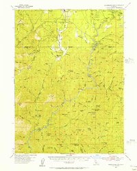
 1952 Ono1954 Print · USGSShasta and Tehama counties appear in the early fifties as a landscape of remote ranching outposts and deep drainage basins. Genealogists and historians can trace old homesteads and roads through Ono, Gas Point, and the high terrain around Chickabally Mtn.3 unique versions available
 - 1953 Map of Millville, 1955 Print
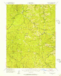
 1953 Millville1955 Print · USGSShasta County transitions from the valley floor to the forested ridges of the southern Cascades during the 1950s. Genealogists can locate family names at the Masonic Cem and Odd Fellows Cem or trace vanished locales like Tollgate (Site).3 unique versions available
 - 1954 Map of Shoeinhorse Mountain, 1956 Print
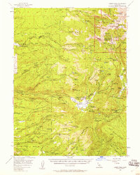
 1954 Shoeinhorse Mountain1956 Print · USGSThe McCloud River canyon in the mid-fifties is a landscape of timber camps and remote retreats. Genealogists and historians can trace the sites of Wyntoon, Fowler Camp, and the Logging Camp alongside landmarks like Shoeinhorse Mtn.3 unique versions available
 - 1954 Map of Dubakella Mtn, 1956 Print
 1954 Dubakella Mtn1956 Print · USGSMid-century Trinity County comes into focus in this survey of the mountainous terrain where Six Rivers National Forest meets the Shasta border. Researchers can trace old homesteads and mountain outposts like Peanut, Shiell Ranch, and the Old Bill Mine.3 unique versions available
 - 1954 Map of Dunsmuir, 1957 Print
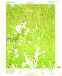
 1954 Dunsmuir1957 Print · USGSThe Sacramento River canyon in the 1950s was a critical transit corridor where the rail and road network shaped mountain life. Genealogists and historians can trace the canyon floor communities of Dunsmuir, Castella, and Shasta Retreat, or find remote landmarks like Whalan Station and Castle Rock Sch.4 unique versions available
 - 1954 Map of Alturas, 1968 Print
 1954 Alturas1968 Print · USGSThe Modoc Plateau and Surprise Valley appear in the mid-1950s as a landscape of remote ranching towns and vast wildlife refuges. Researchers can trace early settlements like Fort Bidwell, locate the McArthur Grain Elevator, and follow the Southern Pacific rail lines.4 unique versions available
 - 1955 Map of Bonanza King, 1957 Print
 1955 Bonanza King1957 Print · USGSThe Trinity River valley in the mid-fifties is captured here during a time of active ranching and high-country mining. Genealogists and historians can locate old homesteads like Eagle Creek Ranch and traces of the mining era at Altoona Mine or the Integral Mine.4 unique versions available
 - 1955 Map of Westwood, 1959 Print
 1955 Westwood1959 Print · USGSIn the mid-fifties, the northeastern California interior supported a landscape of mountain timber and high-desert basins. Genealogists and historians can locate early settlements and industrial sites like Susanville, Herlong, and the Sierra Ordinance Depot.
 - 1956 Map of Lassen Peak, 1958 Print
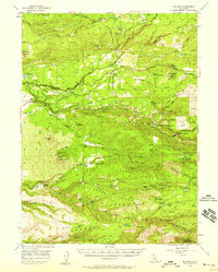
 1956 Lassen Peak1958 Print · USGSTehama County in the mid-fifties is captured as a rugged landscape of active timber mills and volcanic landmarks. Researchers can trace historic mountain sites like Rockland Sch, the high-altitude Sulphur Works, and Forward Mill.3 unique versions available
 - 1956 Map of Manton, 1958 Print
 1956 Manton1958 Print · USGSThe northern California foothills in the mid-fifties show a unique mix of hydroelectric power development and remote mountain ranching. You can trace early 20th-century family holdings like Childs Ranch or explore industrial sites including the Volta Powerhouse and Inskip Powerhouse.2 unique versions available
 - 1956 Map of Manzanita Lake, 1958 Print
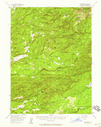
 1956 Manzanita Lake1958 Print · USGSShasta County saw a shift toward recreation and forest management in the 1950s as mountain ranching remained a vital local fixture. Researchers can locate family landmarks like Farnsworth Ranch, the settlement of Viola, and historical routes like the Old Emigrant Trail.3 unique versions available
 - 1956 Map of Shasta Dam, 1958 Print
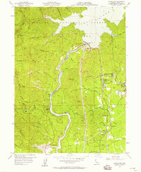 1956 Shasta Dam1958 Print · USGSMid-century Shasta County undergoes a radical transformation as the completion of Shasta Dam reshapes the canyon. Trace the development of Summit City, the infrastructure of Government Camp, and legacy mines like the Uncle Sam Mine.5 unique versions available
 - 1956 Map of Whitmore, 1958 Print
 1956 Whitmore1958 Print · USGSShasta County's eastern foothills are shown in the mid-1950s as a landscape of remote ranches and forest management. Researchers can trace family history at Inwood Cemetery, find the Kilarc Powerhouse, or locate the site of the former Ritts Mill.3 unique versions available
 - 1956 Map of Mt. Harkness, 1958 Print
 1956 Mt. Harkness1958 Print · USGSThe high Cascades of Plumas and Tehama counties appear here during the mid-fifties, centered on the geothermal wonders of the national park. Genealogists and historians can locate remote outposts like Drakesbad, St Bernard, and the Smith Cabin among the peaks.4 unique versions available
 - 1956 Map of Montgomery Creek, 1958 Print
 1956 Montgomery Creek1958 Print · USGSShasta County's rugged Cascade foothills are captured here in the mid-1950s as hydroelectric power and forestry operations shaped the Pit River region. Researchers can trace tribal lands at the Montgomery Creek Indian Rancheria and locate early community sites like Halcumb Cemetery and the Pineland School.3 unique versions available
 - 1957 Map of Redding, 1958 Print
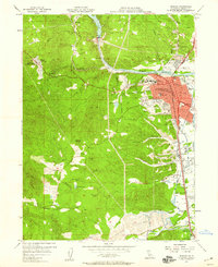 1957 Redding1958 Print · USGSRedding and its surrounding gold-country landscapes are captured here during a period of significant mid-century growth. Genealogists and historians can trace family locations near the Middletown Cem, identify early sites like Shasta, or locate the Yankee John Mine among the foothills.4 unique versions available
 - 1957 Map of Enterprise, 1958 Print
 1957 Enterprise1958 Print · USGSShasta County experienced a surge of mid-century development east of the Sacramento River during the late fifties. Researchers can trace early suburban growth through sites like Enterprise High Sch, Loomis Corners, and the Redding Municipal Airport.6 unique versions available
 - 1957 Map of Project City, 1958 Print
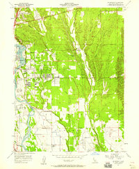
 1957 Project City1958 Print · USGSShasta County during the late 1950s shows the growth of communities like Project City and Central Valley alongside the rising waters of Shasta Lake. Researchers can locate mid-century landmarks such as the Bass Sch, the Southern Pacific rail line, and the small settlements of Newtown and Pine Grove.4 unique versions available
 - 1957 Map of Prospect Peak, 1959 Print
 1957 Prospect Peak1959 Print · USGSShasta and Lassen counties meet in this 1950s survey of a landscape shaped by fire and early migration. Researchers can trace the Emigrant Trail past geological landmarks like Subway Cave, Cinder Cone, and the Old Station post office.3 unique versions available
Showing maps 1-25 of 34
Top cities of Shasta County
- Redding historical maps
- Anderson historical maps
- Shasta Lake historical maps
- Burney historical maps
- Cottonwood historical maps
- Cottonwood historical maps
See more
Frequently asked questions
- What are the different types of historical maps available for Shasta County?
- What is the oldest map of Shasta County?
- Where can I purchase historical maps of Shasta County for my home or office?
- Where can I download high-res historical maps of Shasta County?
- Are there historical topographic maps available for Shasta County?
- Is there historical aerial imagery available for Shasta County?
- Where are historical maps of Shasta County sourced from?