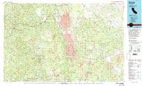
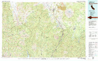
1970s Maps of Shasta County, California
Explore 9 historic maps of Shasta County from the 1970s. These maps offer a rare glimpse into what life looked like during the 1970s — showing old roads, neighborhoods, homes, and landmarks that have changed or disappeared over time.
Whether you're researching your family's past, planning a metal detecting trip, or studying how Shasta County's landscape evolved across the 1970s, these high-resolution maps are a powerful tool for exploring the history of this region.
- Focus on a specific era: All maps on this page are from the 1970s, giving you a focused view of this time period.
- See what’s changed: Compare century-old streets, trails, and buildings to today's modern landscape using overlays and satellite layers.
- Research with precision: Use these maps for genealogy, historical research, land use analysis, or educational projects.
- View, download, or print: Maps are fully viewable online in high resolution, and can be downloaded or printed for your own records.
Start exploring Shasta County's history through authentic maps from the 1970s. This is your window into the past.
Shasta County, CA maps
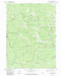
(9)- 1975 Map of Prospect Peak SE, 1981 Print
 1975 Prospect Peak SE1981 Print · USGSThe Lassen wilderness in the mid-1970s is revealed through this detailed aerial survey of volcanic landforms. Researchers can examine the sharp margins of lava fields near Cinder Cone and the shoreline of Snag Lake below the heights of Prospect Peak.
 - 1976 Map of Burney, 1992 Print
 1976 Burney1992 Print · USGSShasta and Lassen counties come alive in the mid-seventies, documenting a rugged landscape of volcanic peaks and timbered wilderness. Genealogists and hikers can trace the Pacific Crest Trail, early ranger outposts like Poison Station, and tribal lands at Montgomery Creek Indian Rancheria.3 unique versions available
 - 1978 Map of Shasta Bally
 1978 Shasta Bally1978 Print · USGSThe high peaks of the Shasta-Trinity border are captured here in the late seventies, showing a landscape defined by rugged summits and water management. Hikers and historians can trace the Jerusalem Trail or locate remote landmarks like Coggins Park and Musselbeck Dam.
 - 1979 Map of Whiskeytown
 1979 Whiskeytown1979 Print · USGSShasta County in the late seventies reveals a landscape where old gold and copper mines meet a massive recreational reservoir. Genealogists and industrial historians can trace numerous workings including the Gladstone Mine, Old American Mine, and the high-elevation South Mtn Lookout.
 - 1979 Map of Red Bluff
 1979 Red Bluff1979 Print · USGSTehama and Shasta counties come alive in the late seventies as the agricultural heart of the northern valley meets the high wilderness. Genealogists and local historians can trace the rail-and-river corridor from Red Bluff to Los Molinos, finding sites like Balls Ferry and the Southern Pacific line.3 unique versions available
 - 1979 Map of Mount Shasta
 1979 Mount Shasta1979 Print · USGSUpper California's mountainous landscape appears in the late seventies as a busy network of timber towns, railroads, and high-altitude mining claims. Trace the legacy of extraction and industry through the Southern Pacific rail line and sites like McCloud and the Bonanza King Mine.3 unique versions available
 - 1979 Map of Igo
 1979 Igo1979 Print · USGSThe Shasta County hills in the late 1970s reveal a landscape shaped by both the gold rush and modern engineering. Genealogists and researchers can locate the Whiskeytown Cemetery, the Igo-Ono School, and several legacy mining sites like the Potosi Mine.2 unique versions available
 - 1979 Map of French Gulch
 1979 French Gulch1979 Print · USGSThe Trinity Mountains were still a hub of gold mining and mountain transit in the late seventies. You can trace the legacy of the local gold rush through sites like the Brown Bear Mine, the settlement of French Gulch, and the old Lewiston Turnpike Road.2 unique versions available
 - 1979 Map of Garberville, 1996 Print
 1979 Garberville1996 Print · USGSThe redwood forests and river canyons of Humboldt and Trinity counties are shown here in the late seventies. Genealogists and historians can trace rail-side life along the Northwestern Pacific RR or locate small settlements like Fort Seward, Alderpoint, and Zenia.
End of results
Showing maps 1-9 of 9
Top cities of Shasta County
- Redding historical maps
- Anderson historical maps
- Shasta Lake historical maps
- Burney historical maps
- Cottonwood historical maps
- Cottonwood historical maps
See more
Frequently asked questions
- What are the different types of historical maps available for Shasta County?
- What is the oldest map of Shasta County?
- Where can I purchase historical maps of Shasta County for my home or office?
- Where can I download high-res historical maps of Shasta County?
- Are there historical topographic maps available for Shasta County?
- Is there historical aerial imagery available for Shasta County?
- Where are historical maps of Shasta County sourced from?